Kansas Geological Survey, Open-file Report 2004-39
Index of Images || Small Web Image || Acrobat PDF (598K)
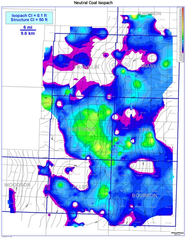
The Neutral coal exhibits a lenticular coal-seam geometry oriented parallel to depositional strike (NW-SE). Coal extent is estimated to be 3,429 sq mi (8,881 sq km). Continuity is estimated to be 1,236 sq mi (3,201 sq km), or 36.0% of the seam extent. Coal thickness ranges from 0 to 2.6 ft (0 to 0.8 m), averaging 0.7 ft (0.2 m). Thick Neutral coal trends occur in Anderson, eastern Allen, Bourbon, and southern Miami counties. In contrast to the Riverton coal, the Neutral coal is present in Miami County. The Neutral coal tends to thicken on regional structural highs and thin into structural lows of the Mississippian surface. Absence of the Neutral coal may be due to nondeposition, erosion, or from overlying channel incision.