Kansas Geological Survey, Open-file Report 2004-39
Index of Images || Small Web Image || Acrobat PDF (749K)
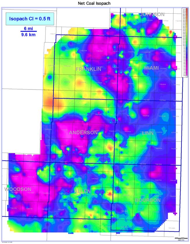
A net coal isopach of all mapped coals in the study area ranges from 0 to 22 ft (0 to 6.7 m), averaging 9.0 ft (2.7 m) across the Bourbon arch study area. Thicker net coal isopach values occur in southern Johnson, southern and western Franklin, central Miami, central Linn, eastern Allen, and western Bourbon counties. Additional local coals may be present in a well log at any given location and increase the net coal value of an individual well. In areas with historical hydrocarbon production from relatively shallow, upper Cherokee or Marmaton reservoirs, many wells do not penetrate the entire coal-bearing sequence and deeper coals. As a result, deeper coals may not be adequately represented.