Kansas Geological Survey, Open-file Report 2004-39
Index of Images || Small Web Image || Acrobat PDF (783K)
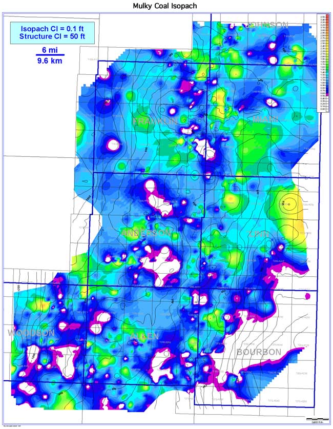
The Mulky coal exhibits a discontinuous, circular and pod-like seam geometry trending NW-SE. The coal extends an estimated 4,133 sq mi (10,704 sq km). Estimated continuity is 2,334 sq mi (6,045 sq km), or 56.5% of extent. Coal thickness in the Bourbon arch ranges from 0 to 2.8 ft (0 to 0.9 m), averaging 1.0 ft (0.3 m). Relatively thicker Mulky coal areas occur in nearly every county except Bourbon. Superimposing the Mulky coal isopach contours with Mulky coal basal structural contours illustrates two key relationships: 1) the Mulky appears to be more developed on localized structural highs and thinner in structural lows, and 2) NW-SE linear trends of thicker coal occur over and follow regional structural highs. The Mulky pinches out to the southeast in Bourbon County.