Kansas Geological Survey, Open-file Report 2004-39
Index of Images || Small Web Image || Acrobat PDF (660K)
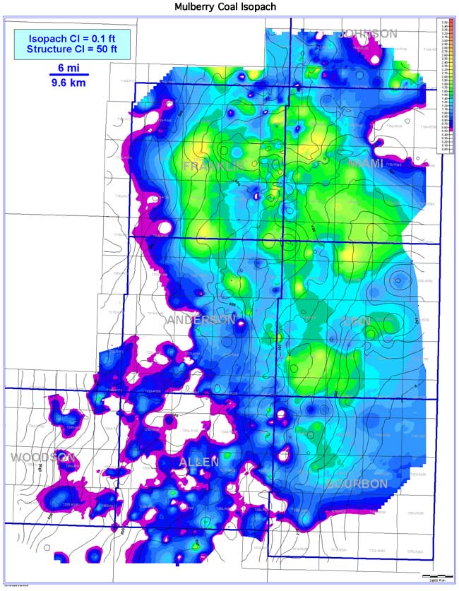
The Mulberry coal exhibits a lenticular to pod-like, extensive (3,617 sq mi [9,368 sq km]) and laterally continuous (2,046 sq mi [5,299 sq km; 56.6%]) coal-seam geometry oriented NW-SE. The thickness of the Mulberry coal in the Bourbon arch ranges from 0 to 2.7 ft (0 to 0.8 m), averaging 0.9 ft (0.3 m). Thicker areas of the Mulberry coal occur in a NW-SE trend across Franklin, Miami, Linn, eastern Anderson, and northern Bourbon counties. The coal pinches out towards the southwestern portion of the study area. The Mulberry coal exhibits thickening on structural highs and thinning into structural lows when superimposed on the structure contours of the underlying Pawnee Limestone.