Kansas Geological Survey, Open-file Report 2004-39
Index of Images || Small Web Image || Acrobat PDF (716K)
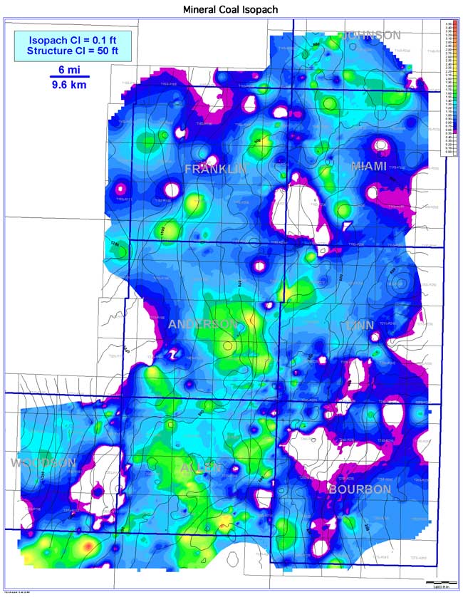
The Mineral coal exhibits a slightly lenticular geometry oriented parallel to depositional strike (NW-SE). The Mineral coal is more continuous (2,166 sq mi [5,610 sq km; 53.5% of extent]) and better developed than the underlying Scammon coal, extending 4,064 sq mi (10,526 sq km) across the study area. Coal thickness in the Bourbon arch ranges from 0 to 3.7 ft (0 to 1.1 m); averaging 1.0 ft (0.3 m). Consistently thicker coal trends occur in Allen, Anderson, northwestern Linn, southern Franklin, northern Miami, and Johnson counties. The coal shows localized thickening on the basal structural highs and thinning into structural lows of the coal's basal structure contours. Absence of the Mineral is most likely due to nondeposition, but overlying channel incision and erosion associated with an overlying unconformity could be a factor.