Kansas Geological Survey, Open-file Report 2004-39
Index of Images || Small Web Image || Acrobat PDF (376K)
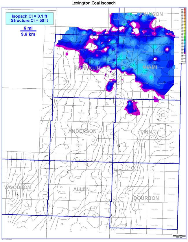
The Lexington coal pinches out towards the southwest and is absent across most of the study area. The Lexington exhibits a lenticular to pod-like coal geometry oriented NW-SE. Estimated extent of the Lexington is 1,151 sq mi (2,981 sq km), mainly due to the isolation of the coal to the northernmost portions of the study area. Coal continuity is estimated to be 232 sq mi (601 sq km), or 20.1% of coal extent. The thickness of the Lexington coal in the Bourbon arch ranges from 0 to 2.5 ft (0 to 0.8 m), averaging 0.4 ft (0.1 m). Thicker areas of the Lexington coal occur in the northern portion of the study area (Franklin, Miami, and southern Johnson counties). The coal exhibits thickening on structural highs and thinning into structural lows when superimposed on the structure contours of the underlying Fort Scott Limestone.