Kansas Geological Survey, Open-file Report 2004-39
Index of Images || Small Web Image || Acrobat PDF (463K)
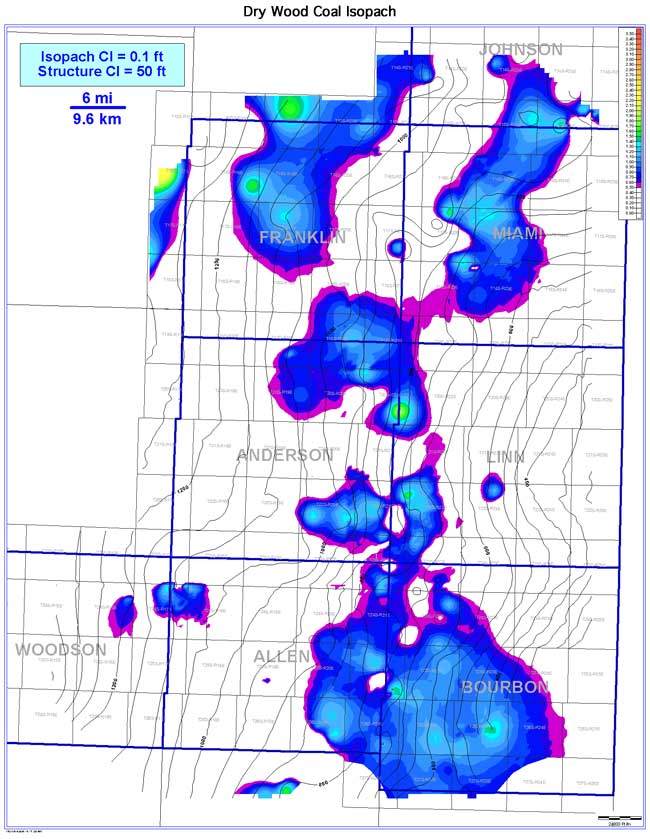
The Dry Wood coal exhibits a lenticular geometry oriented perpendicular (NE-SW) to depositional strike (NW-SE), but is more discontinuous (310 sq mi [803 sq km]) relative to underlying coals. The discontinuity (16.1%) and extent (1,925 sq mi [4,986 sq km]) of the coal is the result of channel incision by the overlying upper or lower Bluejacket sandstones. Coal thickness in the study area ranges from 0 to 2.4 ft (0 to 0.7 m); averaging 0.4 ft (0.1 m). Where present, the Dry Wood tends to thicken on highs and thin into lows of Mississippian structure. Thicker coal trends occur in western Bourbon, Miami, and central Franklin counties.