Kansas Geological Survey, Open-file Report 2004-39
Index of Images || Small Web Image || Acrobat PDF (749K)
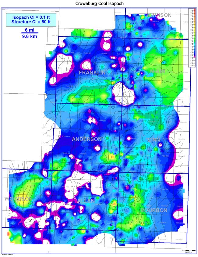
The Croweburg coal exhibits an elongate to slightly lenticular coal-seam geometry oriented parallel to depositional dip (southwest). Coal extent is estimated to be 4,067 sq mi (10,534 sq km). Coal continuity is estimated to be 52.8% of extent, or 2,146 sq mi (5,558 sq km). Thickness of the Croweburg in the Bourbon arch ranges from 0 to 3.8 ft (0 to 1.2 m), averaging 1.0 ft (0.3 m). Trends of consistently thick coal occur throughout the study area, specifically in Bourbon, western Linn, eastern Miami, Woodson, and southern Franklin counties. A general correlation between thick Croweburg coal and high Croweburg basal structure contours and thin Croweburg coal and low structure contours is discernible. The absence of coal is due to channel incision from overlying Squirrel sandstones.