Kansas Geological Survey, Open-file Report 2004-39
Index of Images || Small Web Image || Acrobat PDF (762K)
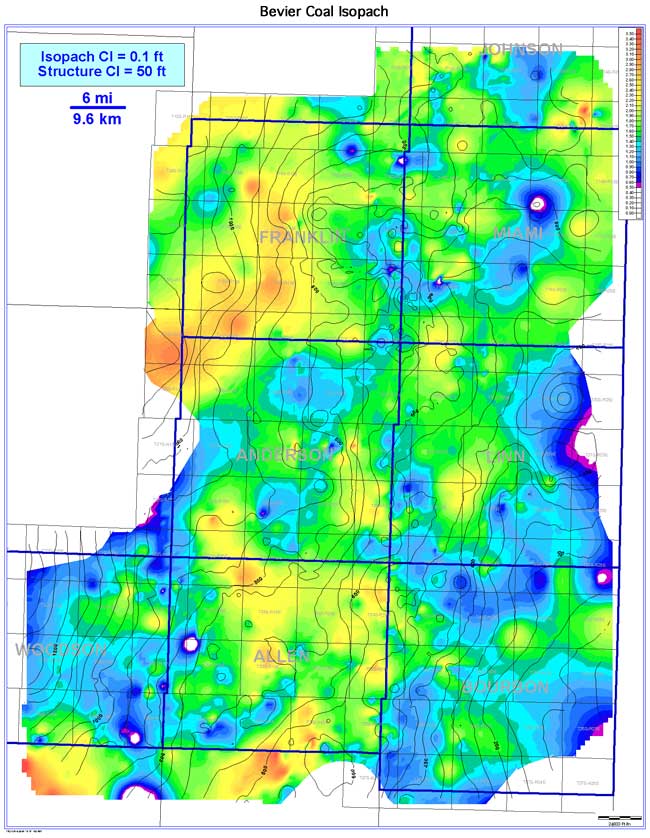
The Bevier coal has a NE-SW-trending, lenticular to slightly elongate coal seam geometry that extends over nearly all of the study area (4,246 sq mi [10,997 sq km]). The Bevier is one of the more continuous coals across the Bourbon arch, with an estimated continuity of 3,987 sq mi (10,326 sq km), or 93.9% of the extent. Coal thickness in the Bourbon arch ranges from 0 to 3.7 ft (0 to 1.1 m), averaging 1.5 ft (0.5 m). Thicker trends of the Bevier coal occur in Franklin, Allen, Anderson, and Linn counties. When superimposed on the basal Bevier coal structure contours, the coal exhibits thickening on regional structural highs and thinning on regional structural lows. Patterns of isopach thins and absences are due to minor incision from channels of the overlying Squirrel Sandstone.