
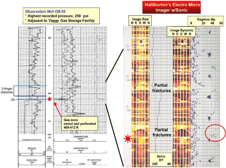
Logs
Formation micro-imaging log (right) alongside conventional gamma ray-caliper-neutron-density-photoelectric log (left) for observation well OB #2. The 3A zone is a gas-bearing dolomite interval in this well, exhibiting washout and gas show on drilling.
Scalloped patterns on the formation micro-imaging log in the interval encompassing the 3-finger dolomite and 3A are partial fractures with dips of approximately 50 degrees. The partial fractures are oriented west-northwest, while healed fractures occur along a north-south axis. These fractures parallel the two major lineaments observed in mapping.
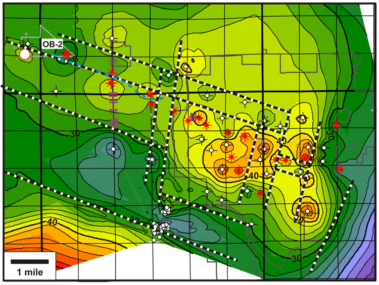
Isopach
S2-S1 isopach map with a preliminary interpretation of structural lineaments superimposed (heavy dashed lines). Locations of faults intersecting the S1 horizon, as interpreted from the Wilson Road and Rice Park seismic lines, are shown as short purple lines. The dashed blue line indicates the boundary between gas in the 3A zone (to the north) and in the 3-finger dolomite (to the south). This boundary is nearly coincident with a northwest-trending lineament interpreted as the edge of a narrow salt-dissolution trough to the north of the Yaggy-Hutchinson anticline. The lineament may represent a zone of weakness that allowed vertical migration of high-pressure gas from 3A to the 3-finger dolomite. OB-2, which exhibits west-northwest fractures, lies adjacent to this lineament. The orientations of the fractures on the seismic lines are unknown; however, fractures on the Wilson Road seismic line appear to preferentially occur on the flanks of the Yaggy-Hutchinson anticline, suggesting that they may have contributed to the salt dissolution that enhanced relief of this anticline.
Last updated June 2004
http://www.kgs.ku.edu/PRS/publication/2004/AAPG/NG_Migration/P2-05.html