
The Role of Evaporation Dissolution
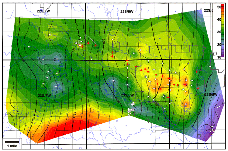
When structural contours of the top 3-finger dolomite interval are superimposed on the S2-S1 isopach map, it can be seen that the Yaggy-Hutchinson anticline overlies a west-northwest-trending zone of thicker salt and that regions of flexure in the top 3-finger dolomite structure correspond to areas of salt thinning. The flexure is hypothesized to be related in part to subsidence due to salt dissolution. Increased tensional forces in the strata overlying the Hutchinson Salt Member adjacent to areas of salt dissolution most likely created preferred zones of weakness, which may have been exploited as gas pathways.
Thin evaporite layers within the stratigraphic column are also susceptible to focused dissolution. This may be the cause of the localized thinning seen in the M1A to M2 isopach at the location of DDV #64. Collapse and natural fracturing associated with this dissolution may cause sufficient disruption of the stratigraphic column to carry pressured gas from one dolomite-rich interval to another.
S1 - S2 Isopach with Top 3-Finger Dolomite Contours Superimposed
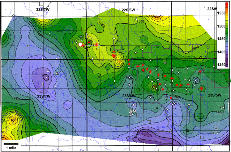
Base Equus Beds Configuration
The configuration of the base of the Quaternary Equus beds, an extensive unconfined freshwater aquifer that unconformably overlies the Permian strata in the vicinity of Hutchinson, shows a paleo-valley which follows the same northwest trend as the present Arkansas River valley, as well as closely paralleling the zone of S1-S2 salt dissolution. The coincidence of these patterns suggests a common control, possibly related to episodic structural activation along a zone of basement weakness
Last updated June 2004
http://www.kgs.ku.edu/PRS/publication/2004/AAPG/NG_Migration/P2-03.html