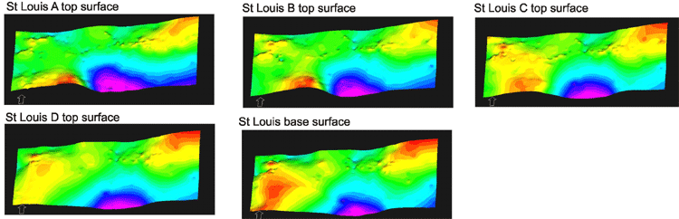
Five surfaces have been imported into RMS to build the Big Bow and Sand Arroyo Creek St Louis Limestone reservoir modeling grid. These surfaces all show the original St Louis structure.
Modeling grids with 4 subgrids (St Louis A, B, C and D)
The grid was built with equal X and Y increment to 500 ft and a constant layer thickness = 2 feet parallel to bottom surface within the St Louis A, B, C and D subgrids in Z axis.
Geometry data for modeling facies
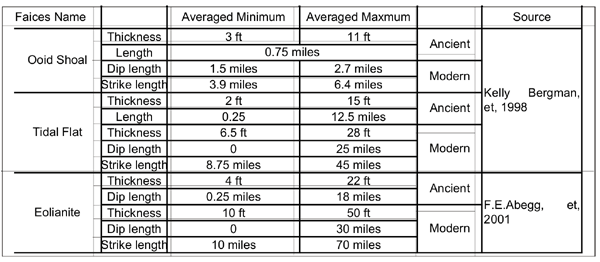
Ooid shoal, tidal flat and eolianite dune generally all have strike-elongated geometry. Above table summarizes the general 3D geometry data of these facies from Bergman, 1998 and Abegg, 2001. Final geometry data was selected after various trials to fit the Mississippian St Louis carbonate system.
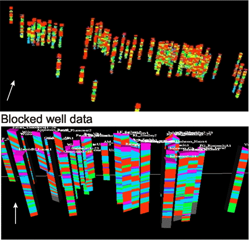 |
Original well data (lithofacies, porosity, perm and Sw) have been
upscaled to the grid size after importing to geostatistical simulation
project. Facies logs have been treated as blocked within a facies interval.
Average values have been blocked into the grid cells for continuous
logs. |
Argillaceous limestone (deep marine) and skeletal wackestone (open marine) were combined into marine facies and treated as the background facies (code=0) in modeling. Peloidal grainstone limestone was defined as tidal flat facies (code=1), and cross-bedded quartz-rich carbonate grainstone as eolianite facies (code=4). Ooid skeletal grainstone (code=2) and cemented ooid skeletal grainstone (code=3) were combined into oolitic shoal complex facies. Then, permeability barriers in the complex were modeled by merging the separately modeled cemented oolitic facies into the complex.
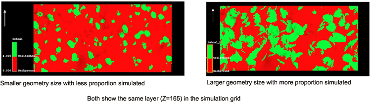
Comparison of the effect of different geometry and simulation proportion for oolitic shoal complex
http://www.kgs.ku.edu/PRS/publication/2004/AAPG/3DReservoir/p3-01.html
Last Modified December 2004