 |
|
Kansas Geological Survey Open-file Report 2003-30 |
Panoma (Council Grove) Geomodel
Data
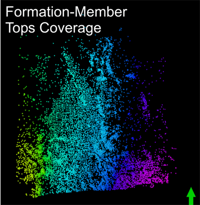 |
Initial data set included 11,367 wells with detailed formation-member level tops picked by Hugoton consortium funded KGS geologists |
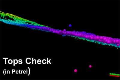 |
Initial quality check of tops showing obvious data busts; rotated view looking north. Tops were corrected for wells with proper log suite for facies/petrophysical modeling. Other tops were deleted |
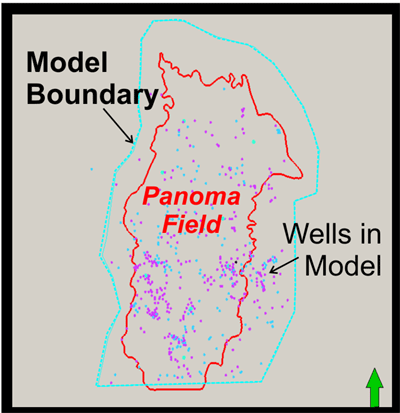 |
Distribution of approximately 500 wells with proper log suite used for facies and petrophysical modeling |
Data Management |
|
| Tops data set | |
| 24,879 | Total wells in initial PETRA project, including regions outside of model |
| 12,097 | Wells having at least Council Grove top pick by KGS geologist |
| 11,367 | Wells in initial structure model. |
| 10,836 | After screening for tops busts. Further screening reduced the well count to10,700. |
| Digital well log data set | |
| 1,103 | Sufficient Council Grove penetration |
| 536 | After removing wells with bad curves, data gaps or other problems |
| 469 | Final count after further screening |
|
|
|
e-mail : webadmin@kgs.ku.edu
Last updated May 2003
http://www.kgs.ku.edu/PRS/publication/2003/ofr2003-30/P3-01.html