 |
|
Kansas Geological Survey Open-file Report 2003-30 |
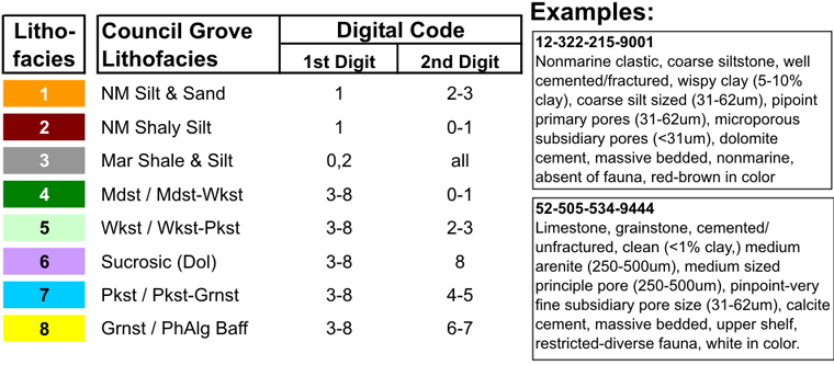
Lithofacies
Classification
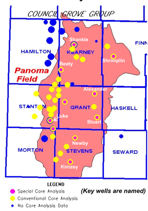
Rock properties data represent analyses from 33 wells that have attempted to sample the complete range in porosity, permeability, geographic distribution, and formational unit for each of the major lithofacies. Lithofacies were described for core using a digital classification system to facilitate data management and because it offered the ability to use non-parametric categorical analysis. Digits generally represent continuous variation of a lithologic property that may be correlated with petrophysical properties. Final petrophysical trends used the eight major lithofacies shown below.
Core Analysis Data
Digital Rock Classification System
Alan Byrnes, Martin Dubois

|
|
|
e-mail : webadmin@kgs.ku.edu
Last updated May 2003
http://www.kgs.ku.edu/PRS/publication/2003/ofr2003-30/P2-01.html