 |
|
Kansas Geological Survey Open-file Report 2003-26 |
Future Work
This study will also investigate the utility of GPR (ground-penetrating radar) in imaging of channel forms and internal geometries of Merriam Strata. Outcrop and GPR data could aid in developing 3D models of these channels in transgressive limestones, which could be potential reservoirs in the subsurface (see diagrams below).
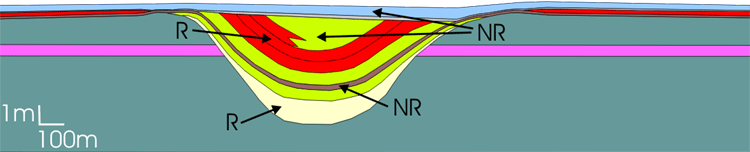
Potential reservoir model for Merriam channels R= reservoir facies; NR= non-reservoir facies
Central Kansas Oil Production |
|
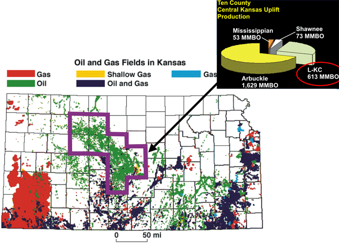 |
Kansas Total 6.6 Billion Central Kansas Uplift Total 2.4 Billion |
| Map of Kansas hydrocarbon production. Pie graph shows contribution of the Lansing and Kansas City Groups (L-KC) in the Central Kansas Uplift area. | |
|
|
|
e-mail : webadmin@kgs.ku.edu
Last updated May 2003
http://www.kgs.ku.edu/PRS/publication/2003/ofr2003-26/P3-03.html