|
|
|
|
Kansas Geological Survey, Open-file Report 2001-14
2000 Digital Petroleum Atlas Annual Report
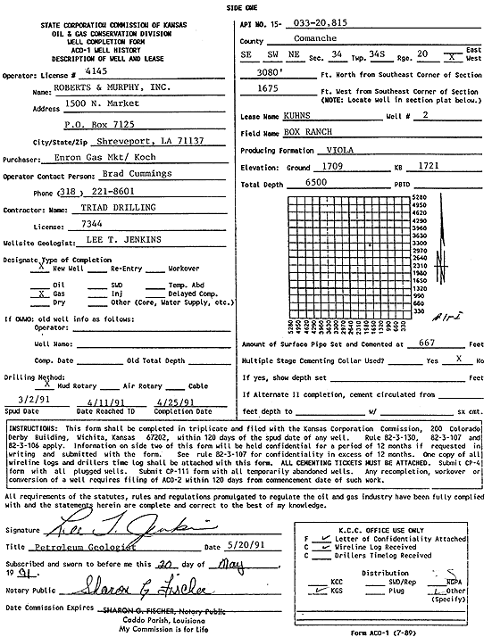
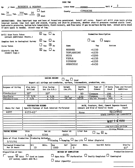
Figure 18. Raster images of Kansas Corporation Commission Completion report for a selected well in the Box Ranch Field, Comanche County, Kansas. The images for every well in the field are stored in a relational database table. The images are linked and a dynamic well page is constructed on demand for the Digital Petroleum Atlas.
| Table of Contents | Previous Page | Figure 17c | Next Page | Figure 19 |