|
|
|
|
Kansas Geological Survey, Open-file Report 2001-14
2000 Digital Petroleum Atlas Annual Report
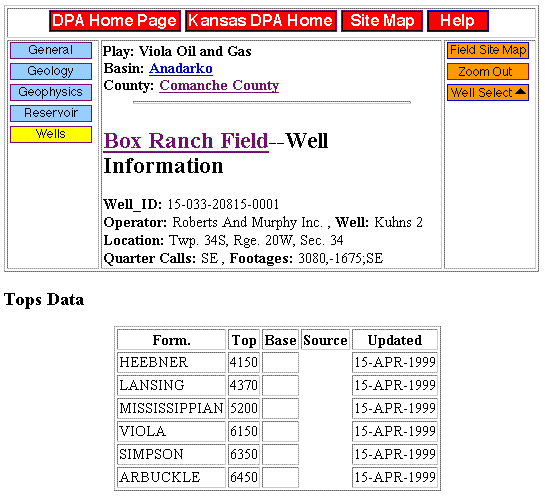
Figure 17a. Sample of well data for an individual well (Roberts and Murphy Kuhns 2) in the Box Ranch Field, Comanche County, Kansas. The well data is assembled from multiple individual data tables and includes header information (e.g., location, operator, API number) and geologic tops. Information continues in figures b and c.
| Table of Contents | Previous Page | Figure 16 | Next Page | Figure 17b |