


Kansas Geological Survey, Open File Report 96-51
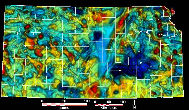
- Color maps, "relief" created by vertical illumination, with overlays of...
- County Lines Only ||
Oil and Gas Fields ||
Post-Mississippian Structure ||
Regional Precambrian Structure
- Top of the Precambrian ||
Regional lineations ||
Local lineations
- Color maps with overlays of...
- County Lines Only ||
Oil and Gas Fields ||
Top of the Precambrian ||
Regional lineations ||
Local lineations
- Black and white maps, "relief" created by vertical illumination,
with overlays of...
- Oil and Gas Fields ||
County Lines Only
- Maps showing...
- Regional lineations, oil and gas fields ||
Local lineations, oil and gas fields
Kansas Geological Survey, Petroleum Research Section
Updated Dec. 17, 1996
Please send comments to webadmin@kgs.ku.edu
The URL for this page is HTTP://www.kgs.ku.edu/PRS/PotenFld/mag/county.html