
|
Reservoir Characterization to Inexpensively Evaluate
the Exploitation Potential of a Small Morrow Incised Valley-fill
Field
|

Kansas Geological Survey
Open-file Report 2002-9 |
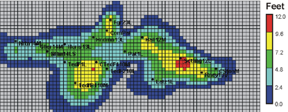
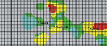
Reservoir Simulation
Input GeoModel
Model Parameters
3 layer reservoir - Sands #1, #2, #3
74 by 32 grid cells per layer
Grid size 250 ft by 250 ft
Reservoir pressure (June 1982) = 1880 psi
Reservoir temperature = 124oF
Initial solution GOR (approximated) = 650 scf/STB
Oil density (reservoir conditions) = 43.9 lb/cu ft
Gas gravity (@ 60F, 30” Hg dry) = 0.765 (Air =1.0)
Water salinity = 2.5%
Water density (reservoir conditions) = 67.52 lb/cu ft
Water formation volume (124F & 2000 psi) = 1.01res bbl/STB

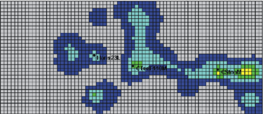
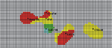
Pay Thickness Distribution
|
Sand #1 |
Sand #3 |
|
|
|
Sand #2 |
Wireline logs, DST, IP data, and core data were used to define
the lateral and vertical architecture of the reservoir. The geologic
model characterized the reservoir as comprising three major flow-units
representing distinct sandstone beds namely sands #1, #2, and
#3. For each well, porosity, BVW, and permeability cut-offs were
applied on Super-Pickett plots in order to identify “netpay”.
Well-level netpay data was used to grid and map the pay distribution
in each sand body. |
|
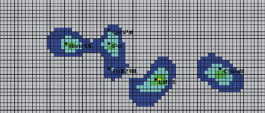
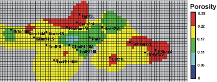
Porosity Distribution
|
Sand #1 |
Sand #3 |
|
|
|
Sand #2 |
Average grain density, needed for density log interpretation,
was measured (from core plugs) to be 2.647 g/cc with a standard
deviation of 0.012 g/cc. At each well, porosity was averaged
over the net pay interval of each sand body. Porosity in the
producing region of the field varies between 11 to 28%. |
|
e-mail : webadmin@kgs.ku.edu
Last updated March 2002
http://www.kgs.ku.edu/PRS/Poster/2002/2002-9/P3-01.html