 |
Oomoldic Reservoirs of Central Kansas, Controls on Porosity, Permeability, Capillary Pressure and Architecture |
Kansas Geological Survey Open-file Report 2002-48 |
Oolite Shoals in Pennsylvanian Kansas and Modern Analogs
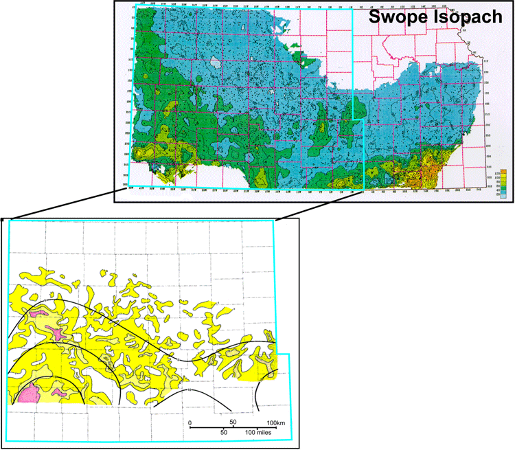
Swope Oolites
Isopach map of Swope Limestone with porosity greater than 8% using the same well data as the upper map. Porous carbonate is mainly oolitic lithologies dominated by oomoldic pores. Whereas the large-scale lobes in the map resemble in form modern oolite shoals, these lobes are interpreted to represent composites of temporally distinct shoals similar in scale to shoals deposited in the present-day Joulter’s Cays region.
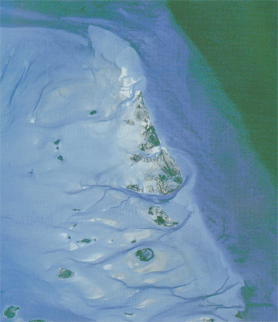 |
Modern Analog - Joulters Cays
Satellite image of Joulters Cay area showing ooid sand complex with fringing windward margin and active sand shoals to east and shallow sand flat to west. (Harris, 1994) |
|
|
|
e-mail : webadmin@kgs.ku.edu
Last updated March 2004
http://www.kgs.ku.edu/PRS/Poster/2002/2002-48/P1-05.html