| Kansas Geological Survey Open-File Report |
Index of Images || Small Web Image || Large Web Image || Acrobat PDF (11.3 Megs)
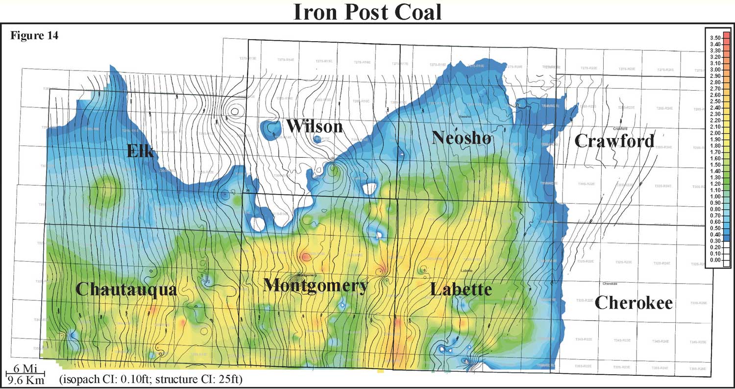
Isopach mapping of the Iron Post coal reveals a coal that is laterally continuous and has a consistency in thickness over an average of 6 miles (9.6 km). Thickness of the Iron Post coal ranges from 0 to 2.6 feet with an average of 1 foot and a distribution that is skewed to the minimum (0 to 0.8 m, average of 0.3 m). The Iron Post coal exhibits an elongate geometry that is oriented parallel to depositional dip. Unlike some of the other coals local structure does not appear to influence the local thickness of coal. The Iron Post coal is consistently thicker in the southern half of the study area, especially within Chautauqua, Montgomery, and Labette counties.