| Kansas Geological Survey Open-File Report |
Index of Images || Small Web Image || Large Web Image || Acrobat PDF (14.2 Megs)
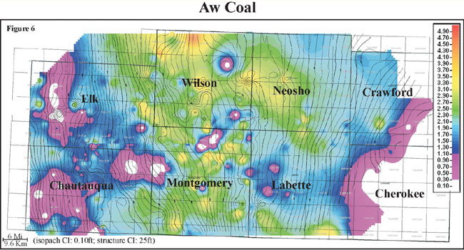
Isopach mapping of the Aw coal reveals a coal that stays fairly consistent in thickness over an average of 3 miles (4.8 km). Thickness of the Aw coal ranges from 0 to 4 feet with an average of 1.7 feet and a slightly skewed distribution to the maximum (0 to 1.2 m, average of 0.5 m). When overlaying contours of bottom Aw coal structure, the coal appears to thicken onto local highs and thin into lows. The Aw coal exhibits an elongate geometry that is oriented parallel to depositional dip, and is consistently thicker within a north-south fairway through Montgomery, Wilson, and Neosho counties. Local thin areas and linear trends in the Aw coal thickness may be due to removal by erosion (i.e. channel erosion).