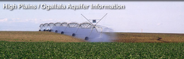
Numerical Model of the Middle Arkansas River Subbasin
Ground-water levels have been declining during the last few decades in most of the High Plains aquifer in the Middle Arkansas River subbasin, which extends from the Ford-Edwards county line to the confluence with Rattlesnake Creek in southwest Rice County. The water-level declines have decreased ground-water discharge to the Arkansas River, thereby causing declining streamflow. Smaller stream inflows to the subbasin, especially from the Arkansas River, have also decreased streamflow during this period. In response to these declines, the Division of Water Resources of the Kansas Department of Agriculture and the Kansas Water Office requested that the Kansas Geological Survey develop a calibrated ground-water flow model to provide additional information on the nature of stream-aquifer interactions and the effect of ground-water pumpage for use in planning and management of water resources in the Middle Arkansas subbasin. A numerical model was constructed for an area extending from northeast Ford County through much of Edwards and Pawnee counties to north-central Stafford and southern Barton counties.
 |
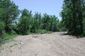 |
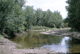
Above: Arkansas River northeast of Larned in July 2001 (left) and dry riverbed in May 2005.
The major focus of the project was the development of a calibrated transient model that simulated ground-water flow and stream-aquifer interactions during the period 1944-2004. The base model was completed in February 2006 and a presentation was given on the model at the Upper Arkansas Basin Advisory Committee (BAC) meeting in Great Bend, February 27, 2006. Five different scenarios were simulated with the calibrated transient model. One scenario involved running the model for 1944-2004 using increased stream inflows during 1980-2004. The other four scenarios involved simulations of future conditions (50-year period 2005-2054) using different pumping strategies under the climatic conditions of 1980-2004 (repeated twice). The scenarios were completed in April 2006 and a presentation was given on the results at the Upper Arkansas BAC meeting in Great Bend, May 4, 2006. Links to a report on the numerical modeling and the presentations at the BAC meetings are listed below.
Presentation of model at Upper Arkansas BAC meeting, Great Bend, February 27, 2006
Presentation of model scenarios at Upper Arkansas BAC meeting,
Great Bend, May 4, 2006
Updated October 17, 2007
Comments to webadmin@kgs.ku.edu