
U.S. National Science Foundation Project OCE 00-03970
Click on a logo below to visit a project site.
![]()
![]()
![]()
GIS, database design and web interfacing by Jeremey Bartley and Grimay Misgna
GIS database development and web interfacing by Casey McLaughlin
Database administrative support: Kurt Look
Basin-scale database development is a joint undertaking of the Hexacoral, LOICZ and BAHC projects, and the University of New Hampshire
Please select from the menu below
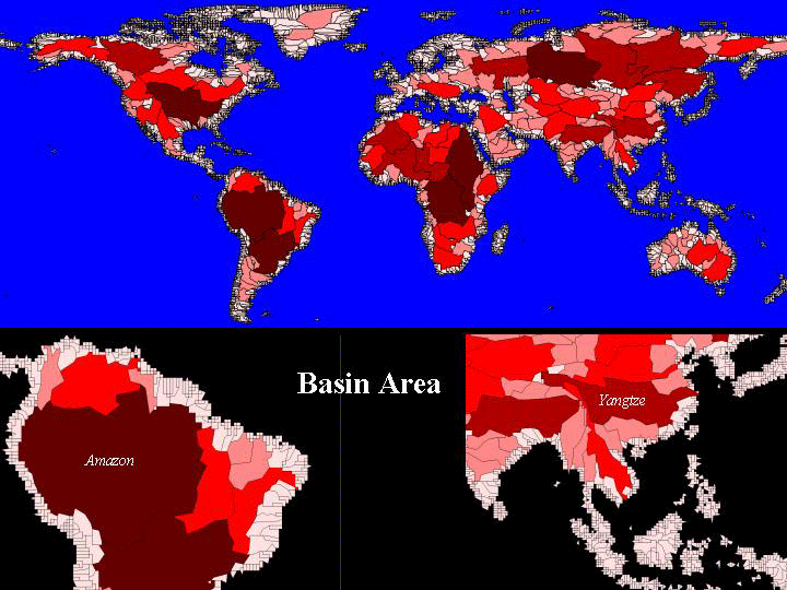
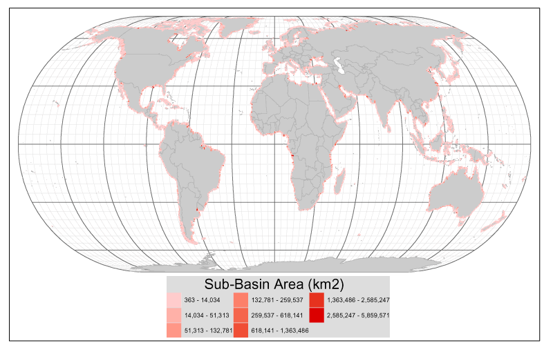
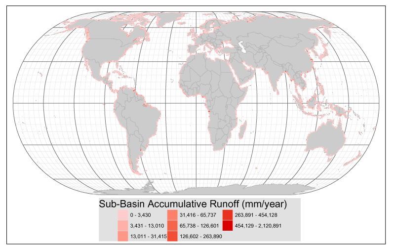
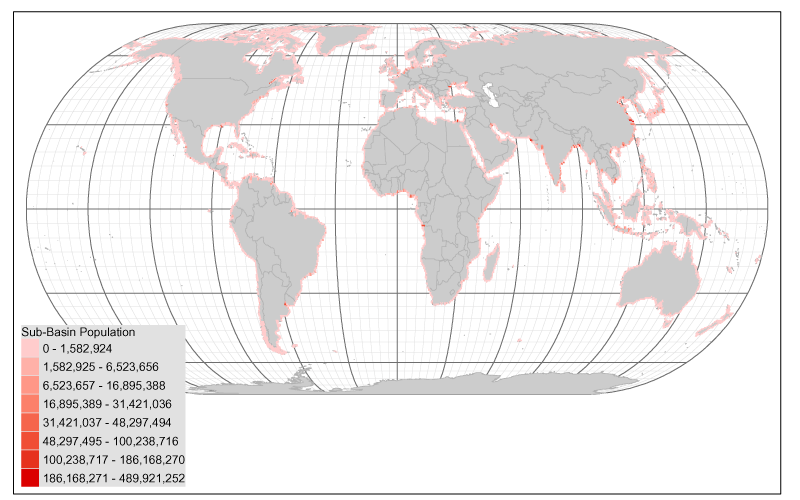
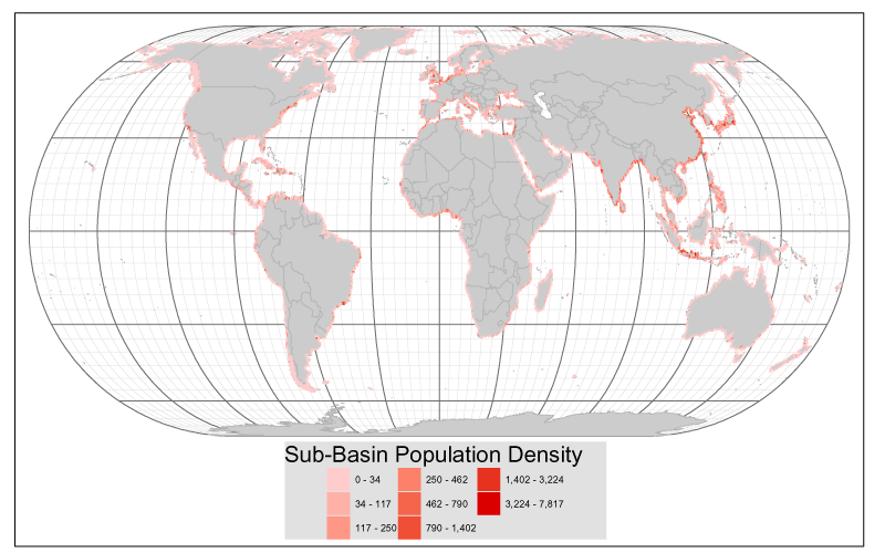
The basin variables are fundamentally different from the other variables in the data base, in that they identify with a single cell the accumulated characteristics associated with a number of other linked cells.
The linkage is by surface water flow -- stream and river channels and the drainage basins contributing to them. Therefore, the value of basin runoff in a coastal cell is the cumulative value for all of the land area comprising the drainage for the stream that discharges through that cell. Similarly, population is the total population of the basin exiting the cell.
However, averaged or apportioned values are also available from the basin data sets -- population density, for example, is the basin average, assigned to the outflow cell. Similarly, the percent of total basin land cover of a specific type is normalized to the total area. These variables may have values of the same magnitude as the similar variables for individual cells, but the underlying total amounts are very different.
It is important not to confuse the basin variables with the similarly named local variables. For example, a coastal cell that is the outflow point of a major drrainage may have two very different 'population' numbers -- one for the local cell, and another for the entire upstream basin.
Because of the uneven distribution and great variation in basin sizes, the basin variables show a limited number of coastal 'hotspots' corresponding to major discharge points. The images linked below provide an overview of these distributions. Each map color codes the coastal cells according to the magnitude of the basin variable shown. Where flow networks are shown, the thickness of the line reflects the basin discharge.
Basin variables projected to coastal cell classifications Basins of the World World Basin Area (km2) World Basin Runoff (1000 m3) World Basin Population World Basin Population Density (km-2) World