Update
April 21, 2026

Presentations from the quarterly meeting are now available in the Tier 1 member area.
Presentations from the quarterly meeting are now available in the Tier 1 member area.
Presentations from the quarterly meeting are now available in the Tier 1 member area.
Presentations from the Eighth Annual Consortium meeting are now available in the member areas.
Presentations from the Seventh Annual Consortium meeting are now available in the member areas.
Presentations from the Sixth Annual Consortium meeting are now available in the member areas.
Video and slide PDFs from the Fifth Annual Consortium meeting - held on August 3 in McPherson, Kansas - are now available in the Tier 1 member area.
Video and slide PDFs from the Fourth Annual Consortium meeting - held virtually on August 5 - are now available in the member areas.
Video and slide PDFs from the Third Annual Consortium meeting - held virtually on August 12 - are now available in the member areas.

The interactive mapper is now available to Tier 1 members. The mapper is an exploratory tool for the consortium earthquake and injections databases. Click "Network Updates" in the Tier 1 members area and look for the "Interactive Map" link.

Announcement of second annual meeting now online. The meeting will be held Tuesday, July 23, 2019. More info...

A new Scientific Publications section has been added to the Publications Page listing important background papers.

Two new publications providing a useful overview on induced seismicity in Kansas have been added to the Publications Page.
Presentations from July's Annual Meeting are now available for Tier 1 and Tier 2 members. In addition, draft versions of the Annual Report are available for review for Tier 1 and Tier 2 members.

First Annual Meeting of the Consortium for the Study of Semicity Trends will be held in July.
The meeting will be held Wednesday, July 18, 2018, from 10:00 am-2:00 pm at the Meadowlark Room, Sedgwick County Extension Education Center. The address is 7001 W. 21st North, Wichita, Kansas. More info...

Second and Third quarterly reports now available, covering October 1-December 31, 2017 and January 1-March 31, 2018.

First quarterly report now available, covering July 1-October 1, 2017.
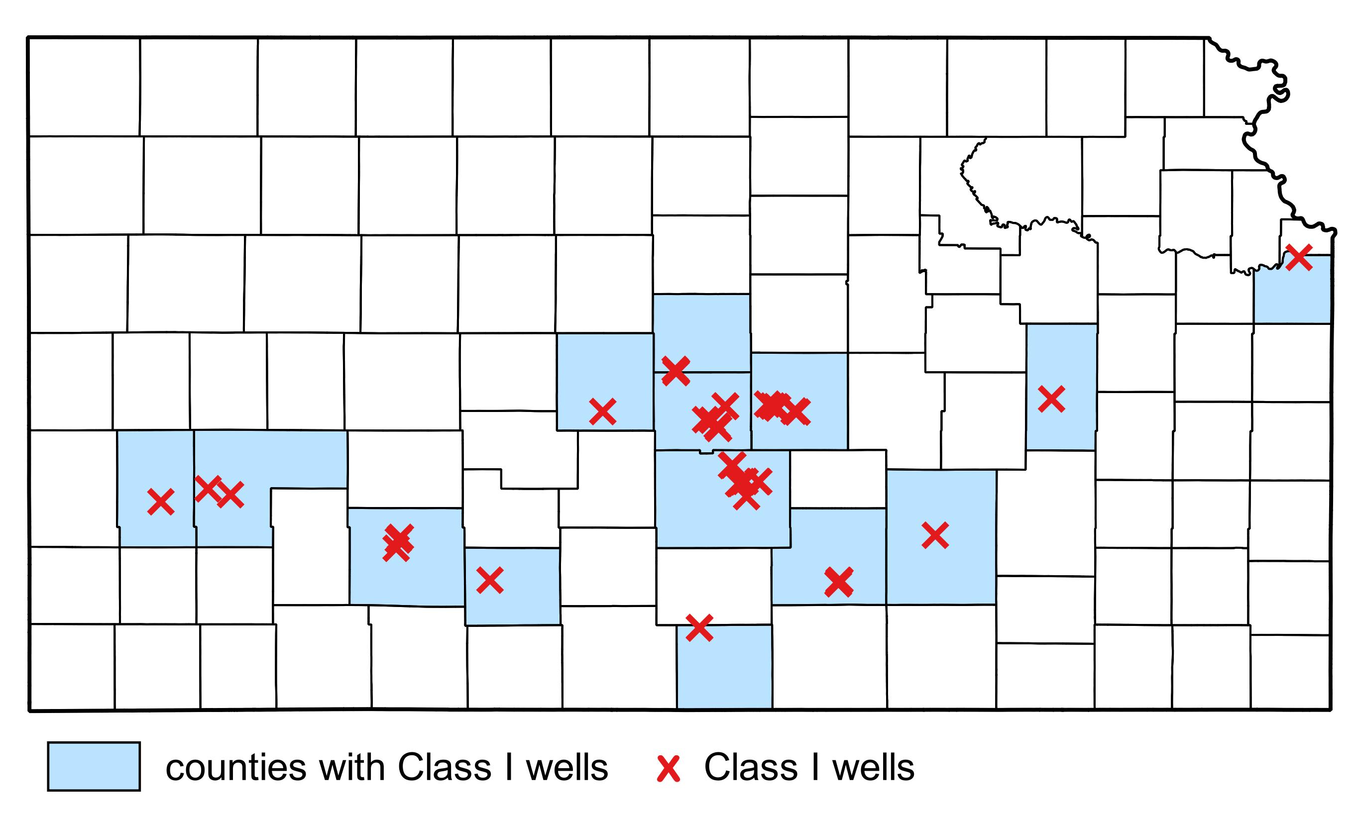
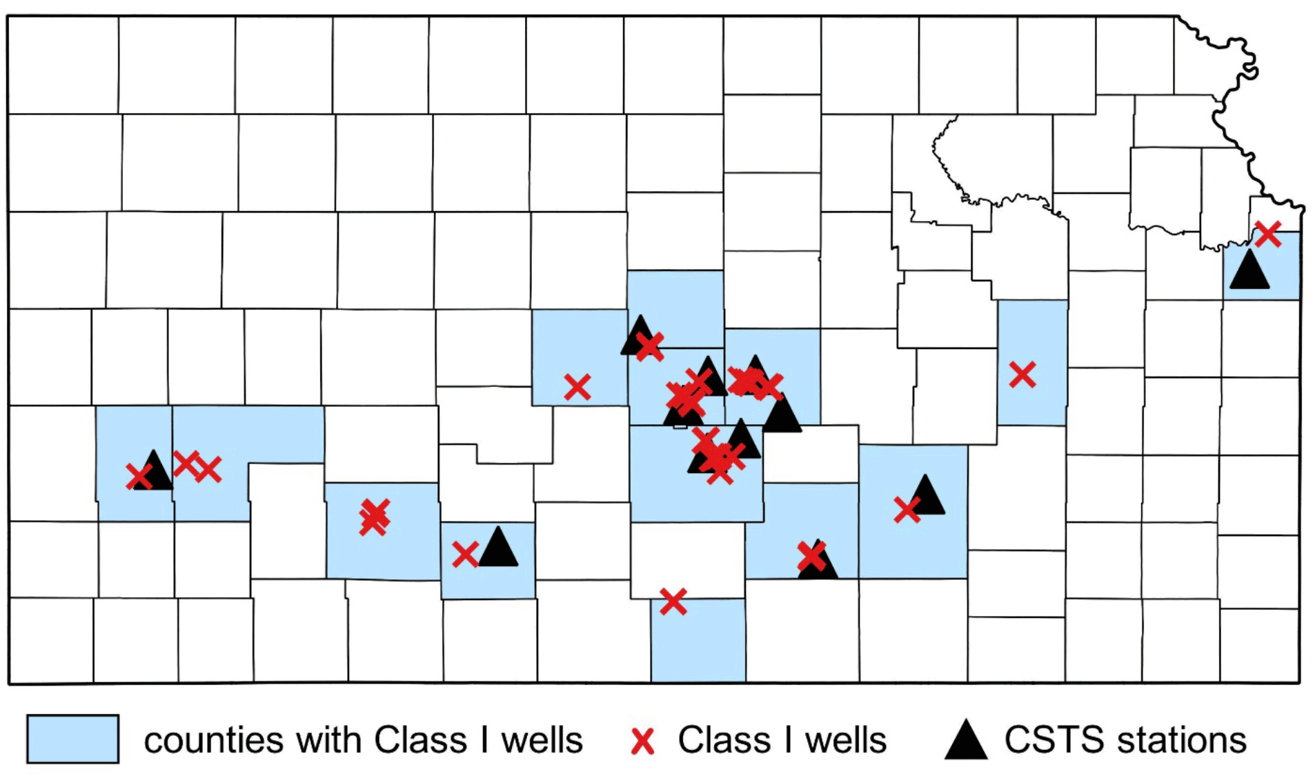
Map showing Class 1 locations (red X); counties with Class 1 wells shaded in blue.
Rex Buchanan, Consortium Director, Kansas Geological Survey
Email: rex@kgs.ku.edu
Shelby Peterie, Technical Lead, Kansas Geological Survey
Email: speterie@kgs.ku.edu
Gregg Eichorn, Industry Representative, ONEOK
geichorn@oneok.com
Rick Miller, Program Oversight, Kansas Geological Survey
Email: rmiller@kgs.ku.edu

Ten M 2 and M 3 earthquakes were detected in Reno, Harper, Sumner, and Sedgwick counties...
Three M 2 earthquakes (Table 1) were detected in Reno and Sumner counties within 30 miles of several class I wells.
With the installation of two additional stations in western Kansas, the currently planned network is now fully operational, with a total of twelve stations.

Several M 2 and M 3 earthquakes were detected in Sumner County by the KGS network this weekend ...

Several M 2 and M 3 earthquakes were detected by the KGS network this weekend ...

Since the last update, installation has been started or completed at four additional stations in Reno, McPherson, and Johnson counties. ...

Last week, five stations were installed in Rice, Reno, and Sedgwick counties ...

Twenty ambient noise tests have been completed in eight counties, providing a snapshot used to identify ...
Due to ambient noise levels outside the acceptable range at Butler County station BU01, this station was moved to state property at El Dorado Lake and renamed BU02.

Installation of the first consortium station was completed in Butler County on April 19.
Progress update on Consortium station installation for Tier 1 Consortium Members.
New documents available from the initial Consortium meeting in early March.
The Consortium to Study Trends in Seismicity is a public-private project to study trends in seismicity in Kansas. More ...