|
|
|
|
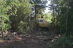
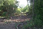
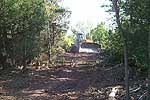
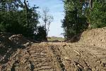
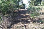
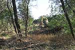
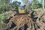
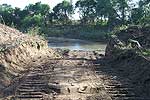
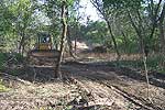
Photos from October 2003 |
|
|
|||
|
Development of a digital route and station map has required pre-acquisition travel between and occupation of all 810 shot and 240 receiver locations as determined optimum by computer simulations. After three site visits and extensive route mapping (necessary for computer-aided guidance system on vibrator) areas in need of line clearing were identified and permission to clear granted from the affected landowners/tenants. To insure the optimum trace configurations (azimuthal, offset, and fold symmetry) and year-to-year and season-to-season consistency in source locations over the six year duration of this monitoring program, source access paths needed to be straight and clear of all trees. To minimize the impact on the vegetation and to maximize the consistency in source and receiver coupling, the paths were made narrow with as many of the large relief river terrace features cut and smoothed (in some cases as much as a meter) to reduce the potential static anomalies and to allow all-season travel along the paths.
On the next survey trip to the site the final digital route map will be checked and corrected and the preliminary night vibrator guidance system tested. |
||
| Click on a photo to view larger version | ||
|---|---|---|
 |
 |
 |
 |
 |
 |
 |
 |
 |
|
Kansas Geological Survey, 4-D Seismic Monitoring of CO2 Injection Project Placed online Oct. 10, 2003 Comments to webadmin@kgs.ku.edu The URL is HTTP://www.kgs.ku.edu/Geophysics/4Dseismic/Photos/oct03.html |