|
|
|
|
Photos from June 2003--Figure 1 |
|
|
|||
| Photo Index |
|
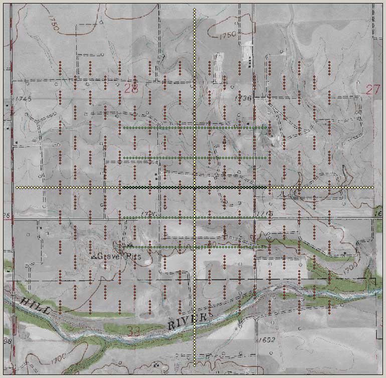
Figure 1. Base map of site with roads. The red dots are sources, the green dots are P-wave receivers, and the yellow are S-wave receivers. The larger green dots are where both P- and S-wave receivers overlap. The GPS base station is near the intersection of the yellow lines.
|
|
Kansas Geological Survey, 4-D Seismic Monitoring of CO2 Injection Project Placed online June 30, 2003 Comments to webadmin@kgs.ku.edu The URL is HTTP://www.kgs.ku.edu/Geophysics/4Dseismic/Photos/Jun03/fig1.html |