![]()
Prev Page--Contents || Next Page--Stratigraphy
Introduction
Shawnee County and parts of adjacent counties were mapped as part of a cooperative project between the U.S. Geological Survey and the State Geological Survey of Kansas. The objective of the project was to study in detail the stratigraphy of outcropping rocks of Upper Pennsylvanian and Lower Permian age. Data from the study contribute to the knowledge of the geology and mineral resources of the Missouri River basin and provide structural information that may aid in the search for oil and gas in the region.
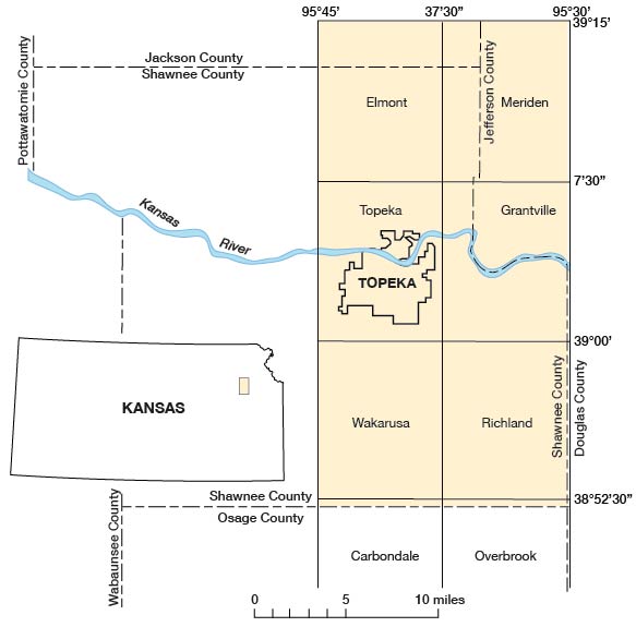
The eastern Shawnee County and vicinity study area encompasses about 355 square miles of northeastern Kansas-eastern Shawnee County, and parts of southwestern Jefferson, southeastern Jackson, and extreme western Douglas Counties. Topographic coverage is provided by the Elmont, Grantville, Meriden, Richland, Topeka, and Wakarusa 7 1/2-minute quadrangles and the northernmost parts of the Carbondale and Overbrook 7 1/2-minute quadrangles (fig. 1). The area is in the Dissected Till Plains section of the Central Lowlands physiographic province (Fenneman, 1938).
Figure 1--Location of eastern Shawnee County, Kansas, and vicinity.
This chapter describes the east half of the project area; western Shawnee County is discussed in "Chapter B" (by Johnson and Wagner) of this report.
This investigation was begun in the autumn of 1954 by H. C. Wagner, who mapped the southwestern part of the project area. In the autumn of 1955 W. D. Johnson, Jr., assumed direction of the project, H. J. Hyden assisted in the project during the autumn of 1957 and the spring of 1958, and W. L. Adkison was active on the project from the summer of 1958 to the completion of the fieldwork in the autumn of 1959.
The geology was plotted on aerial photographs at a scale of 1:17,000 and was transferred to topographic quadrangle maps by means of a vertical projector. The geologic map (pl. 1) was compiled on the combined topographic bases.
Rock-color terms used in this report are those from the "Rock-Color Chart" (Goddard and others, 1948). The grade scale of Wentworth (1922) was used in classifying sand- and silt-sized detrital grains.
Rough-textured limestone is described as crystalline if crystal faces can be seen when observed with a hand lens; it is described as granular if crystal faces are absent. Smooth-textured limestone and chert are described as dense. Nonporous limestone is described as compact. Bedding structure is described as follows:
Laminated, less than 1/16 inch thick
Platy, 1/16-1/2 inch thick
Very thin bedded, 1/2-2 inches thick
Thin bedded, 2-4 inches thick
Medium bedded, 4-12 inches thick
Thick bedded, 1-3 feet thick
Massive, more than 3 feet thick
In the descriptions of subsurface stratigraphic units, the term "shale" is used for clastic rocks composed largely of clay or of fine to medium-silt-sized particles of silicate minerals, regardless of bedding characteristics.
The lithologic descriptions of the outcropping formations are based on rock descriptions from many measured sections and outcrop exposures; however, only one or two stratigraphic sections representative of each of the formations are included in "Stratigraphic Sections" of this report. Reference to the appropriate stratigraphic sections is given with each stratigraphic unit. The faunas collected by the authors from the various units and reported on by E. L. Yochelson of the U.S. Geological Survey are so credited. Fusulinids that were retained and cataloged in the U.S. Geological Survey foraminiferal collection are also indicated, even though they had not been identified when this report was prepared.
Acknowledgments
The authors are indebted to geologists of the State Geological Survey of Kansas, particularly to Dr. F. C. Foley, Director, for his active support, and to H. G. O'Connor for his several field conferences regarding the glacial deposits and older geologic units. The State Survey made facilities available to the authors and supplied samples from several wells in the area.
The fossil identifications were made by E. L. Yochelson, who was aided by David Delo, Jr., in consultation with Helen Duncan and S. H. Mamay, all of the U.S. Geological Survey. The authors' conclusions regarding depositional history of the area are based largely on the interpretations by E. L. Yochelson of the possible depositional environments of those strata represented in the fossil collections. The authors collected the fossils but sampled few localities exhaustively.
Previous Work
The general geology of eastern Shawnee County and vicinity, particularly that near the Kansas River, has been known for many years. Previous authors who contributed to knowledge of the area were Meek and Hayden (1859), Swallow (1866), Prosser (1894), Haworth (1895), Bennett (1896), and Beede (1898). Smyth (1898) and Todd (1909, 1911, 1918) were previous authors on the glacial geology of this part of Kansas.
Revisions of the initial classification and description of Pennsylvanian rocks of Kansas were made by Moore (1932, 1936a, 1949), Moore, Frye, and Jewett (1944), Moore, Frye, Jewett, Lee, and O'Connor (1951), and by Moore and Mudge (1956).
Until publication of the geologic map of Kansas (Moore and Landes, 1937), only general reconnaissance maps of Shawnee County existed, Davis and Carlson (1952) described the geology and groundwater resources of the Kansas River valley between Topeka and Lawrence. The geology of Jackson County was studied in detail by Walters (1953). Part of the east edge of the mapped area was included in O'Connor's report (1960) on Douglas County. O'Connor (1955) also mapped Osage County which is adjacent to Shawnee County on the south.
The subsurface geology of this part of Kansas was described by Ockerman (1935) and by Lee (1940) in his study of the Mississippian rocks in Kansas. The stratigraphy and structural development of the Forest City basin, of which the mapped area is a part, were described by Lee (1943) and by Lee and others (1946). The eastern Shawnee County and vicinity study area was also included in the reports by Lee, Leatherock, and Botinelly (1948) and by Lee (1956) on the stratigraphy and structural development of the Salina basin, which lies west of the mapped area. Jewett (1954) summarized the oil and gas explorations in Shawnee and adjacent counties. Many other authors, some of whom are cited in this report, have described local aspects of the geology or mineral resources of eastern Shawnee County and vicinity.
Prev Page--Contents || Next Page--Stratigraphy
Kansas Geological Survey, Geology
Placed on web October 2005; originally published 1967.
Comments to webadmin@kgs.ku.edu
The URL for this page is http://www.kgs.ku.edu/General/Geology/Shawnee/E/02_intro.html