Wilson County

|
|
Wilson County |
|
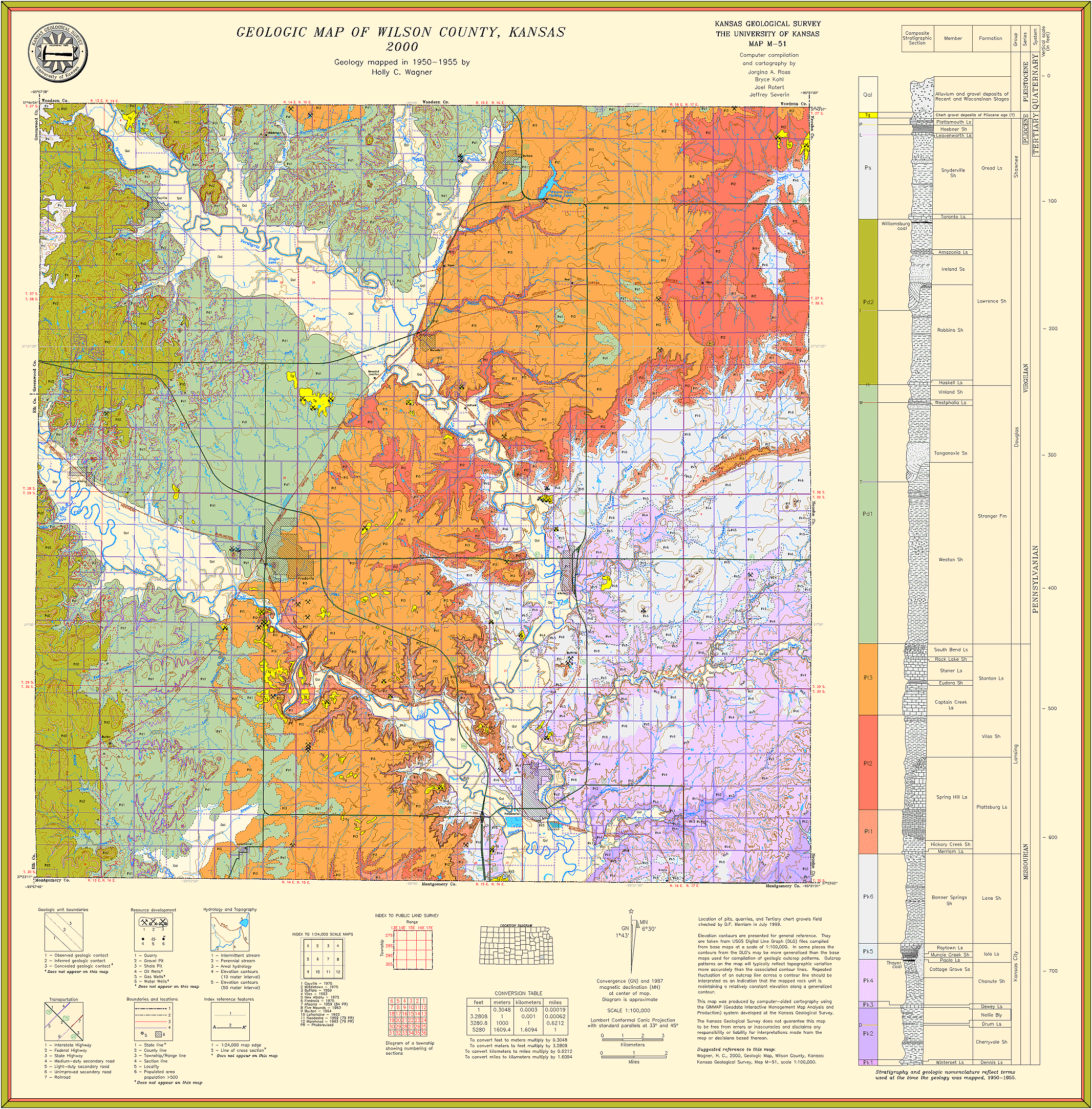
Wagner, H.C., 2000, Geologic map of Wilson County, Kansas: Kansas Geological Survey, Map M-51, scale 1:50,000, 48 inches by 32 inches
Paper copies of the complete map (with stratigraphic column and legend info) can be purchased from the Kansas Geological Survey, 1930 Constant Ave., Lawrence, KS 66047 (or phone 785-864-3965) and at 4150 W. Monroe St., Wichita, KS 67209-2640 (phone 316-943-2343).