Pottawatomie County
|
|
Pottawatomie County |
|
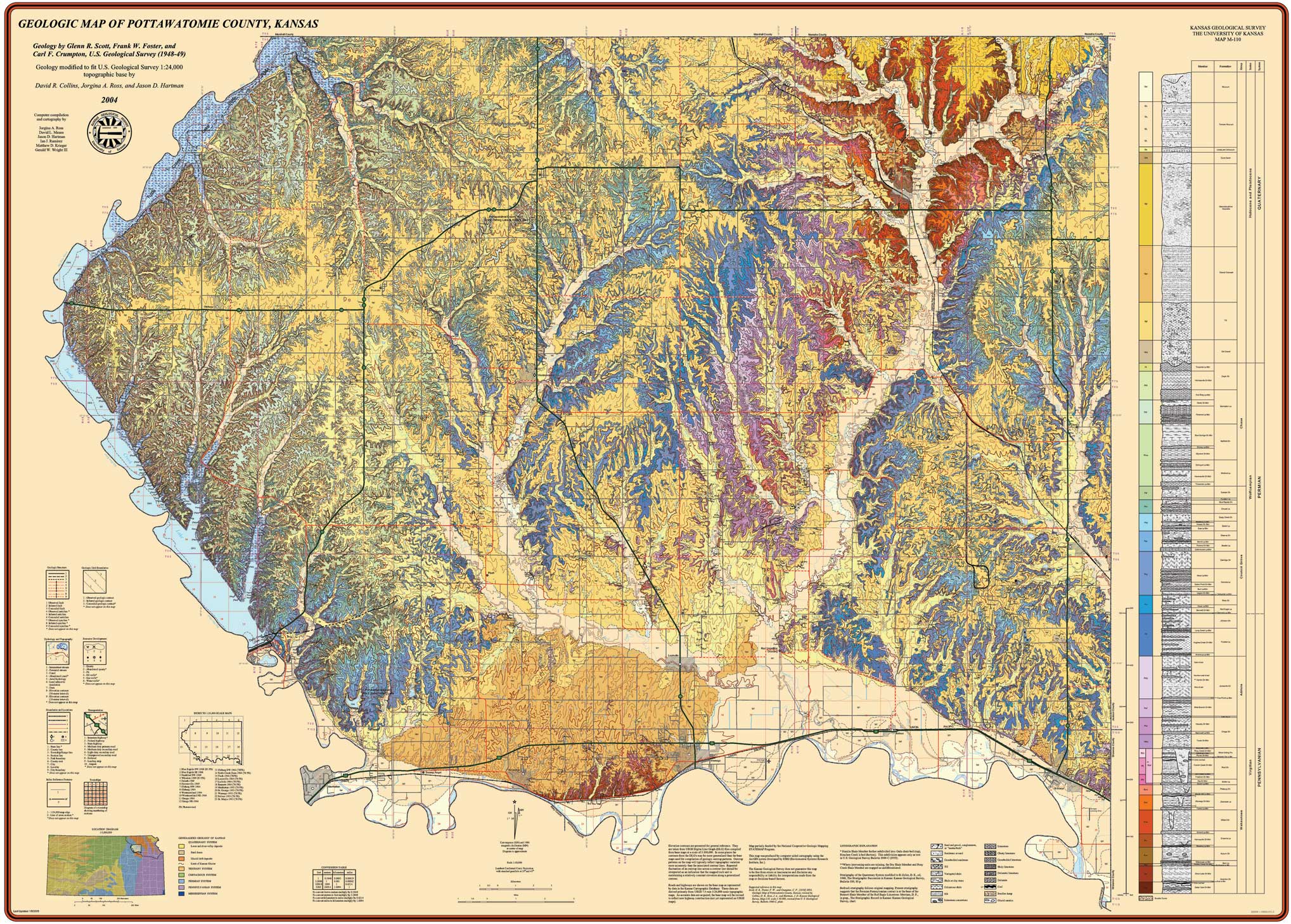
G. R. Scott , F. W. Foster , C. F. Crumpton, 2004, Geologic Map of Pottawatomie County, Kansas: Kansas Geological Survey, M-110, 1 sheet, 1:50,000
Paper copies of the complete map (with stratigraphic column and legend info) can be purchased from the Kansas Geological Survey, 1930 Constant Ave., Lawrence, KS 66047 (or phone 785-864-3965) and at 4150 W. Monroe St., Wichita, KS 67209-2640 (phone 316-943-2343).
Scott, G.R.; Foster, F.W.; and Crumpton, C.F., 1959, Geology and construction-material resources of Pottawatomie County, Kansas: U.S. Geological Survey, Bulletin 1060-C, pp. 97-178 (available from the U.S.G.S.)
Automated Cartography Unit, Kansas Geological Survey
Updated March 1, 2006
Comments to webadmin@kgs.ku.edu
URL=http://www.kgs.ku.edu/General/Geology/County/nop/pottawatomieLarge.html