Cherokee County
|
|
Cherokee County |
|
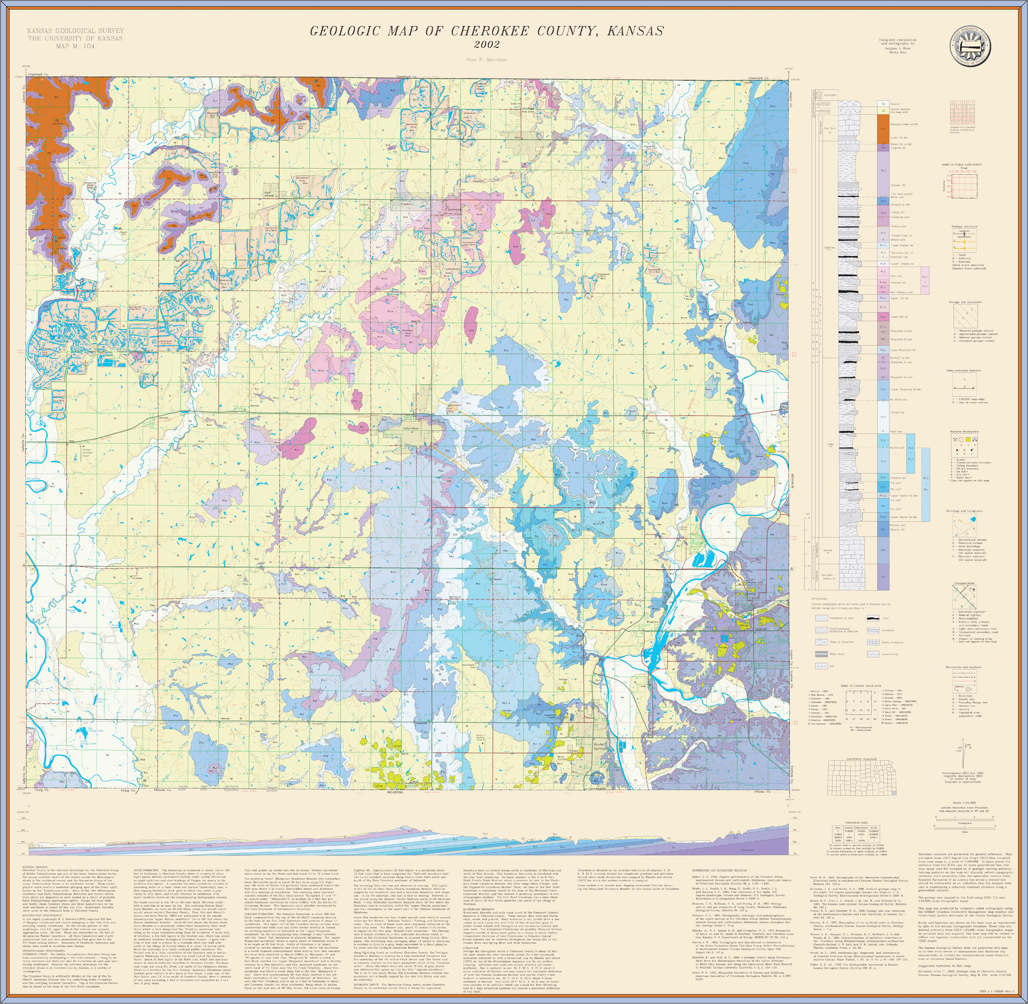
Bennison, Allan P., 2002, Geologic map of Cherokee County, Kansas: Kansas Geological Survey, Map M-104, scale 1:50,000, 43 x 41.5 inches.
Paper copies of the complete map (with stratigraphic column and legend info) can be purchased from the Kansas Geological Survey, 1930 Constant Ave., Lawrence, KS 66047 (or phone 785-864-3965) and at 4150 W. Monroe St., Wichita, KS 67209-2640 (phone 316-943-2343).
Cartographic Services, Kansas Geological Survey
Updated June 26, 2006
Comments to webadmin@kgs.ku.edu
URL=http://www.kgs.ku.edu/General/Geology/County/abc/cherokeeLarge.html