


Kansas Geological Survey, Open-File Rept. 91-1a
Pre-Graneros Paleogeography--Page 4 of 16
Figure 4. Summary core stratigraphy of the Gaydusek WII test hole in Washington County, Kansas.
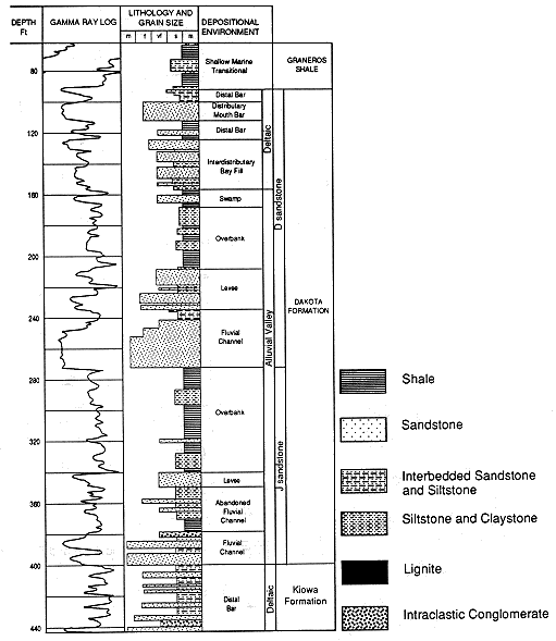
Figure 5. Summary of stratigraphy of the Kenyon #1 test hole in Republic County, Kansas.
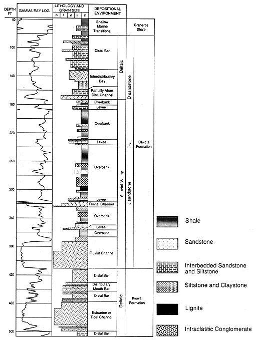
Figure 6. Summary core stratigraphy of the KGS #1 Jones test hole in Lincoln County, Kansas.
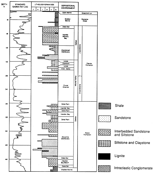
Figure 7. Summary stratigraphy of the Haberer test hole in Russell County, Kansas.
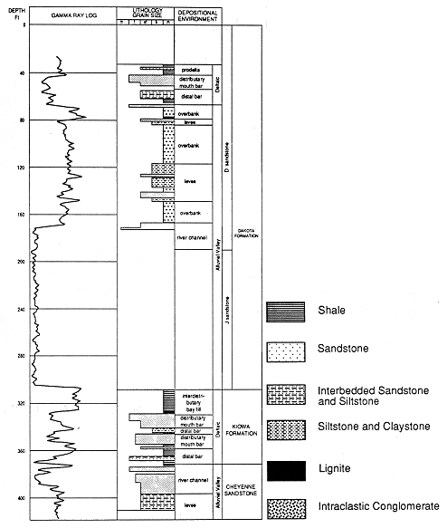
Table 1. Depth to the top of the Graneros Shale, Dakota Formation, Kiowa Formation, and Permian strata in feet (meters) in the Kenyon #1, Gaydusek WII, and KGS #1 Jones test holes, central Kansas.
| Test Hole | Graneros Shale | Dakota Formation | Kiowa Formation | Permian |
|---|---|---|---|---|
| Kenyon #1 | 58 (18) | 82 (25) | 410 (125) | 510 (155) |
| Gaydusek WII | 62 (19) | 90 (27) | 400 (122) | 443 (135) |
| KGS #1 Jones | 14.5 (4.4) | 59 (18) | 273 (83.2) | 474 (144) |
Previous page--Regional Sequence Stratigraphy ||
Next page--Surface and Subsurface Sections
Start of this report ||
Table of Contents