


Kansas Geological Survey, Open-File Rept. 91-1
Annual Report, FY91--Figure 45
Use "Back" on your browser to return to the page you were viewing.
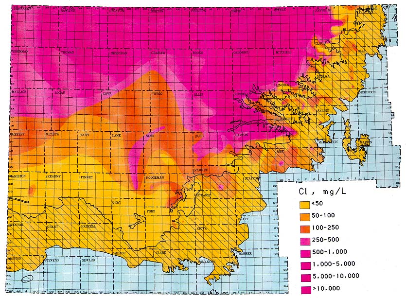
Figure 45.
Spatial variation of chloride concentration in ground
waters from the upper Dakota aquifer. The hatched area represents parts
of the aquifer that outcrop or are overlain by unconsolidated sediments
such as alluvium and the Ogallala aquifer. The map was prepared using
the ARC/INFO geographic information system.
Use "Back" on your browser to return to the page you were viewing.
Start of this report ||
Table of Contents
Kansas Geological Survey, Dakota Project
Original report available from the Kansas Geological Survey.
Electronic version placed online Nov. 1998
Comments to webadmin@kgs.ku.edu
URL=http://www.kgs.ku.edu/Dakota/vol3/fy91/fig45.htm