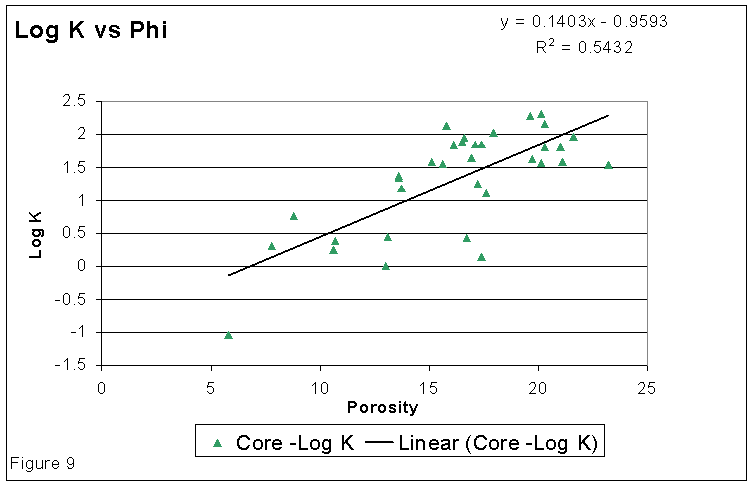
Results of laboratory analyses on whole cores were available for 4 wells in and around the unitized area. The wells for which core data was analyzed are: Widner #1-17 (NW NE of Section 17 in 30s-25w), Patton #1-3 (inside the unitized area, N/2 SW SE of Section 3 in 30s-25w), Statton #2-12 (NW NW NW of Section 12 in 30s-25w), and Fager #1-16 (NW NW NW of Section 16 in 30s-25w). Helium porosity and horizontal permeability measurements were available for 34 whole core samples taken from the Morrow sands in the above four wells. The log of the permeability was plotted (Figure 9) against the porosity to develop a permeability-porosity correlation. The equation of the best fitting linear trend through the plotted points is also shown in Figure 9.
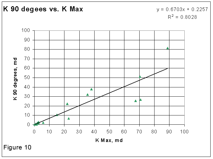
Maximum horizontal permeability and permeability in the direction perpendicular to the maximum horizontal permeability was available for eighteen core plugs from two wells: Patton #1-3 and Widner #1-17. This data is plotted in Figure 10 along with the equation of the best fitting linear trend.
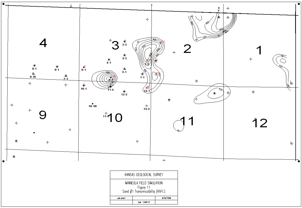
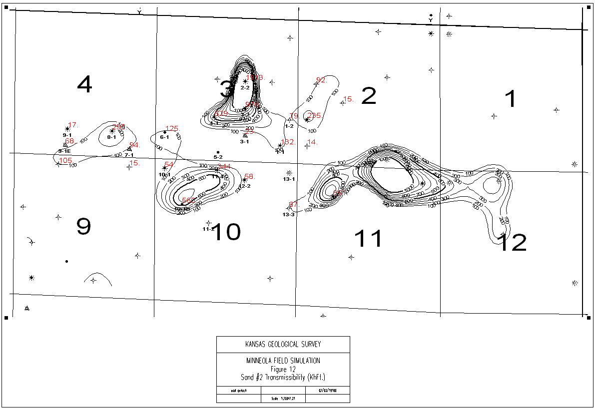
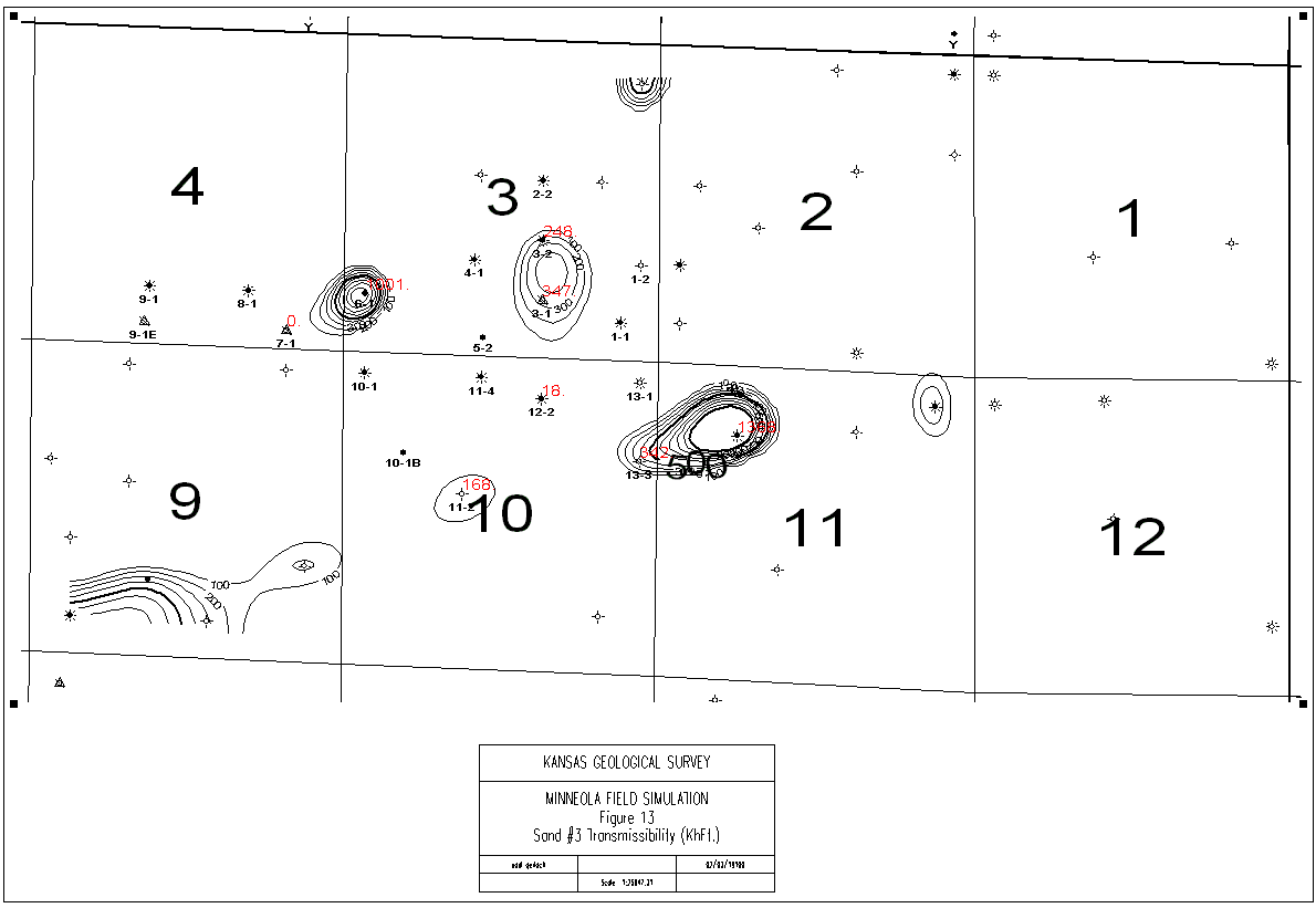
The permeability-porosity correlation obtained from Figure 9 was used to obtain average permeability for the sands at each well from the corresponding average porosity value (from Super-Pickett plot analysis). Transmissibility maps of the three sands in the unitized area are displayed in Figures 11, 12, and 13. These maps contour the permeability-thickness of the individual sands and also show the location of the wells. A comparison of Figure 12 and 13 reveals that most of the injected water from injector #7-1 will tend to enter sand #2. In case of injector #3-1, the situation is reversed. Both sand #2 and sand #3 have finite transmissibilities near injector #3-1. However, the transmissibility of sand #3 at injector #3-1 is about three and half times that of sands #2. Thus, in absence of bottom hole flow measurements of the injected fluids, it is reasonable to assume that most of the injected water in well #3-1 is entering sand #3.
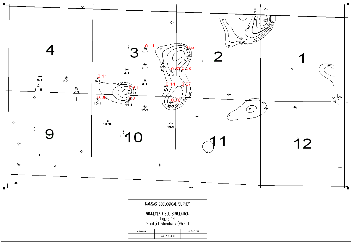
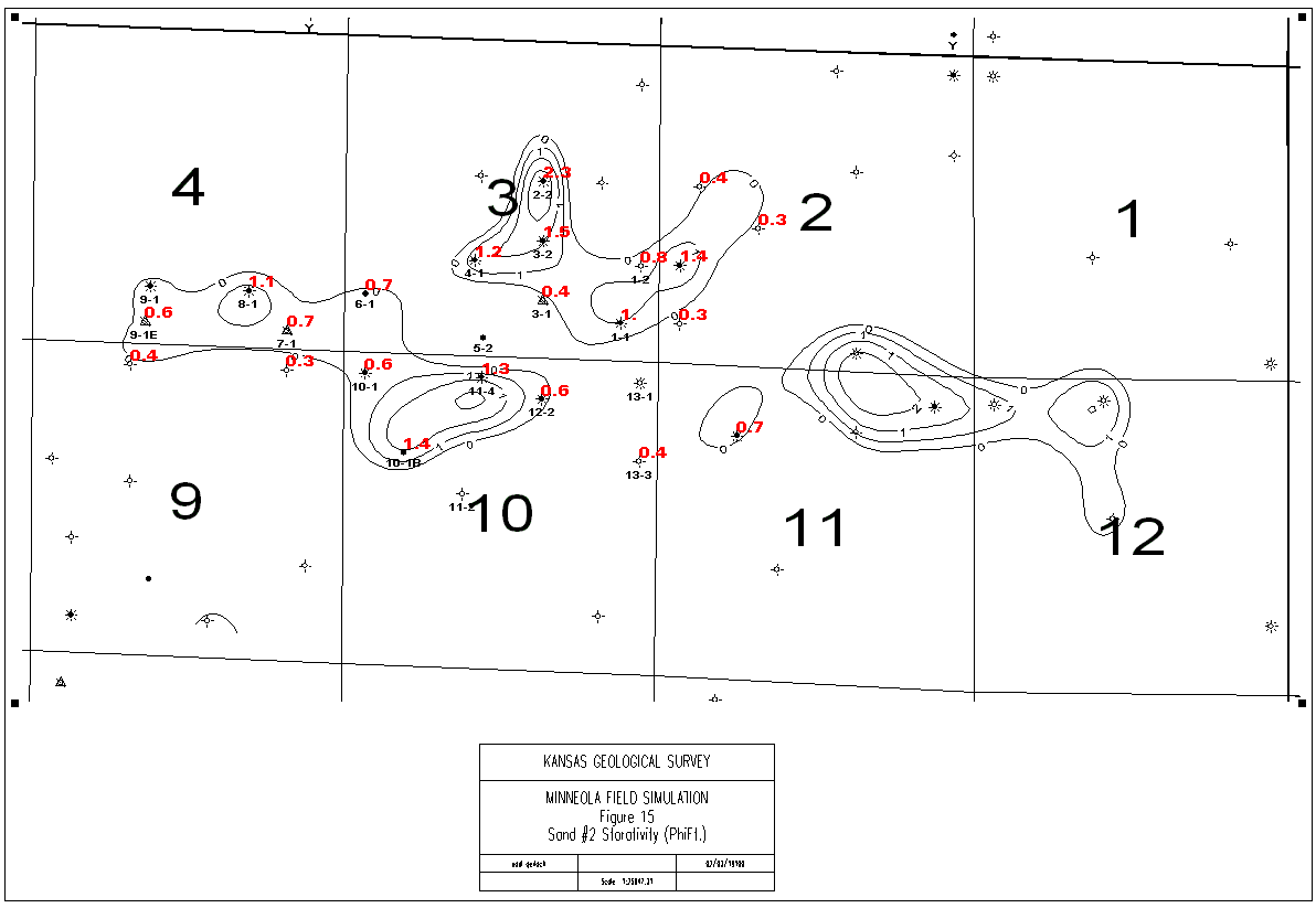
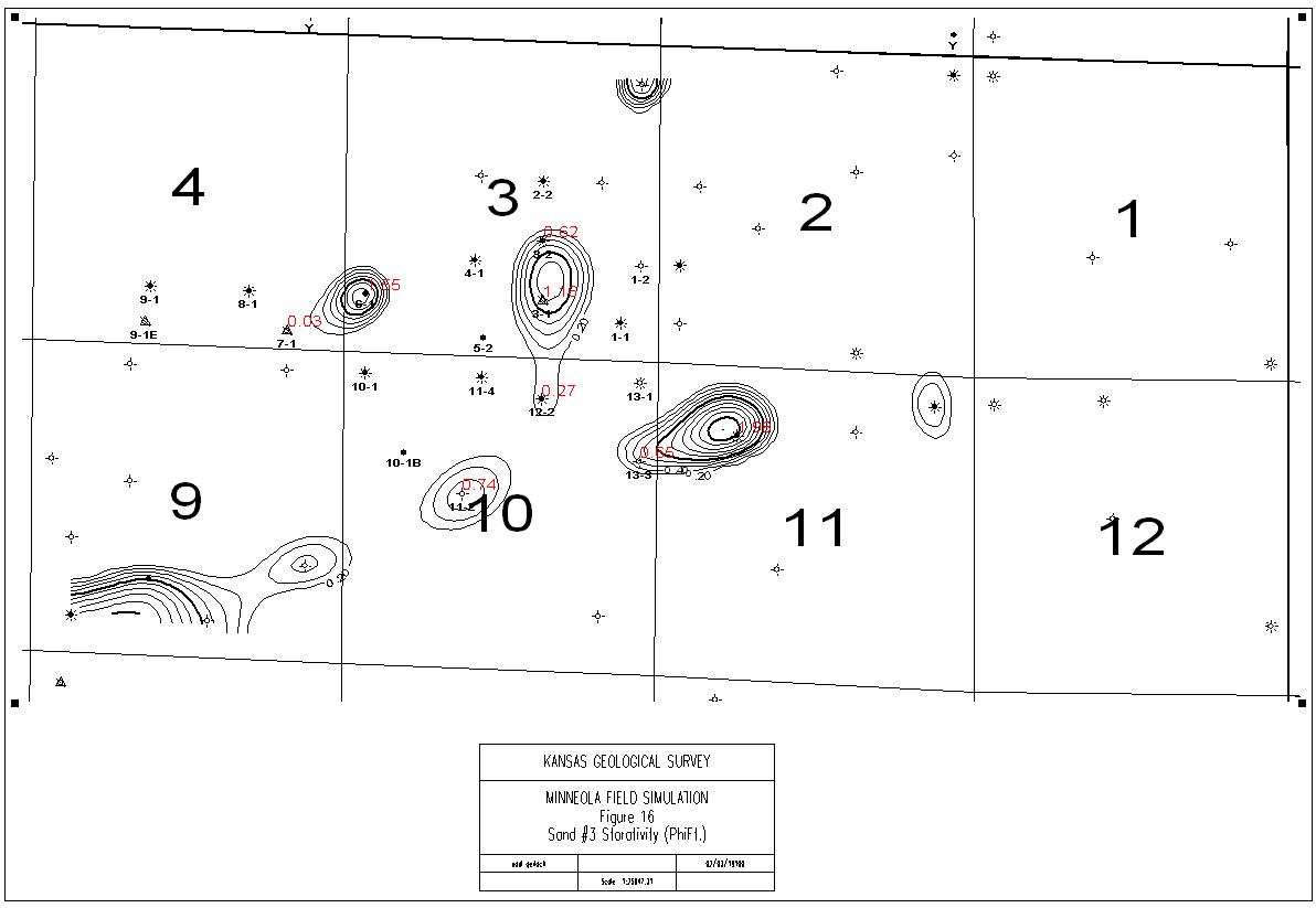
The storativity distributions in the three sands are plotted in Figures 14, 15 and 16. It is apparent from Figures 15 and 16, that the storativity of sand #3 around injector #3-1 is about 3 times that of sand #2. This difference in storativity will cause the major portion of the injected water at this injection well to flow into sand #3. Also, the storativity of sand #3 around the injector #7-1 is insignificant to that of sand #2 and this will divert most of the injected water into sand #2.
Storativity and transmissibility maps show that almost all
the injected water at well #7-1 will tend to flood sand #2 and
while at well #3-1 the injected water enters sand #3 in preference
to sand #2. Neither of the two injection-wells is open in sand
#1 and thus wells producing out of sand #1 will remain out of
the reach of water flood barring any hydraulic communication that
may exist between these sands in the inter-well areas.
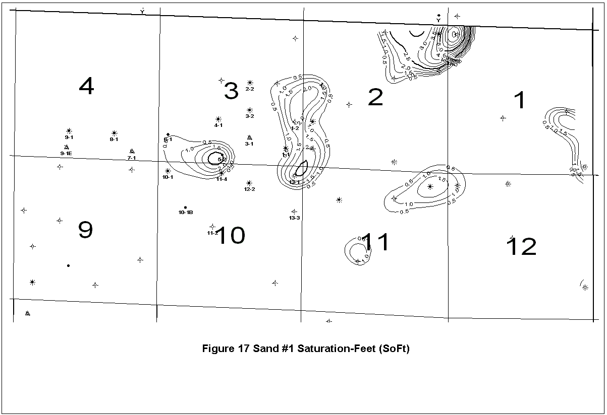
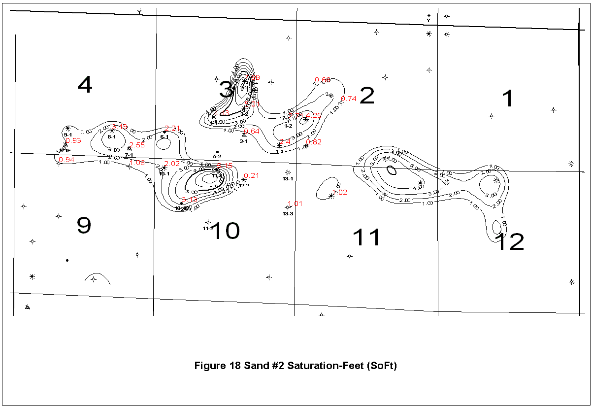
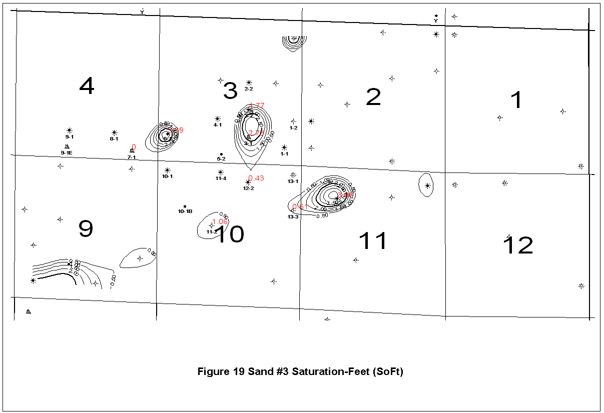
Figures 17, 18,
and 19 show the oil saturation-feet
distribution in the three sands. The oil saturations were used
in the volumetric calculations to obtain the original oil in place.
| Previous Page | Geological Mapping | Next Page | DST Analysis |
The URL for this page is http://www.kgs.ku.edu/DPA/Reports/Minneola/coredata.html
February 2000
Please send comments to webadmin@kgs.ku.edu