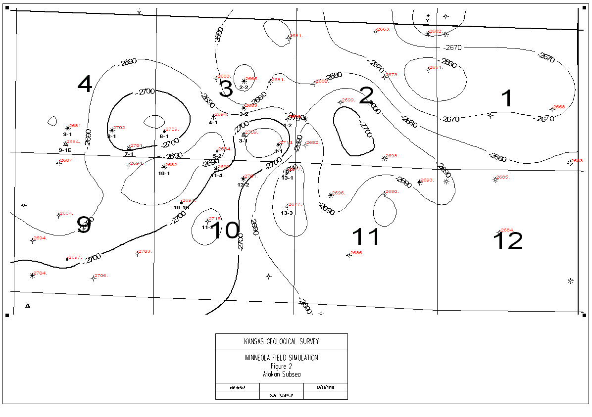
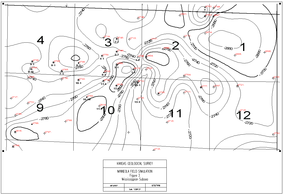
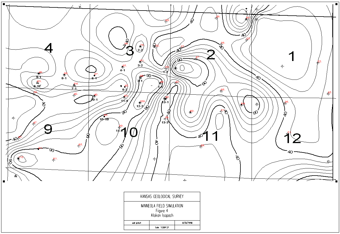
Most of the wells in the unitized area and its surrounding have petrophysical logs, and they were used to construct a geologic model. Figures 2 and 3 are subsea structure maps of the Atokan group and Mississippian system. Figure 4 displays the variation in thickness of the Atokan formation. Lithogic cross-sections enabled the identification of three sand bodies within the Morrow.
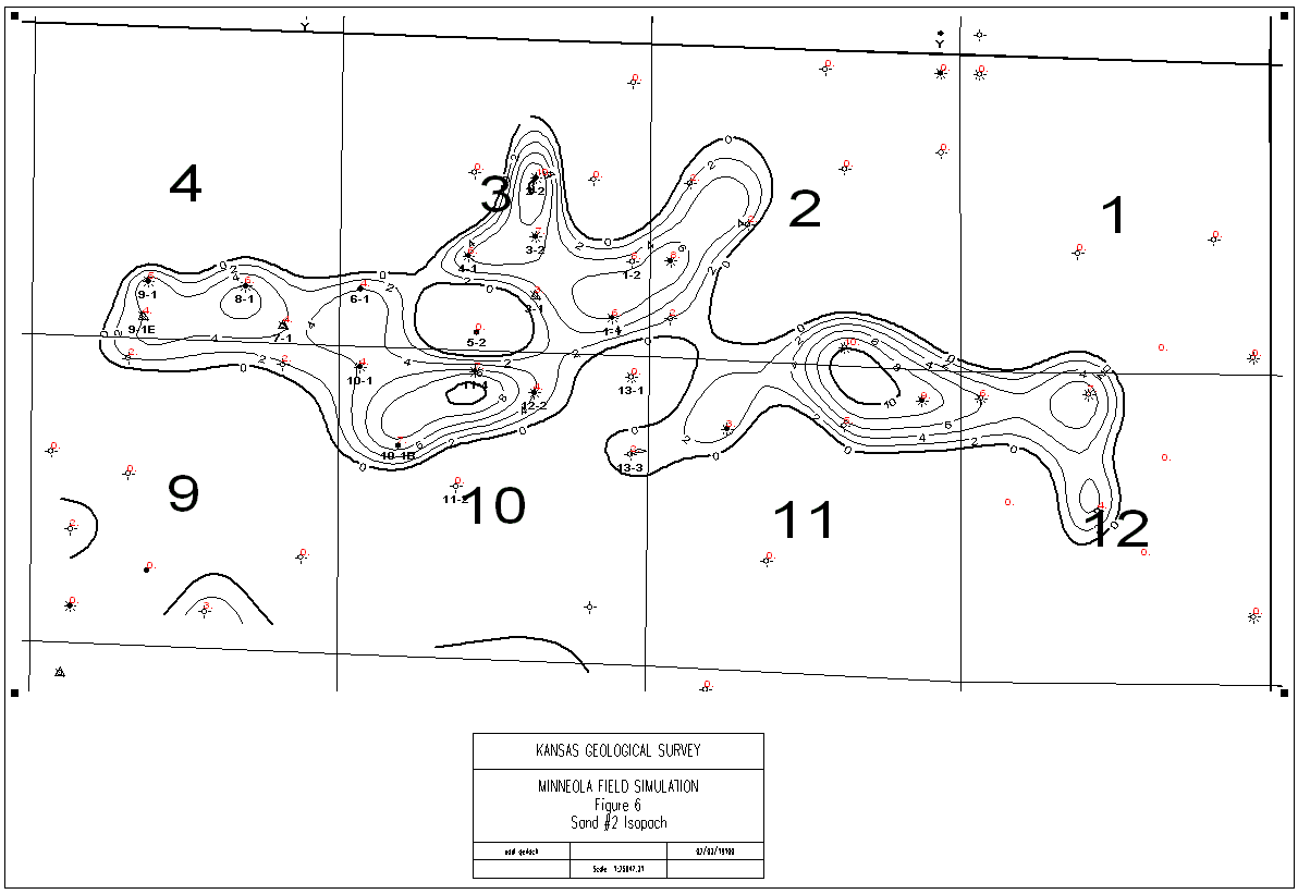
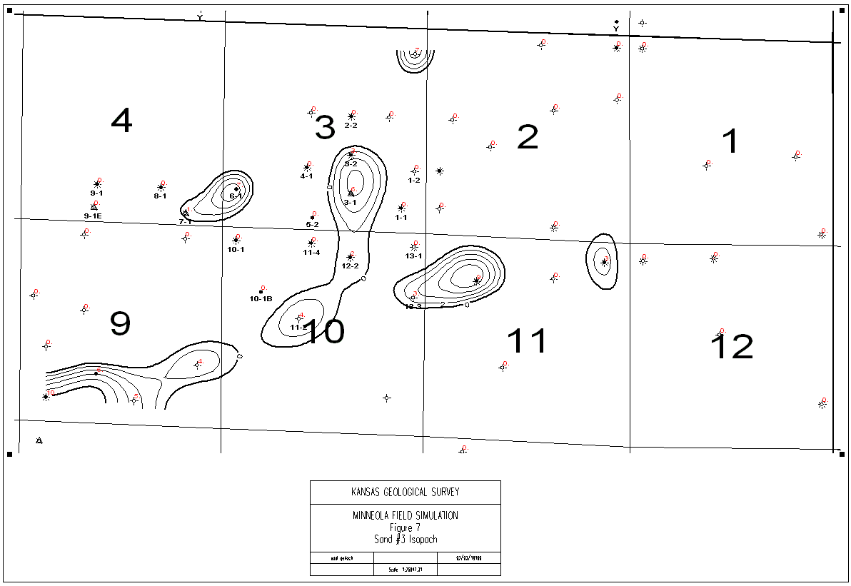
Figures 5, 6 and 7 are the isopachs of sand #1, sand #2, and sand #3. Initial mapping indicated that shale layers separated these sands. The above figures also show the sand intervals present in each of the wells. The isopach maps (Figures 5 and 6) show that sand #1 and sand #2 extend, into section 2 of 30s-25w, beyond the boundaries of the waterflooding unit. Figure 5 shows that sand #1 covers part of south-western corner of section 2 while Figure 6 shows sand #2 to extend into the same region of section 2. The zero isopach lines for sand #2 form a narrow neck at the south-western corner of section 2, and for the purposes of this study it was assumed that the border of sand #2 was located where the zero isopach lines were closest to each other. Because of the extension of the sand bodies beyond the boundaries of the unit, wells such as Rooney B #1-2, Hall #2-2, Hall #1-2, Hall B #1-2, all located in the south western part of section 2, were included in this study and this expanded study area will be termed as "unit plus Hall". Of these wells, only Hall #1-2 is a producer and its production was included in the volumetric study.
Petrophysical analysis was undertaken using Super-Pickett crossplots were constructed for each well, in the unit and surrounding area. The Super-Pickett plots are included in Appendix A. The Super-Pickett crossplot1,2 is a spreadsheet based technique for log analysis. It plots the log-derived porosity against the deep resistivity on a log-log axis. Using Archie's equation it generates the saturation contours on the plot. It also overlays the BVW (bulk-volume-water) contours on the plot. For sandstones, permeability contours can be displayed on the crossplot by using equations such as the Timur's correlation. The graphic capabilities of the spreadsheet environment allow pattern recognition of trends and clusters. These patterns when evaluated in light of the knowledge about sedimentary facies, grain and crystal size, capillary pressures, fluid saturations, pore geometries, and other factors result in modeling of the "petrofacies" in the reservoir.
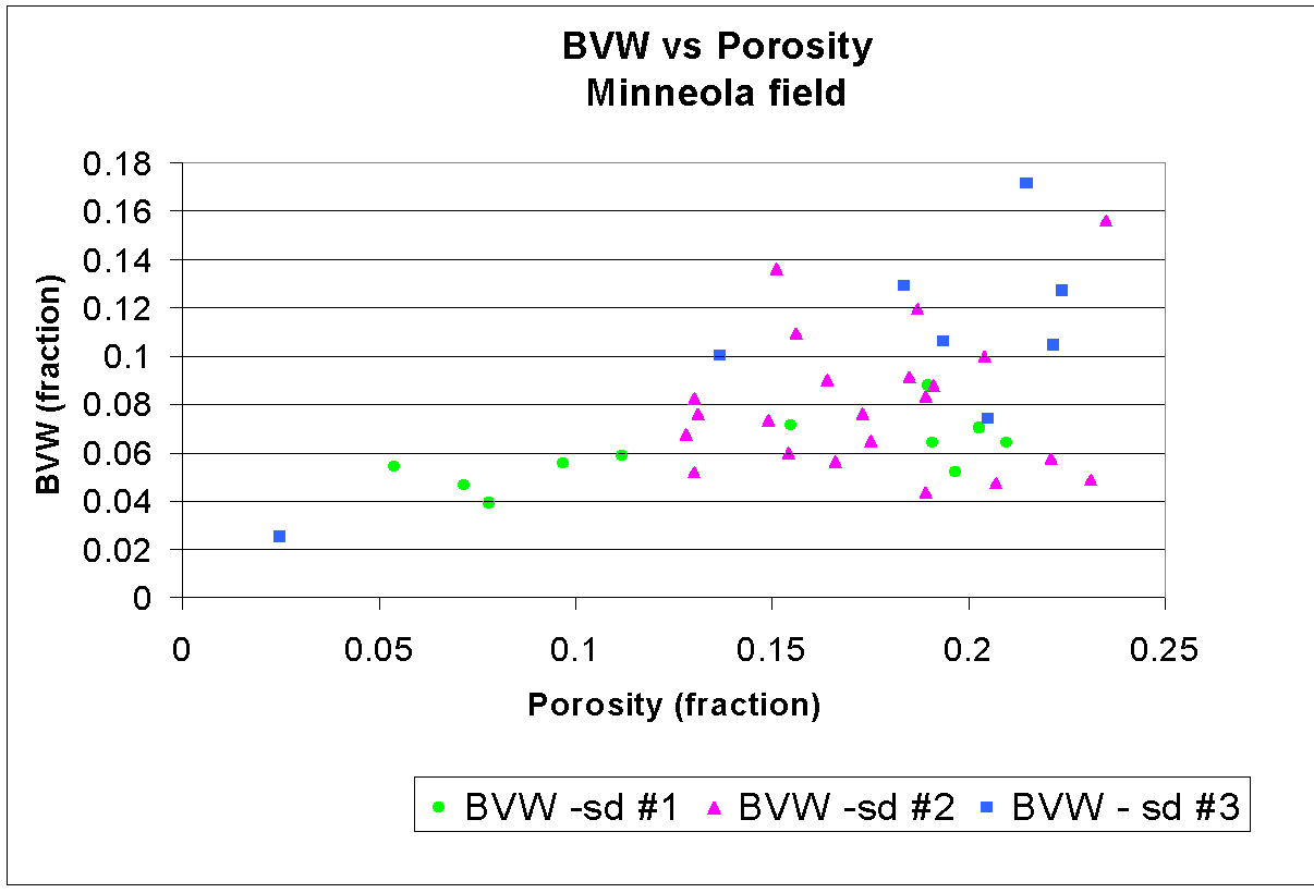
Table 1 summarizes the results of the petrophysical analysis and tabulates the average porosity, water saturation (calculated using Rw = 0.04 ohm-m), and BVW for each of the sands. In some cases, water free production was recorded during the initial testing and this identified the BVWi (i.e. the immobile bound water). The average BVW increases from sand #1 to sand #3 indicating that the fraction of the pore volume that is occupied by water is the maximum in sand #3. BVWi could be obtained in only a few cases, so doubts remain about their representativeness. However, the average values in sand #1 and sand #2 are very similar while those of sand #3 are significantly higher. Such difference in the BVWi values indicates that the pore size distribution in sand #3 contains a greater number of smaller pores as compared to the other two sands. Thus, the water saturation (Sw) cut-off for water-free production from sand #3 is higher than that of sands #1 and #2. Figure 8 is a plot of BVW versus water saturation for the three sands.
Rhomma-Umma plots were used to carry out lithology analyses in wells where the PE log was available. The Rhomma-Umma plots are included along with the Super-Pickett plots of the respective wells in Appendix A. Lithology analysis on sand #2 (in four wells) and sand #3 (in three wells) indicated the composition to be dominated by quartz with minor dolomite. Data from only one well could provide an analysis for sand #1 and it too was found to be predominantly quartz with minor dolomite.
| Previous Page | Introduction | Next Page | Core data analysis |
The URL for this page is http://www.kgs.ku.edu/DPA/Reports/Minneola/mapping.html
February 2000
Please send comments to webadmin@kgs.ku.edu