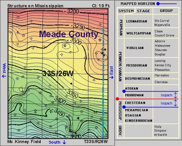
DPA Home Page DPA Home Page DPA Home Page DPA Home Page
General Field Info Field Geology Info Field Geophysics Info Field Reservoir Info Field Well Info Play: Chesteran
Basin: Anadarko
County: Meade and Clark counties

McKinney Field--Geology--Detail

Clicking on the small blue circles on the stratigraphic column will take you to pages showing structure or isopach maps.
Clicking on the "North," "South," "East," or "West" labels on the map will move you to another area of the map.
You can also use the buttons at right to explore.
Local Site Map Zoom Out North
West East
South

structure map Mississippian, McKinney field


Kansas Geological Survey, Digital Petroleum Atlas
Send comments and/or suggestions to webadmin@kgs.ku.edu
Updated Dec. 10, 1998
URL = http://www.kgs.ku.edu/DPA/McKinney/Geology/33S26W-ms-s.html