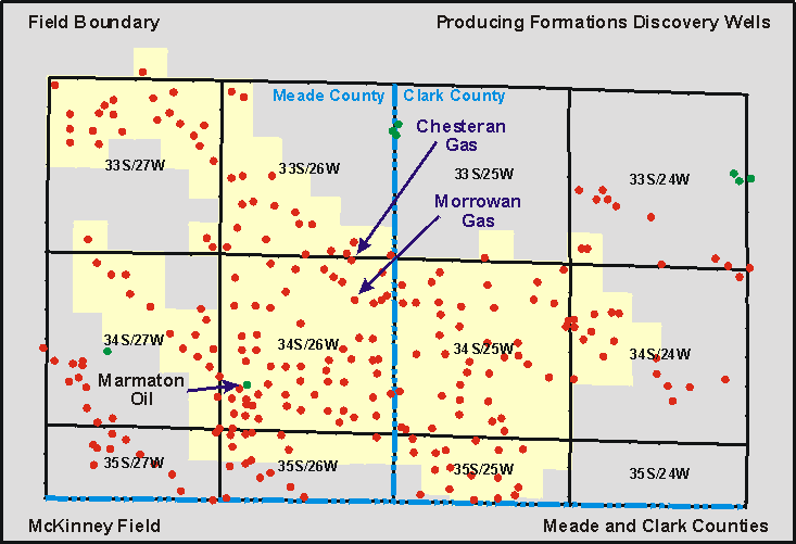
DPA Home Page DPA Home Page DPA Home Page DPA Home Page
General Field Info Field Geology Info Field Geophysics Info Field Reservoir Info Field Well Info Play: Chesteran
Basin: Anadarko
County: Meade and Clark counties

McKinney Field

You can explore the McKinney Field by clicking on the blue topic buttons to the left.
Use the Field Site Map to learn what resources are available for the McKinney Field.
Local Site Map

map of mckinney Field

Discovery Well
Skelly, #1 McKinney, NW NW NE, 2-T34S-R26W, 10/16/50, Chesteran Gas
Skelly, #1 Theis "B", SW SW NE, 11-T34S-R26W, 07/24/51, Morrowan Gas
Midco Exploration, #1 Rogers, SE SE NE, 30-T34S-R26W, 03/14/85, Marmaton Oil
Field Size: 103,680 acres
Total Wells:
Pennsylvanian Marmaton: 1 oil well
Pennsylvanian Morrowan: 58 gas wells
Mississippian Chesteran: 125 gas wells
Cumulative Oil: 887 mbbls as of 03/31/98
Current Average Monthly Oil: 100 bbls as of 03/31/98
Cumulative Gas: 196.2 bcf as of 03/31/98
Current Average Monthly Gas: 117.3 mmcf as of 03/31/98

Annual Field Production Data


Kansas Geological Survey, Digital Petroleum Atlas
Send comments and/or suggestions to webadmin@kgs.ku.edu
Updated Dec. 9, 1998
URL = http://www.kgs.ku.edu/DPA/McKinney/mckinneyMain.html