|
|
|
|
|
Click on Well for data |
|
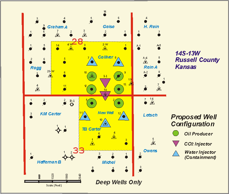
The following data set was compiled to aid in the reservoir characterization of the Lansing-Kansas City "C" zone for the CO2 pilot flood. In the immediate area of the flood (SE/4 Sec 28 and NE/4 Sec 33 of T14S, R13W) the data set includes all electric logs, driller's logs, well bore schematics, and sample logs that were available through the Kansas Geological Survey data library (Lawrence), the Kansas Geological Society Library (Wichita), and MV Energy, LLC's well files. In the areas peripheral to the pilot site (one-half to one mile distant) not all information was gathered and the data set includes mostly electric logs. Due to the vintage of the wells (most were drilled in the late 1930's and early 1940's) there are no modern open hole logs available in the immediate flood area and very few are available in the peripheral area. Most electric logs are un-scaled and un-calibrated gamma ray-neutron logs. Many wells do not have electric logs available. Data may be accessed through a "clickable" map or
through a "clickable" table.
The clickable table accesses |
|
|
Updated December 2000 URL = http://www.kgs.ku.edu/CO2/welldata.html Please send comments to webadmin@kgs.ku.edu |
|