
Operate a rental library of labelled rock samples.
The collection consists of rotary and cable-tool cuttings recovered from approximately 130,000 oil and gas wells, 96% of which are from Kansas and 3% from bordering states. Wells represented were drilled between 1916 and the present. Wells may be checked out for a fee or examined on-site at no cost. Binocular microscopes, a black light, HCL and solvents are furnished or clients may bring their own.
Sample wells are cataloged by legal description (section, township and range) and spot location, operator name, lease/well name and number, county name and total depth. Year drilled and API number are being added. The catalog is available in electronic database format which may be queried by one or a combination of the data entry categories.
Operate a sample cut.
"Raw" well samples, if labelled by depth, are washed and dried if necessary, split into one or more cuts and placed in individually labelled 3x5 inch metal-tab-top envelopes suitable for archiving. Each label contains operator name, lease/well name/number, legal description, spot location, API number and footage in the envelope. A fee is charged for this service.
Bibliographic search for literature and/or titles pertaining to Kansas Geology.
A complete set of publications of the Kansas Geological Survey and Bulletins of the American Association of Petroleum Geologists are available for reference.
Also available are various texts on geology and petroleum engineering,
geological maps, GSA, Kansas Geological Society publications, etc. For
reference use only: older pipeline and oil field maps, clippings from 1930
to the present pertaining to the oil industry, old county landowner/lease
maps and geologists-personal cross-sections and contour maps.
Retail outlet for publications and maps by Kansas Geological Survey.
A stock of out-of-print publications is available for sale and others are available by copy-machine at a cost of $0.10 - $0.20 per page.
Retail outlet for USGS topographic maps of Kansas.
Retail outlet for various USGS maps of the United States.
Furnish geological advice and gather specific geological data for individuals or companies if no more than 2 hours of specialist time is required.
(The two hour limit is to avoid competition with private consulting geologists). Identify rocks, minerals and fossils for clientele. Acquaint and familiarize clientele on use of topographical maps.
Presentations are available to school, club and civic groups on earth-science topics as well as history of local (Kansas) oil and gas activities.
Kansas Geological Survey
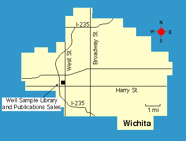
Wichita Well Sample Library
4150 Monroe St.
Wichita, KS 67209
phone (316) 943-2343
fax (316) 943-1261
The Well Sample Database may be accessed by subscription thru Geonet; an electronic bulletin board operated by the Kansas Geological Society. For additional information contact (voice) 316-265-8676, Tim Dugan or modem 316-265-1994.
Updated Oct. 30, 1995
Please send comments to webadmin@kgs.ku.edu
The URL for this page is HTTP://www.kgs.ku.edu/Tis/wichita.html