Kansas Geological Survey, Open-file Report 2009-14
by
Robert S. Sawin and Ronald R. West
KGS Open File Report 2009-14
July 2009
PR = Photorevised
Copies of the field maps are open-filed at the Kansas Geological Survey, Lawrence, Kansas.
These maps indicate lithostratigraphic units only. No temporal, genetic, or related depositional aspects are meant or implied.
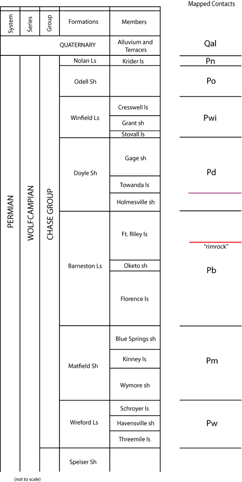
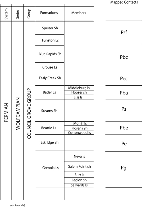
Stratigraphic nomenclature follows:
Zeller, D. E., ed., [1968] 2008, Classification of rocks in Kansas, revised by Kansas Geological Survey Stratigraphic Nomenclature Committee; in, The Stratigraphic Succession in Kansas: Kansas Geological Survey, Bulletin 189, 81 p., chart.
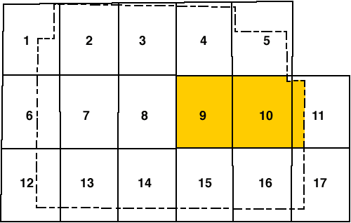
The stratigraphic sequence in this report is restricted to the interval from the Grenola Limestone at the base to the Doyle Shale at the top. Overlying these Permian rocks are Quaternary alluvium and terrace deposits. The following lithostratigraphic contacts were mapped in the Morris County quadrangles of this report:
Solid Line = Observed Contact
Dashed Line = Concealed Contact
Explanation--data control points for the Morris County map are identified by the following letter prefixes:
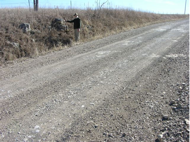
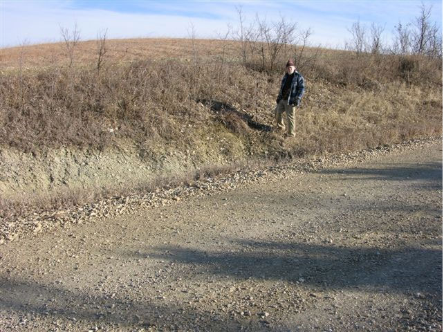
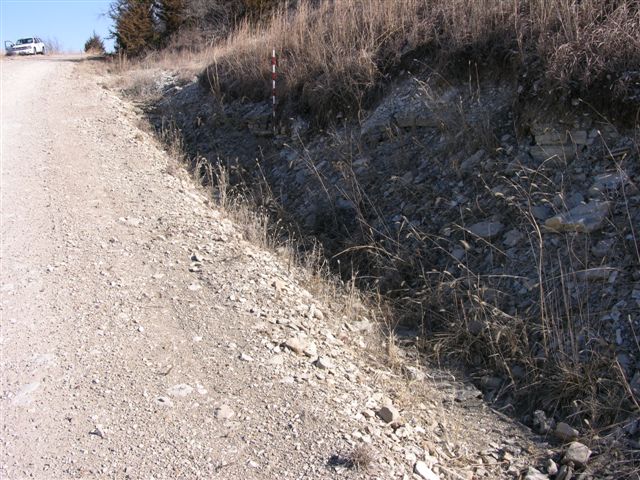
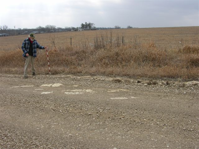
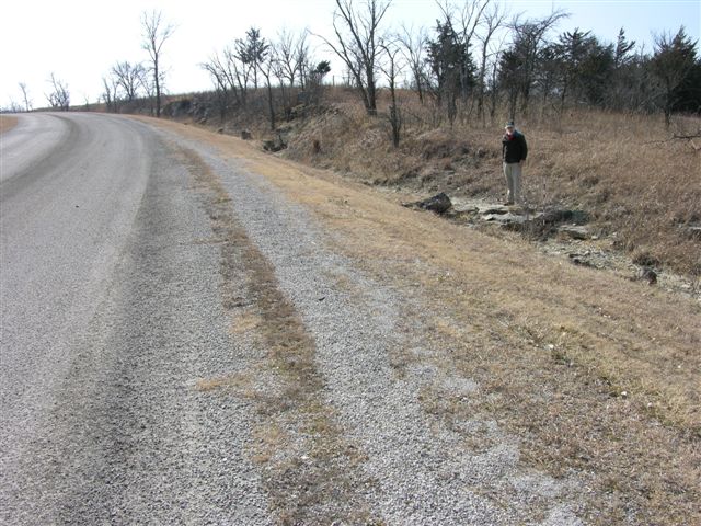
MR-130 = Base of Wreford Limestone (Threemile) inferred at 1360 ft in roadcut exposure on east side of road with mudrock in south creek bank on west side of road; 2 digital photos; approximately 200 ft south of center of west line SW, sec. 24, T. 15 S., R. 9 E., Morris Co., Kansas.
MR-131 = Exposure of Funston Limestone in field west of road (no contacts, on Morris-Lyon County line) at 1330 ft; 2 digital photos; near center of east line, sec. 25, T. 15 S., R. 9 E., Morris Co., Kansas.
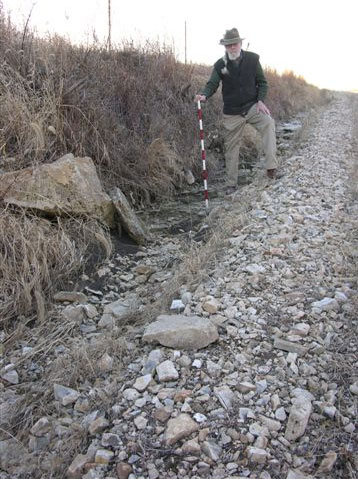
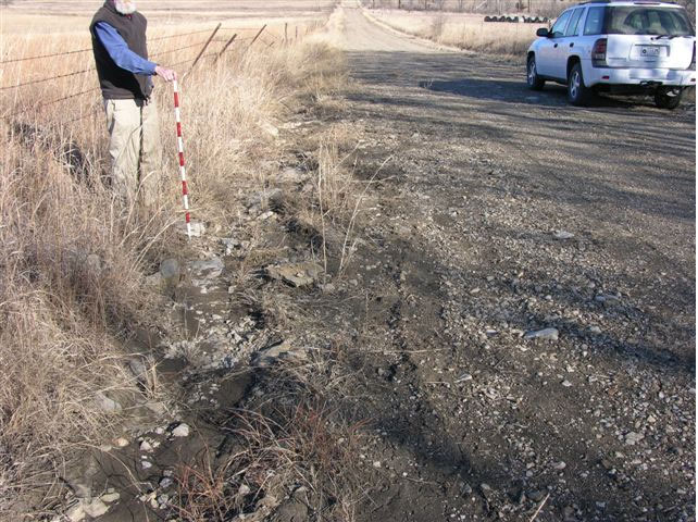
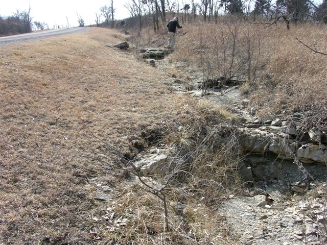
MR-132 = Base of Crouse Limestone at 1295 ft in road and in road ditches on both sides of road; what appears to be Easly Creek Shale with 1 foot of limestone is exposed below in road ditch on east side of road and a gray green to reddish mudrock is exposed in a pasture on the west side of road below the 1 foot limestone in the presumed Easly Creek Shale; 2 digital photos (second one is at water level on west side of road); approximately 250 ft south of center of west line NW NW, sec. 12, T. 16 S., R. 9 E., Morris Co., Kansas.
MR-133 = Funston Limestone at 1340 ft in road and fields on both sides of road with reddish mudrock of Speiser Shale above in road; 1 digital photo; approximately 400 ft north of SW corner, sec. 1, T. 16 S., R. 9 E., Morris Co, Kansas.
MR-134 = Base of Wreford Limestone (Threemile) inferred at 1348 ft in road; 1 digital photo; near center of west line NW, sec. 1, T. 16 S., R. 9 E., Morris Co., Kansas.
MR-135 = Crouse Limestone at 1290 ft in hillside on south side of road; 1 digital photo; near NW corner, sec. 1, T. 16 S., R. 9 E., Morris Co., Kansas.
MR-136 = Base of 5.5 ft of Funston Limestone at 1322 ft in road and on both sides of road; 1 digital photo; approximately 100 ft south of NW corner, sec. 1, T. 16 S., R. 9 E., Morris Co., Kansas.
MR-137 = Base of Wreford Limestone (Threemile) at 1353 ft in roadcut exposure on west side of road with greenish gray mudrock of Speiser Shale below; 1 digital photo; near center of east line NE NE NE, sec. 2, T. 16 S., R. 9 E., Morris Co., Kansas.
NOTE: 22.0 ft of Speiser Shale between the Funston Limestone at MR-136 and the base of the Wreford Limestone (Threemile) at MR-137.
MR-138 = At 1354 ft in a road ditch on the south side of the road is 0.5 ft of mudrock that looks like the mudrock unit in the lower part of the Threemile limestone; 2 digital photos; approximately 800 ft east of NW corner, sec. 11, T. 16 S., R. 9 E., Morris Co., Kansas.
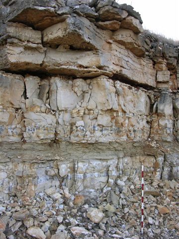
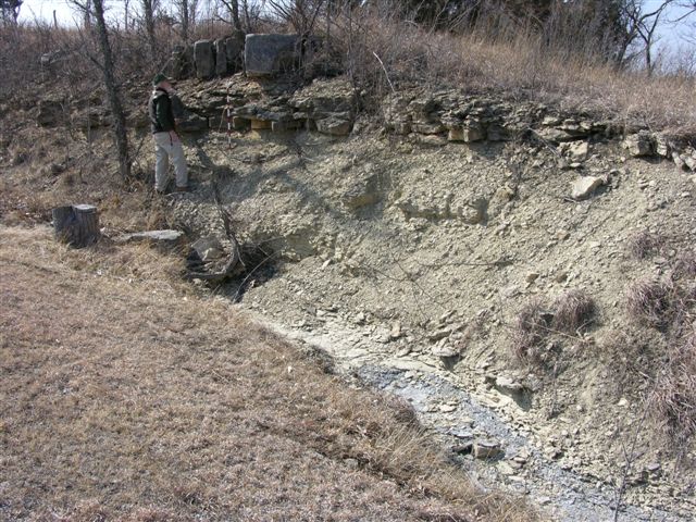
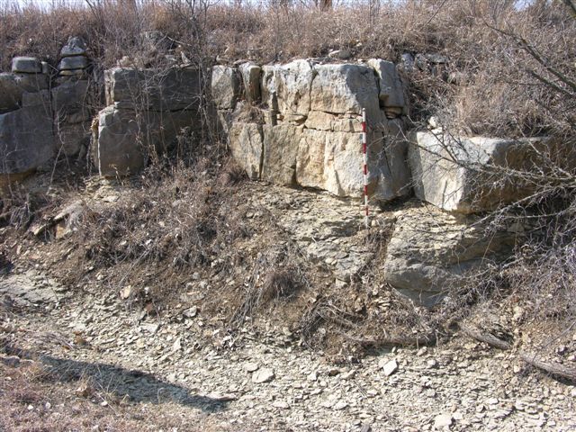
MR-139 = Top of Bader Limestone (Middleburg) at 1282 ft in roadcut exposure on east side of road; lower bed of the Middleburg limestone is separated from the thin and platy beds of the upper Middleburg limestone by a mudrock unit; 1 digital photo; near center of west line NW NW, sec. 18, T. 16 S., R. 10 E., Morris Co., Kansas.
MR-140 = Top of Crouse Limestone at 1310 ft in roadcut exposure on west side of road; upper beds of the Crouse Limestone are thick to massive but weather into thin plates; a spring occurs at the base of these upper beds; 1 digital photo; near center of east line of SE NE, sec. 13, T. 16 S., R. 9 E., Morris Co., Kansas.
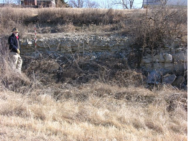
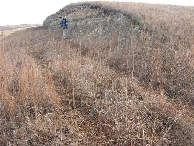
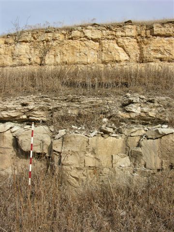
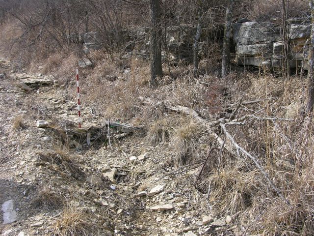
MR-141 = Base of Beattie Limestone (Cottonwood) at 1230 ft in east bank of Rock Creek on south side of road; 1 digital photo; near center of north line NE, sec. 24, T. 16 S., R. 9 E., Morris Co., Kansas--see graphic section.
MR-142 = Top of Easly Creek "limestone" at 1290 ft in roadcut exposure on both sides of road; 1 digital photo of exposure on north side of road; approximately 200 ft west of center of north line NE NE, sec. 24, T. 16 S., R. 9 E., Morris Co., Kansas.
MR-143 = Top of Bader Limestone (Middleburg) at 1293 ft in road ditch on east side of road; tombstone-like topography suggests Middleburg limestone; Easly Creek Shale above Middleburg limestone with lower beds of Crouse Limestone forming a bench above the Easly Creek Shale; 1 digital photo; near center of east line SW SW SW, sec. 12, T. 16 S., R. 9 E., Morris Co., Kansas.
Explanation--data control points for the Morris County map are identified by the following letter prefixes:
MR-116 = MMW-17 = Top of Wreford Limestone (Schroyer) at 1308 ft in roadcut exposure on west side of Kansas Highway 177 north of Council Grove, Kansas; also exposed on east side of highway; 2 digital photos; near center of north line SE SW SW, sec. 23, T. 15 S., R. 8 E., Morris Co., Kansas.
MR-117 = Exposure of Kinney limestone (Matfield Shale) at 1338 ft in hillside on south side of road; 1 digital photo; near center NW NE, sec. 23, T. 15 S., R. 8 E., Morris Co., Kansas.
MR-118 = Top of Wreford Limestone (Schroyer) at 1300 ft in drainage on south side of road; 1 digital photo; approximately 100 ft east of center of west line SE NW NE, sec. 23, T. 15 S.,R. 8 E., Morris Co., Kansas.
MR-119 = MMW-19 = Top of Wreford Limestone (Schroyer) at 1303 ft in roadcut on west side of Kansas Highway 177 north of Council Grove, Kansas; 1 digital photo; also exposed on east side of highway; near old road were MMW-19 was measured and described; near center of east line SW NW, sec. 35, T. 15 S., R. 8 E., Morris Co., Kansas.
MR-120 = Top of Wreford Limestone (Schroyer) at 1321 ft in roadcut on east side of Kansas Highway 177 north of Council Grove, Kansas; 1 digital photo; also exposed on west side of highway; near MMW-21; near center SW SE, sec. 2, T. 16 S., R. 8 E., Morris Co., Kansas.
MR-121 = Base of Barneston Limestone (Florence) at 1380 ft in hillside on east side of road; 1 digital photo; near center of south line SW, sec. 29, T. 15 S., R. 9 E., Morris Co., Kansas.
MR-122 = Top of Wreford Limestone (Schroyer) at 1335 ft in road and field north of road; 1 digital photo; near center of south line SE SW SE, sec. 1, T. 16 S., R. 8 E., Morris Co., Kansas.
MR-123 = Covered base of Barneston Limestone (Florence) estimated at 1445 ft in road ditch on north side of road; underlying mudrock of Blue Springs shale in place; no limestone; 1 digital photo; center south line SW SE, sec. 21, T. 15S., R. 9 E., Morris Co., Kansas.
MR-124 = Probable top of Wreford Limestone (Schroyer) at 1360 ft in road ditch on east side of road; 1 digital photo; approximately 200 ft south of center of west line SW NW, sec. 10, T. 16 S., R. 9 E., Morris Co., Kansas.
MR-125 = Base of Barneston Limestone (Florence) at 1420 ft in roadcut exposure on north side of road; 1 digital photo; approximately 350 ft east of SW corner, sec. 4, T. 16 S., R. 9 E., Morris Co., Kansas.
MR-126 = Top of Wreford Limestone (Schroyer) at 1361 ft in road ditch on east side of road; 1 digital photo; approximately 200 ft south of center of west line SW, sec. 4, T. 16 S., R. 9 E., Morris Co., Kansas.
MR-127 = Exposure of Kinney limestone (Matfield Shale) at 1405 ft in roadcut exposure with a good exposure of Blue Springs shale above on east side of road; 1 digital photo; near center of west line SW SW, sec. 4, T. 16 S., R. 9 E., Morris Co., Kansas.
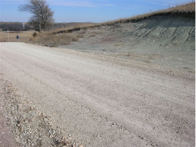
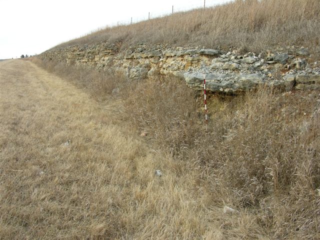
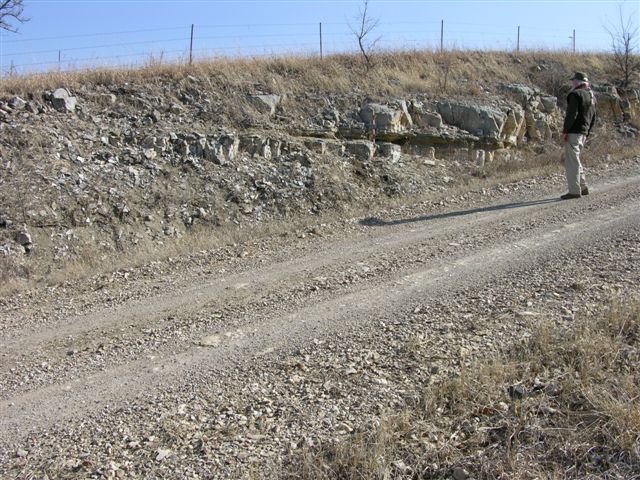
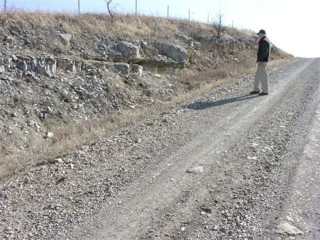
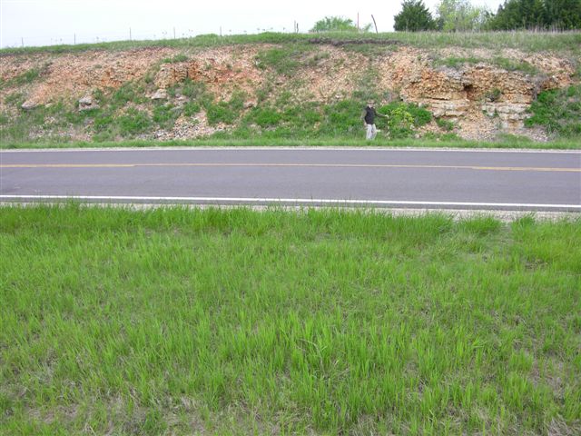
MR-128 = Base of Wreford Limestone (Threemile) at 1330 ft in roadcut exposure on north side of U. S. Highway 56; top of Threemile limestone and lower beds of Havensville shale exposed on both sides of road just north of intersection with U. S. Highway 56 east of Council Grove, Kansas; 4 digital photos: 1 of base of Wreford Limestone, 2 of Threemile limestone one on west and one on east side of road, and 1 of top of Threemile and lower Havensville shale on east side of road; SW corner, sec. 9, T. 16 S., R. 9 E., Morris Co., Kansas.
MR-129 = Top of Wreford Limestone (Schroyer, grainstone with oomoldic porosity) at 1395 ft in road and in field west of road; 1 digital photo; center east line SE SE, sec. 34, T. 15 S., R. 9 E., Morris Co., Kansas.
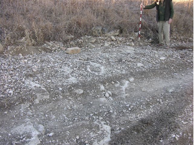
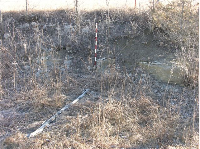
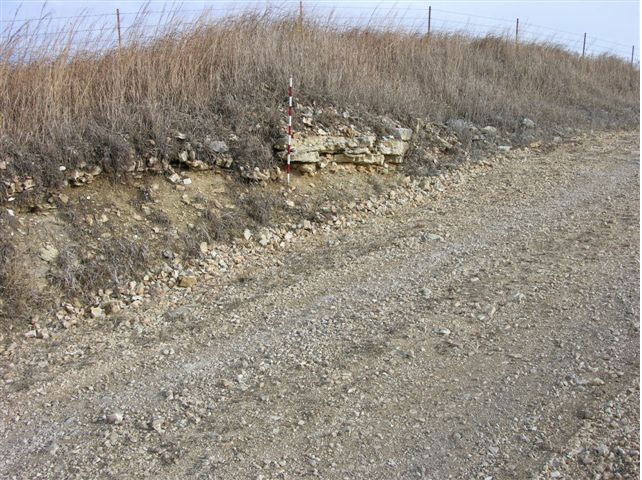
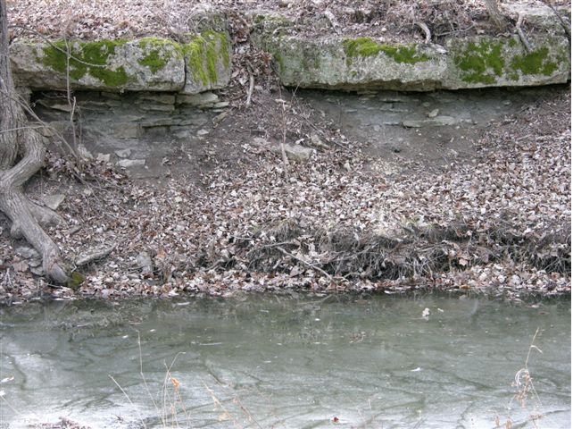
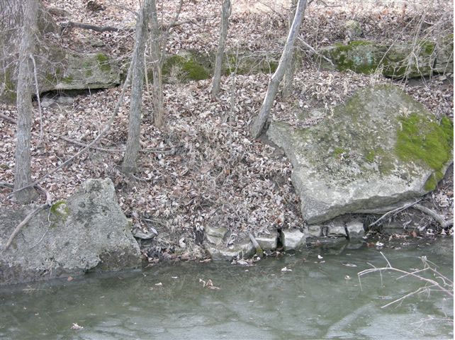
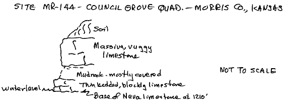
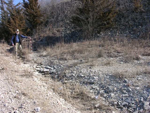
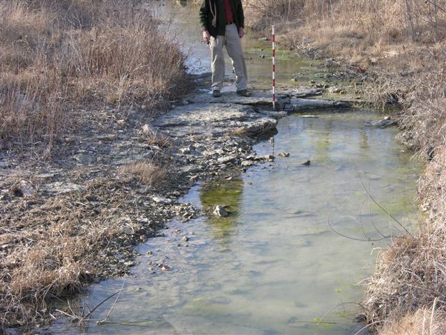
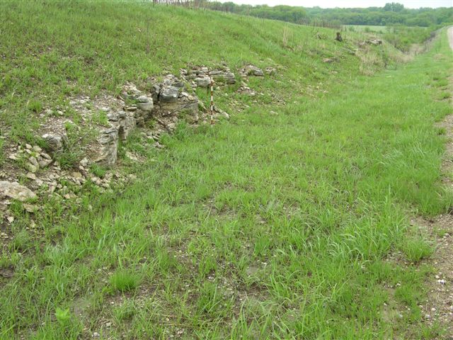
MR-144 = Limestone in the Grenola Limestone (Neva) at 1210 ft exposed in the northeast facing stream bank on the southwest side of road; the conspicuous bed is massive and vuggy overlying a covered interval assumed to be mudrock with two thin beds of limestone below at water level; 3 digital photos, third one is of limestone beds at water level; approximately 200 ft east of center of south line SW NE, sec. 16, T. 16 S., R. 9 E., Morris Co., Kansas.
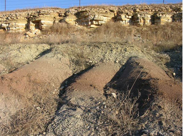
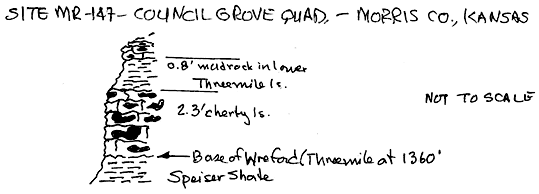
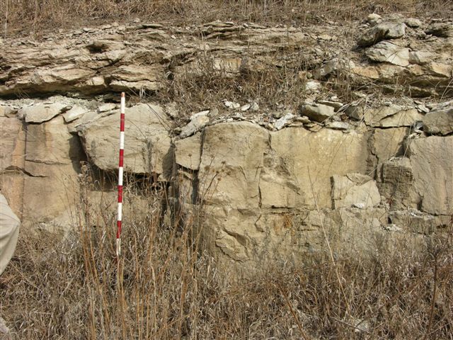
MR-147 = Base of Wreford Limestone (Threemile) at 1360 ft. in roadcut exposure on the north side of U. S. Highway 56 east of Council Grove, Kansas, with Speiser Shale well exposed below; 3 digital photos; center of south line SW, sec. 11, T. 16 S., R. 9 E., Morris Co., Kansas--see graphic section.
MR-148 = Funston Limestone at 1335 ft in road and road ditches on both sides of road; 1 digital photo; center of west line SW SW NW, sec. 14, T. 16 S., R. 9 E., Morris Co., Kansas.
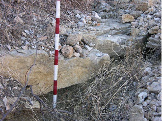
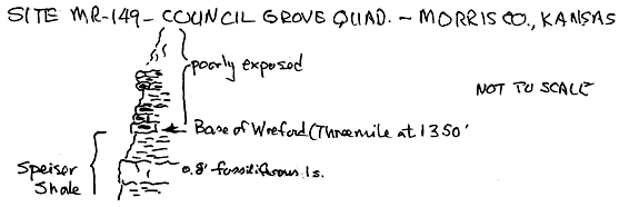
MR-149 = Base of Wreford Limestone (Threemile) at 1350 ft in roadcut exposure on east side of road with 0.8 ft (2.5 dm) of fossiliferous limestone in the upper Speiser Shale; 2 digital photos: 1 of base of Wreford Limestone and one of fossiliferous limestone in Speiser Shale; center of west line, sec 14, T. 16 S., R9E., Morris Co., Kansas--see graphic section.
MR-150 = Base of Wreford Limestone (Threemile) at 1350 ft in roadcut exposure on east side of road with fossiliferous limestone in Speiser Shale as at MR-149; 1 digital photo; near center of west line SW SW, sec. 14, T. 16 S., R. 9 E., Morris Co., Kansas.
MR-151 = Crouse Limestone at 1309 ft in road and road ditches on both sides of road; 1 digital photo with mudrock and limestone of upper Easly Creek Shale below; center of west line SW NW NW, sec. 23, T. 16 S., R. 9 E., Morris Co., Kansas.
MR-152 = Crouse Limestone at 1309 ft in road; similar to limestone at MR-151; 1 digital photo near covered base; near center of west line SW NW, sec. 26, T. 16 S., R. 9 E., Morris Co., Kansas.
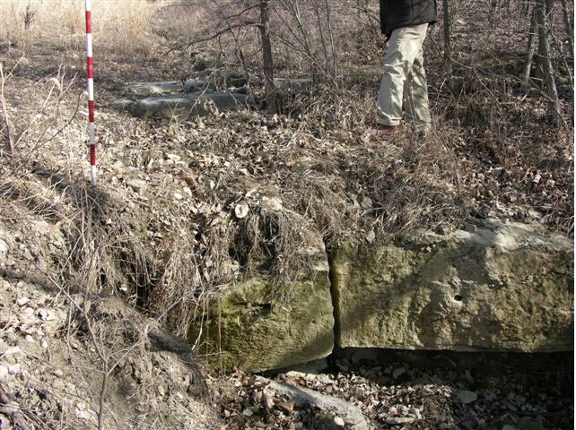
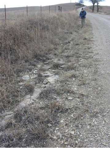
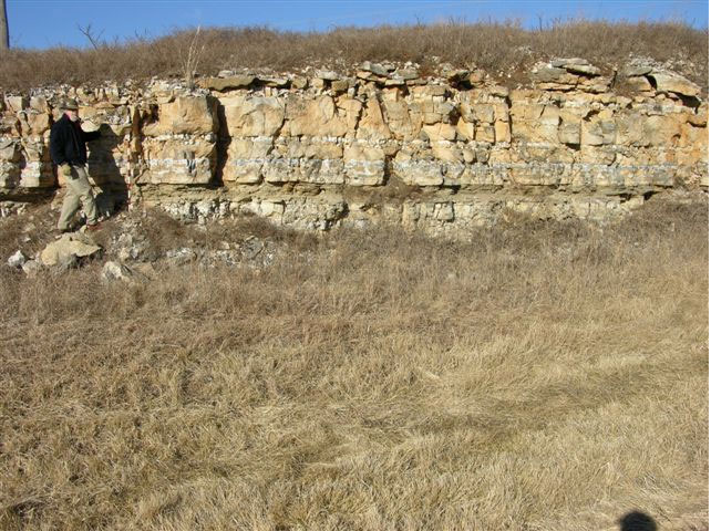
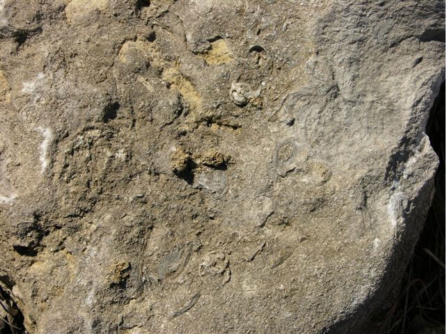
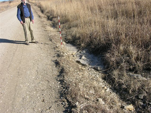
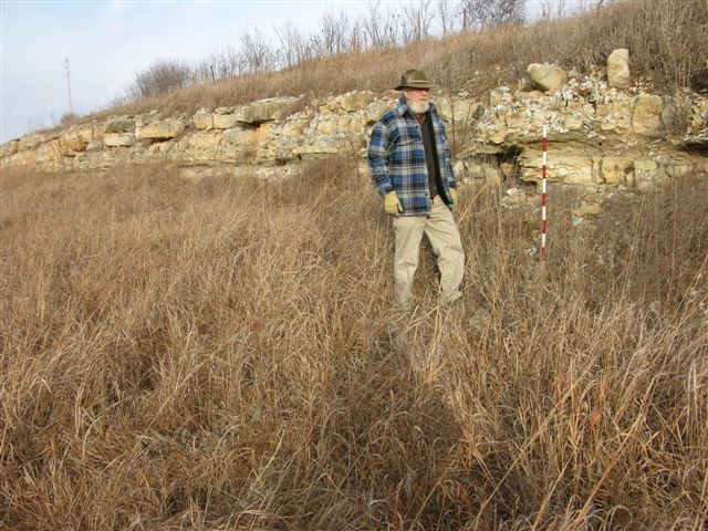
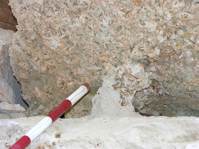
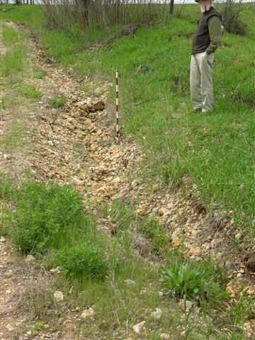
MR-153 = Top of the Eiss limestone (Bader Limestone) at 1279 ft in roadcut exposure on west side of road; 2 digital photos: 1 general view and a close-up of recrystallized bellerophontid gastropods in limestone; center of east line NE NE, sec. 27, T. 16 S., R. 9 E., Morris Co., Kansas.
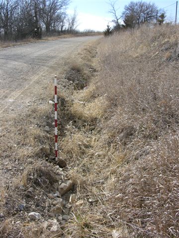
MR-158 = Base of Wreford Limestone (Threemile) at 1321 ft in roadcut exposure on east side of road with upper Speiser Shale exposed below; 1 digital photo; near center of west line SW SW NE, sec. 20, T. 16 S., R. 9 E., Morris Co., Kansas.
MR-159 = Base of Wreford Limestone (Threemile) at 1319 ft in roadcut exposure on south side of road with lower Speiser Shale exposed below; upper Speiser Shale covered by chert rubble from Threemile limestone; 1 digital photo; near center of north line NW NW SW, sec. 20, T. 16 S., R. 9 E., Morris Co., Kansas.
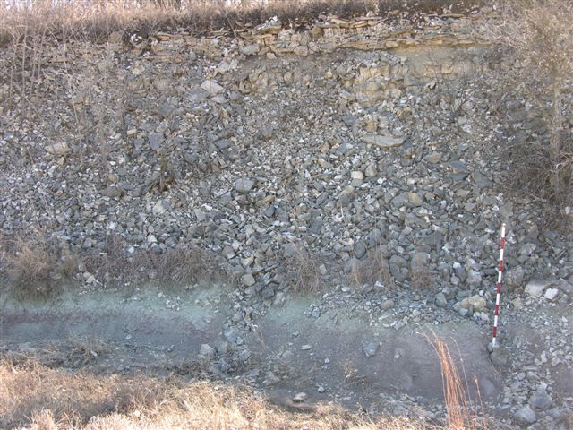
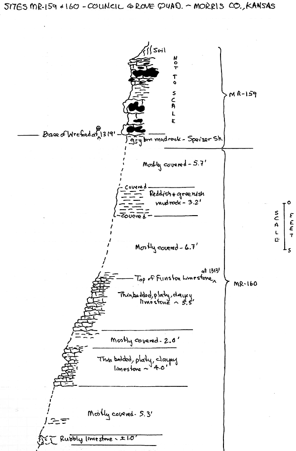
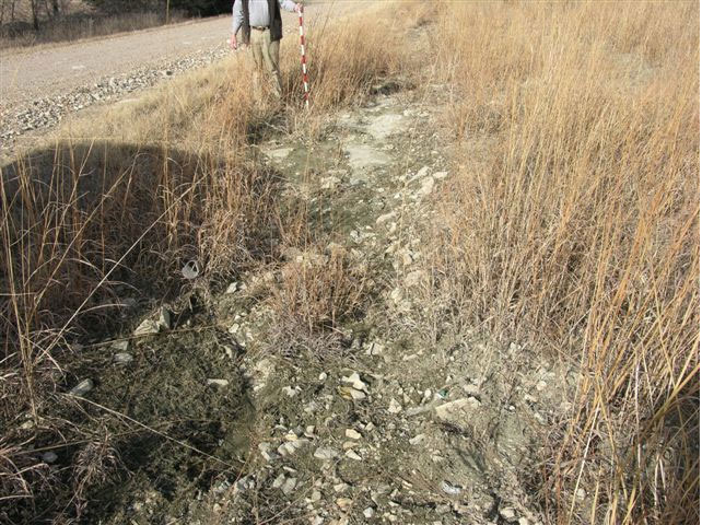
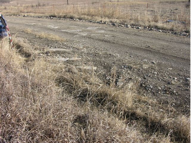
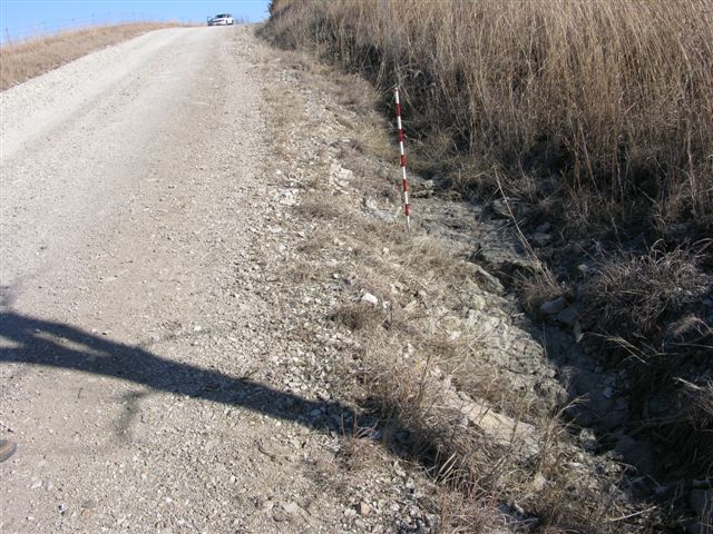
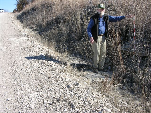
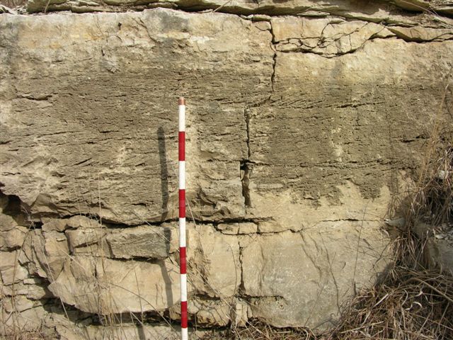
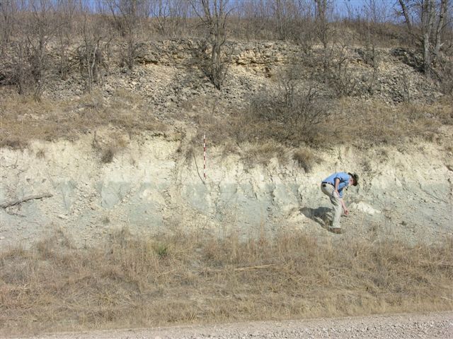
MR-160 = Base of Funston Limestone at 1295 ft in road ditch on south side of road; 4 digital photos from the base to the top of the Funston Limestone; near center of west line NW NW SW, sec. 20, T. 16 S., R. 9 E., Morris Co., Kansas--see graphic section.
MR-161 = Top of 1.5 ft thick limestone, Crouse Limestone, at 1267 ft in road ditch on south side of road with 3 to 4 ft of yellowish green mudrock below; 1 digital photo; approximately 100 ft east of center NE SE, sec. 19, T. 16 S., R. 9 E., Morris Co., Kansas.
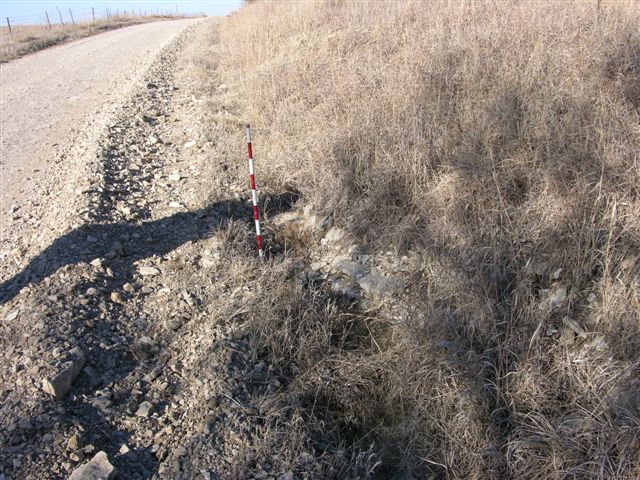
MR-162 = Base of Wreford Limestone (Threemile) at 1328 ft in road ditch on east side of road; 1 digital photo; near center of west line NW SW NW, sec. 16, T. 16 S., R. 9 E., Morris Co., Kansas.
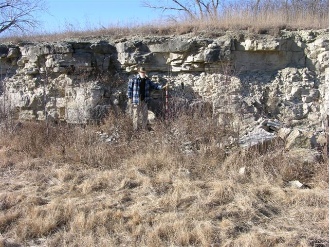
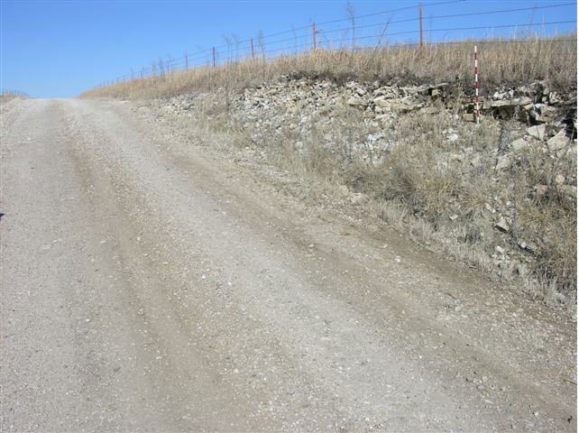
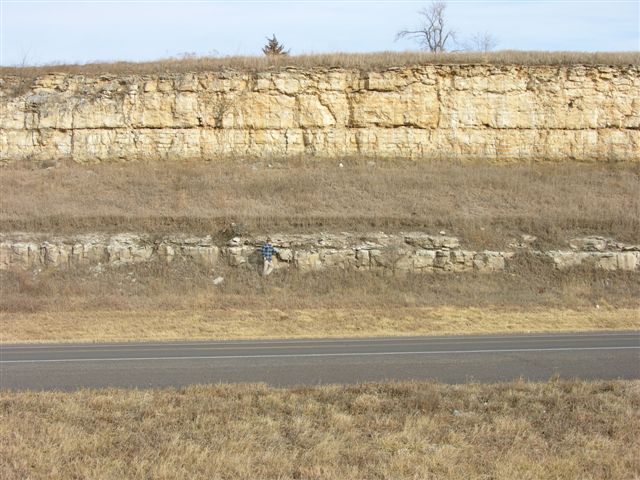
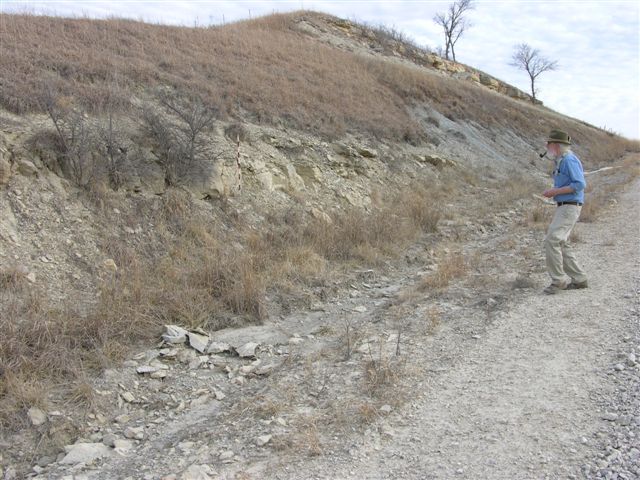
MR-163 = Base of Wreford Limestone (Threemile) at 1315 ft in west facing exposure with complete (15.7 ft) Speiser Shale below at the Morris County Transfer Station east of Council Grove, Kansas, just north of U. S. Highway 56; 2 digital photos; approximately 100 ft north and 200 ft west of center of east line SE SE, sec. 7, T. 16 S., R. 9 E., Morris Co., Kansas.
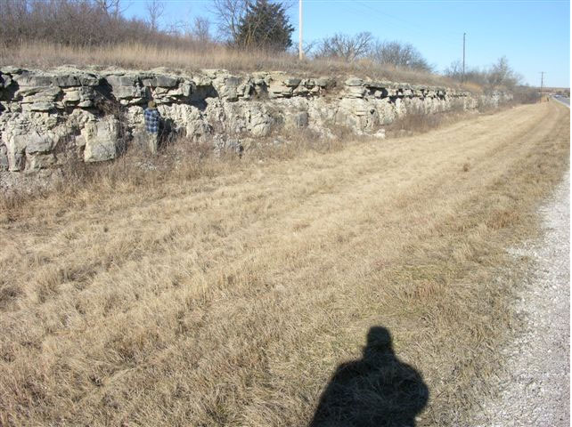
MR-164 = Top of 5.5 ft of Funston Limestone at 1300 ft in north facing exposure; continuation of exposure at MR-163; 1 digital photo; approximately 200 ft north of MR-163 in SE SE, sec. 7, T. 16 S., R. 9 E., Morris Co., Kansas.
MR-165 = Base of Wreford Limestone (Threemile) at 1340 ft in roadcut exposure on north side of U. S. Highway 56 east of Council Grove, Kansas; 1 digital photo; center of south line SE SW SE, sec. 9, T. 16 S., R. 9 E., Morris Co., Kansas.
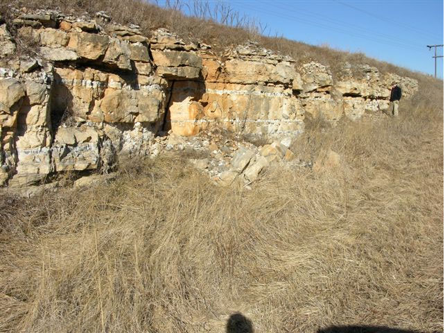
MR-166 = Base of Wreford Limestone (Threemile) at 1320 ft in roadcut exposure on south side of U. S. Highway 56 east f Council Grove, Kansas; 3 digital photos: 2 of the exposure and 1 of bedding plane with gypsum crystal molds; approximately 150 ft east of NE corner, sec. 18, T. 16 S., R. 9 E., Morris Co., Kansas.
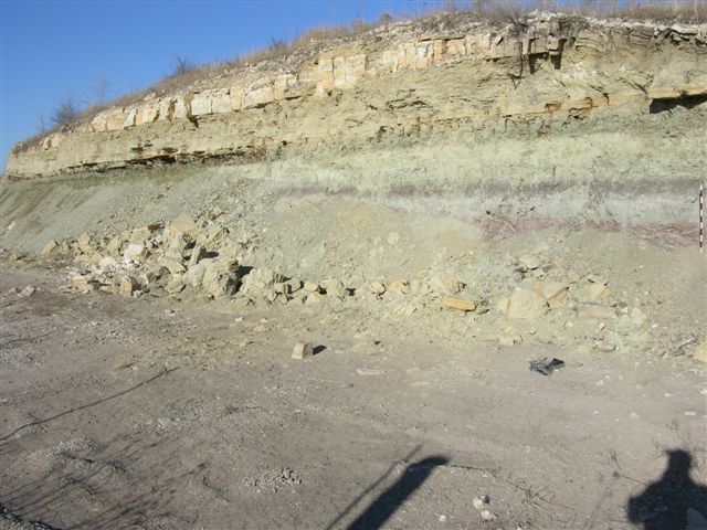
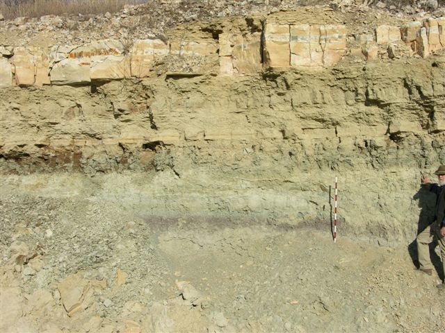
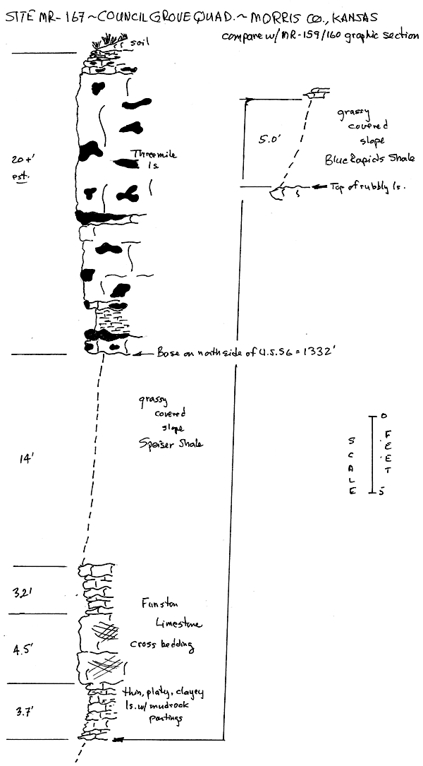
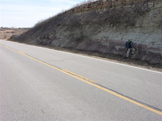
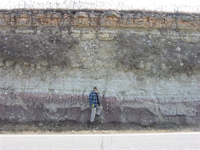
MR-167 (near MMW-25) = Base of Wreford Limestone (Threemile) at 1315 ft in roadcut exposure on north side of U. S. Highway 56 east edge of Council Grove, Kansas; sequence from Blue Rapids shale into Threemile limestone exposed on both sides of U. S. Highway 56; 5 digital photos: 3 of the exposure on north side and 2 of the Funston Limestone exposed on the south side; approximately 100 ft south of center of west1/2, NE, sec. 13, T. 16 S., R. 9 E., Morris Co., Kansas--see graphic section
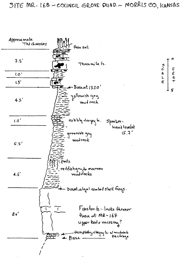
MR-168 (near MMW-24) = Base of Wreford Limestone (Threemile) at 1295 ft in roadcut exposure on east side of Kansas Highway 177/57 south of Council Grove, Kansas, with 15.7 ft of Speiser Shale below and Funston Limestone on west side of highway; 2 digital photos; near center NW SW SE, sec. 23, T. 16 S., R. 8 E., Morris Co., Kansas--see graphic section.
MR-169 = Base of Funston Limestone at 1280 ft in road ditch on west side of road; 1 digital photo; approximately 100 ft east of center NW NE, sec. 23, T. 16 S., R. 8 E., Morris Co., Kansas.
MR-170 = Base of Wreford Limestone Threemile) at 1310 ft in road ditch on west side of road with Speiser Shale below; limestone in upper Speiser Shale is thicker here and weathers into thin sheets; 1 digital photo; approximately 200 ft north of center of west 1/2 NE, sec. 23,T. 16 S., R. 8 E., Morris Co., Kansas.
NOTE: Between sections MMW, 20, 24 and 26 are located between MR-168 and MR-170.
MR-171 (near MMW-27) = Top of Crouse Limestone at 1250 ft in roadcut exposure on both sides of Kansas Highway 177/57 south of Council Grove, Kansas; 1 digital photo of exposure on west side of highway; near center of NE NW NE, sec. 23, T. 16 S., R. 8 E., Morris Co., Kansas.
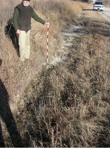
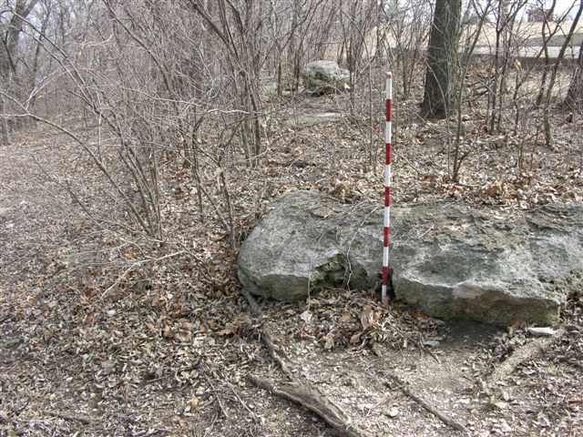
MR-189 = Exposure of thin bedded to platy (slabby), dark gray to bluish, fossiliferous, calcareous mudrock at 150 ft in the bed of the Neosho River just north of U. S. Highway 56 bridge in Council Grove, Kansas; 1 digital photo looking NE from the SW side of the river; near center NE SW NE, sec. 14, T. 16 S., R. 8 E., Morris Co., Kansas.
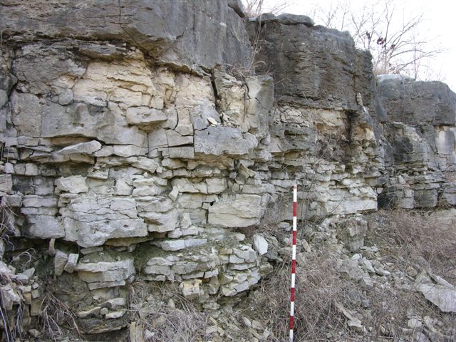
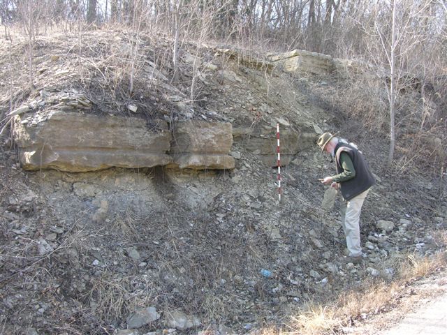
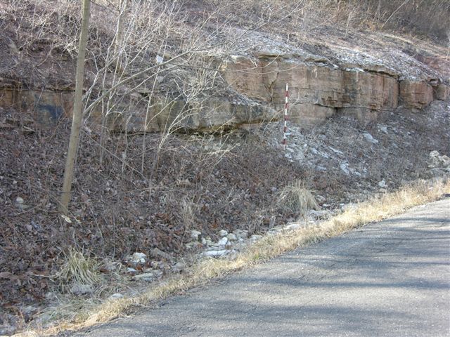
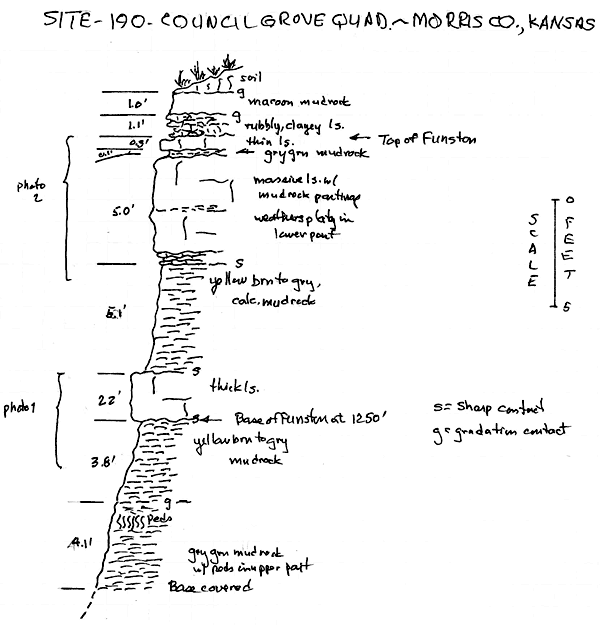
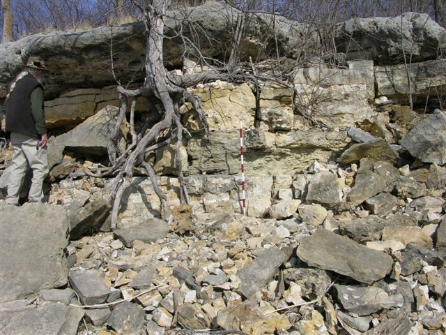
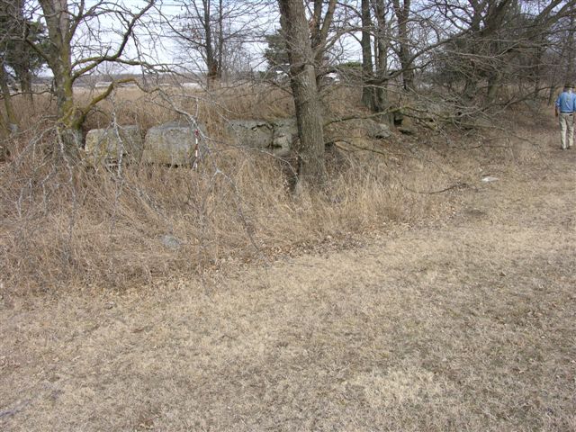
MR-190 = Base of Funston Limestone at 1250 ft exposed in roadcuts on both sides of Huffaker Street in Council Grove, Kansas; 2 digital photos: 1 of the base and 1 of the upper limestone bed(s); approximately 200 ft east and 250 ft north of SW corner NW NE NW, sec. 14, T. 16 S., R. 8 E., Morris Co., Kansas--see graphic section.
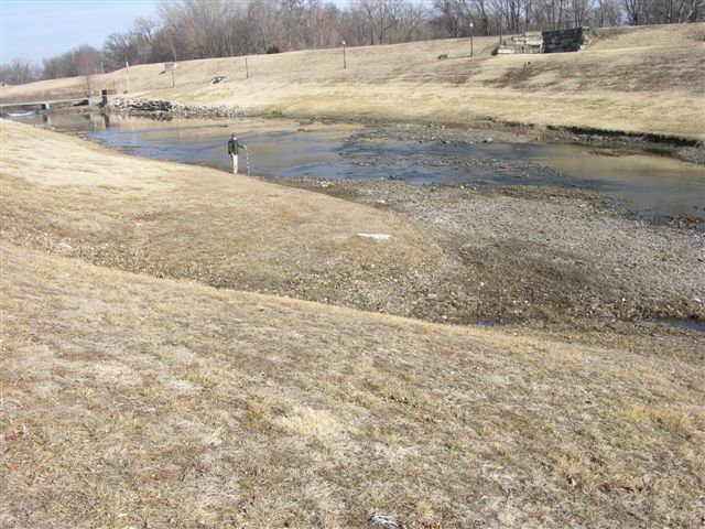
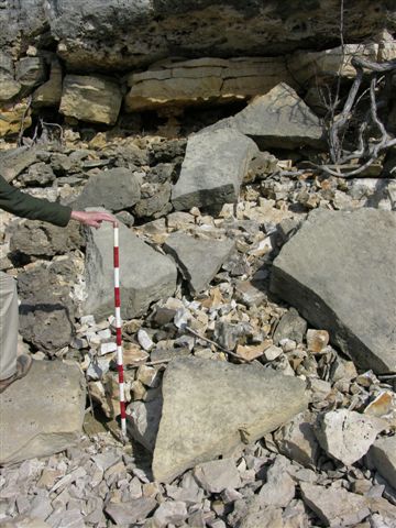
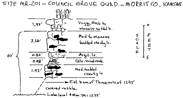
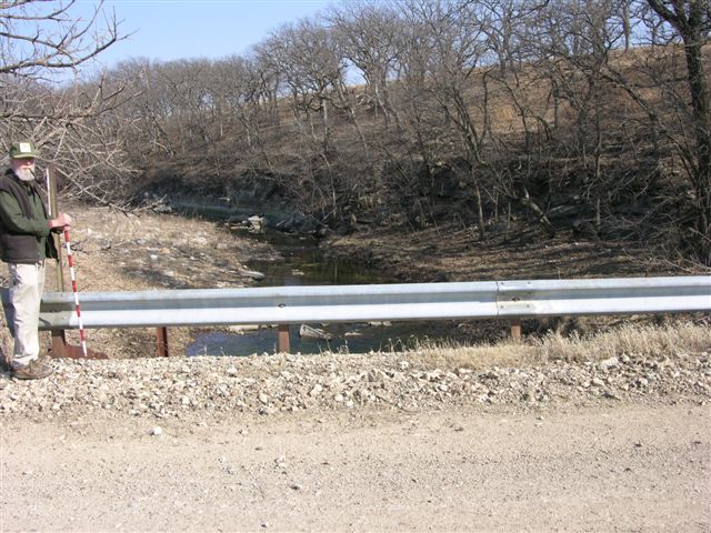
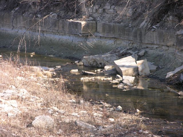
MR-201 = Estimated base of Wreford Limestone (Threemile) at 1275 ft in west facing exposure along the east side of Council Grove Lake just east of the dam; vertical distance from water level (1273 ft) to the base of thick t massive vuggy bed of Threemile limestone is 10 ft; 2 digital photos; near center SW NE SW, sec. 2, T. 16 S., R. 8 E., Morris Co., Kansas--see graphic section.
Explanation--data control points for the Morris County map are identified by the following letter prefixes:
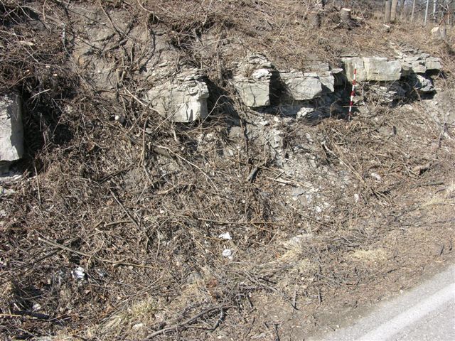
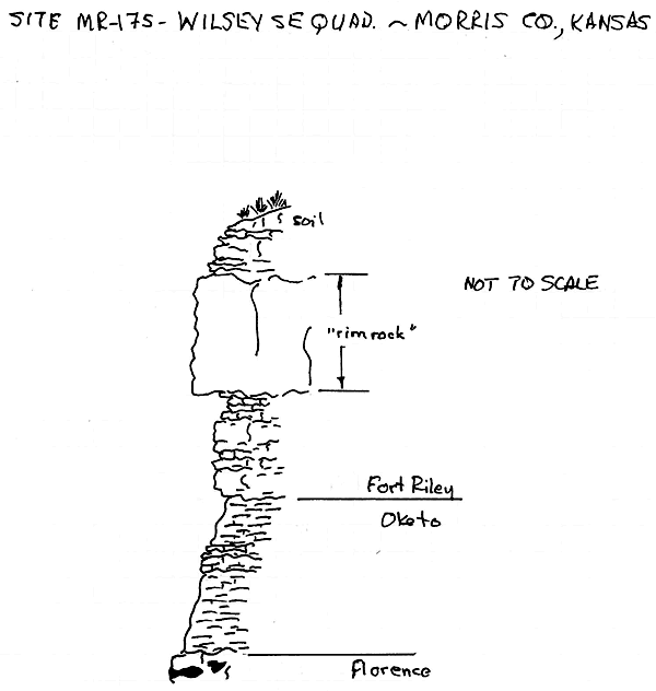
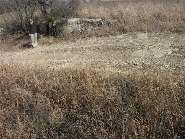
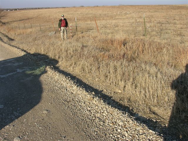
MR-172 = Fort Riley "rim rock" at 1402 ft in roadcut exposures on both sides of U. S. Highway 56 west of Council Grove, Kansas; 2 digital photos, scale in exposure on south side, no scale in exposure on north side; approximately 100 ft east of NW corner, sec. 20, T. 16 S., R. 8 E., Morris Co., Kansas.
MR-173 = Base of Barneston Limestone (Florence) at 1372 ft in roadcut exposure on north side of U. S. Highway 56 west of Council Grove, Kansas; 1 digital photo; near SE corner, sec. 17, T. 16 S., R. 8 E., Morris Co., Kansas.
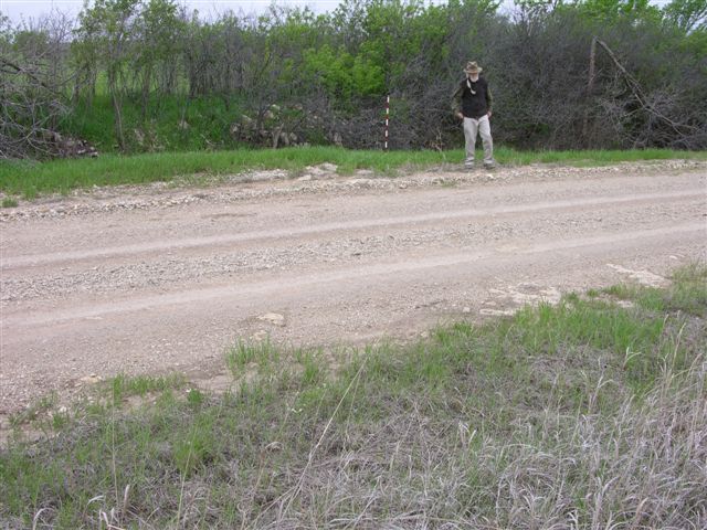
MR-176 = Fort Riley "rim rock" at 1393 ft in road and fields on both sides of road; 1 digital photo; approximately 400 ft west of NE corner, sec. 25, T. 16 S., R. 7 E., Morris Co., Kansas.
MR-178 = Fort Riley "rim rock" at 1461 ft in road and field east of road; 1 digital photo; approximately 100 ft south of center of west line NW, sec. 13, T. 16 S., R. 7 E., Morris Co., Kansas.
MR-179 = Fort Riley "rim rock" at 1385 ft in road and fields on both sides of road; 1 digital photo; approximately 100 ft east of NW corner, sec. 18, T. 16 S., R. 8 E., Morris Co., Kansas.
MR-180 = Fort Riley "rim rock" at 1385 ft in roadcut exposure on west side of road with Oketo shale and Fort Riley limestone exposed on the east side of road; sequence similar to that at MR-175; 4 digital photos: photo 1 is of thin limestone in the Oketo shale, photo 2 is from the upper part of the Florence limestone to the thin limestone in the Oketo shale, photo 3 is of the upper Oketo shale and lower Fort Riley limestone, photo 4 is of the Ft Riley "rim rock"; approximately 4100 ft east and 1100 ft north of SW corner, sec. 7, T. 16 S., R. 8 E., Morris Co., Kansas.
MR-181 = Fort Riley "rim rock" at 1385 ft in road and fields on both sides of road; 1 digital photo of the good exposure on the east side of road; approximately 4100 ft east and 2200 ft north of SW corner, sec. 6, T. 16 S., R. 8 E., Morris Co., Kansas.
MR-182 = Base of Barneston Limestone (Florence) at 1440 ft in road and roadcut exposure on east side of road; 1 digital photo; approximately 400 ft north of SW corner, sec. 31, T. 15 S., R. 7 E., Morris Co., Kansas.
MR-183 = Base of Schroyer Limestone Member, Wreford Limestone at 1380 ft with greenish gray mudrock below in road ditch on east side of road; bedded chert here is unlike the more nodular chert in the Florence limestone; 1 digital photo; approximately 1650 ft south of NW corner, sec. 31, T. 15 S., R. 8 E., Morris Co., Kansas.
MR-184 = Base of Wreford Limestone (Threemile) at 1340 ft on east side of road with upper Speiser Shale; including the thin limestone in the Speiser; lower Speiser Shale is covered; an excellent exposure; 2 digital photos; approximately 500 ft north of SE corner, sec. 25, T. 15 S., R. 7 E., Morris Co., Kansas.
MR-185--Excellent exposure of Funston Limestone at 1310 ft with Blue Rapids Shale below in south facing bank of Gilmore Creek; 2 digital photos; approximately 800 ft north and 200 ft west of SW corner, sec. 30, T. 15 S., R. 7 E., Morris Co., Kansas.
MR-187 (near MMW-15) = Exposure of Kinney Limestone Member at 1311 ft in drainage below spillway of City Reservoir with Blue Springs shale (variegated mudrocks) above and the Wymore shale (variegated mudrocks) below; approximately 200 yards downstream below the Kinney limestone; 1 digital photo; approximately 300 ft east and 200 ft north of center NW NW, sec. 8, T. 16 S., R. 8 E., Morris Co., Kansas.
MR-188 = Fort Riley "rim rock" at 1407 ft in road and fields on both sides of road; 1 digital photo; approximately 3000 ft north and 2500 ft west f SW corner, sec. 18, T. 16 S., R. 8 E., Morris Co., Kansas.
MR-191 = Top of Wreford Limestone (Schroyer) at 1300 ft exposed along west side of Council Grove Lake near picnic site 35 in the Canning Cover Area; 1 digital photo; near center of south line NE NW, sec. 4, T. 16 S., R. 8 E., Morris Co., Kansas.
MR-192 = Top of Wreford Limestone (Schroyer) at 1298 ft exposed on the north side of an old, grassy roadcut in the Marina Area of Council Grove Lake; 1 digital photo; approximately 350 ft west of SE corner, sec. 4, T. 16 S., R. 8 E., Morris Co., Kansas.
MR-193 = Rubble (chert) covered base of Barneston Limestone (Florence) with Blue Springs shale below estimated at 1340 ft exposed in a roadcut on the east side of Parkerville Road; 1 digital photo; approximately 2300 ft west and 2400 ft north of SE corner, sec. 31, T. 15 S., R. 8 E., Morris Co., Kansas.
MR-194 = Kinney Limestone Member at 1320 ft exposed in field and road ditch on SW side of Parkerville Road; slabs of thick limestone as large as an automobile have been displaced down slope along the NW bank of small stream on the SW side of road; 1 digital photo; approximately 3000 ft west and 3600 ft north of SE corner, sec. 31, T. 15 S., R. 8 E., Morris Co., Kansas.
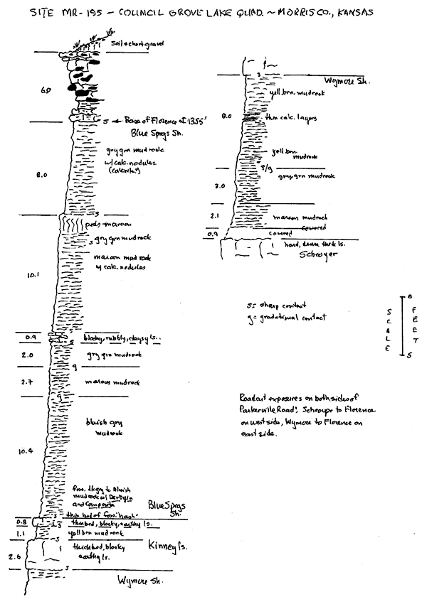
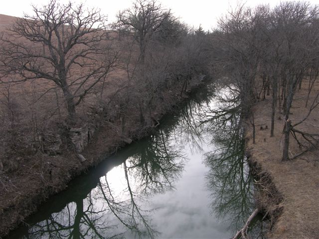
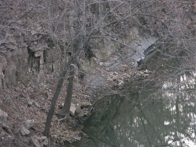
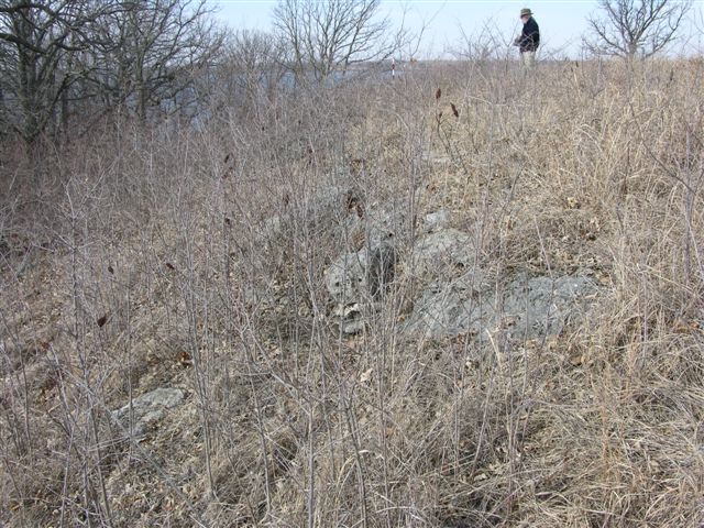
MR-195 = Sequence from the Wreford Limestone (Schroyer) to the Barneston Limestone (Florence) exposed on both sides of Parkerville Road just south of where the road crosses Gilmore Creek; base of the Barneston Limestone (Florence) at 1355 ft.; 2 digital photos, 1 of upper Blue Springs shale and lower Florence limestone and 1 of the Kinney limestone; approximately 24400 ft west and 500 ft north of SE corner, sec. 31, T. 15 S., R. 8 E., Morris Co., Kansas--see graphic section.
MR-196 = MMW-23 = Base of Wreford Limestone (Threemile) with Speiser Shale below at 1280 ft exposed in north facing bank of Gilmore Creek on the north side of Parkerville Road; 2 digital photos; approximately 5100 ft west and 1200 ft north of SE corner, sec. 31, T. 15 S., R. 8 E., Morris Co., Kansas.
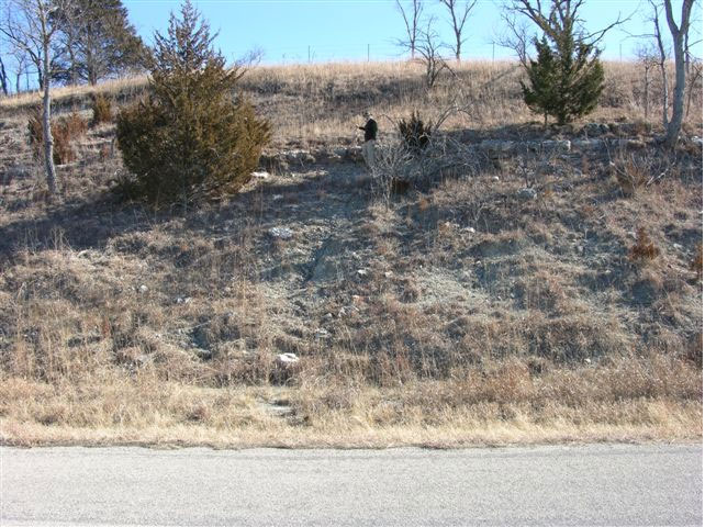
MR-197 = Top of Wreford Limestone (Schroyer) at 1290 ft in south facing gully at White Memorial Camp; 1 digital photo; near center of NE SW SW, sec. 34, T. 15 S., R. 8 E., Morris Co., Kansas.
MR-198 = Base of Barneston Limestone (Florence) at 1388 ft in roadcut and hillside on east side of road with gray green mudrock below and reddish mudrock in road; 1 digital photo; approximately 500 ft north of SE corner, sec. 17, T. 15 S., R. 8 E., Morris Co., Kansas.
MR-199 = Base of Wreford Limestone (Threemile) at 1305 ft in road ditch on north side of road; 1 digital photo; near center of south line SE NW, sec. 20, T. 15 S., R. 8 E., Morris Co., Kansas.
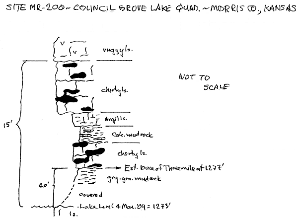
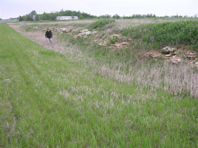
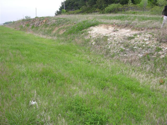
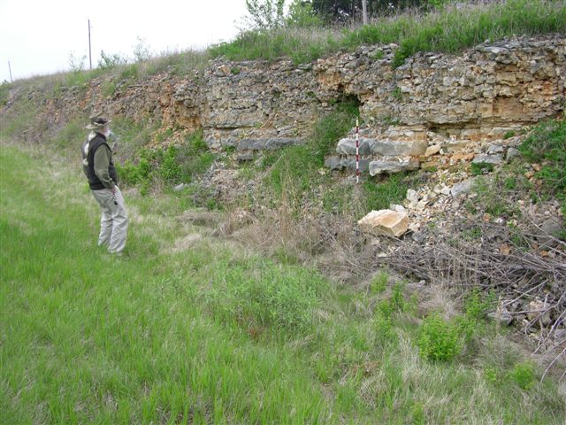
MR-200 = Estimated base of Wreford Limestone (Threemile) at 1277 ft in north facing exposure along the south side of Council Grove Lake just east of the boat ramp; vertical distance from water level (1273 ft) to the base of thick, massive, vuggy bed of Threemile limestone is 15 ft; 2 digital photos, 1 of the gray green mudrock in the Speiser Shale and 1 of lower beds of Threemile limestone including the mudrock interval above the basal beds; 2 digital photos; approximately 200 ft north of center of north 1/2, sec. 10, T. 16 S., R. 8 E., Morris Co., Kansas--see graphic section.
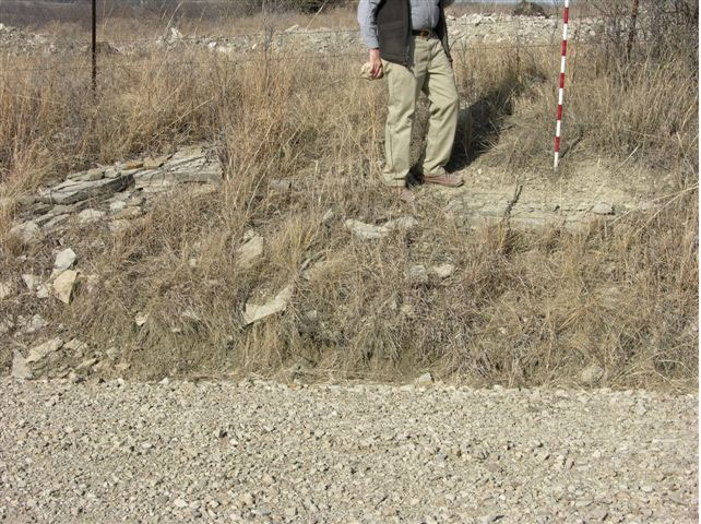
MR-202 = Exposure of Towanda limestone in roadcuts on both side of U. S. Highway 56 west of Council Grove, Kansas; based on the KDOT profile the base of the Towanda is at 1430 ft; 1 digital photo of exposure on north side of highway; near center of south line SW, SE, sec.13, T. 16 S., R. 7 E., Morris Co., Kansas.
MR-203 = Base of Barneston Limestone (Florence) at 1475 ft in roadcuts on both sides of U. S. Highway 56 west of Council Grove, Kansas; apparent dip of limestone beds is approximately 6°E; 3 digital photos, two of the exposure on the south side of highway and one of exposure on north side; near center of south line SE, SW, SW, sec. 14, T. 16 S., R. 7 E., Morris Co., Kansas.
MR-204 = Fort Riley limestone, possibly the "rim rock", at 1430 ft in road and road ditch on the west side of road; 1 digital photo; near center of east line, sec. 1, T. 16 S., R. 7 E., Morris Co., Kansas.
MR-205 = Near the base of the Barneston Limestone (Florence) at 1425 ft in road ditch on west side of road; spring from the base of the Barneston on east side of road; 2 digital photos, one of exposure and one of spring; near center of east line NE, NE, sec. 1, T. 16 S., R. 8 E., Morris Co., Kansas.
MR-206 = Top of Wreford Limestone (Schroyer) at 1337 ft in road ditch on west side of road, could be a limestone in the Threemile; 1 digital photo; approximately 1100 ft south of center of north line, sec. 30, T. 15 S., R. 8 E., Morris Co., Kansas.
MR-207 = Base of Wreford Limestone (Threemile) at 1360 ft in road ditch on south side of road; 1 digital photo; near center of north line NW, NW, NE, sec. 36, T. 15 S., R. 7 E., Morris Co., Kansas.
MR-208 = Top of Wreford Limestone (Schroyer) at 1392 ft in road ditch on north side of road; 1 digital photo; near center of south line SW, SE, SE, sec. 26, T. 15 S., R. 7 E., Morris Co., Kansas.
MR-209 = Base of Barneston Limestone (Florence) at 1460 ft on southeast side of road; 1 digital photo; approximately 300 ft south and 200 ft east of center SE, SW, sec. 26, T. 15 S., R. 7 E., Morris Co., Kansas.
MR-210 = Base of Wreford Limestone (Threemile) at 1320 ft in road ditch on east side of road; 1 digital photo; near center of west line SW, SW, sec. 18, T. 15 S., R. 8 E., Morris Co., Kansas.
Kansas Geological Survey, Geology
Updated July 28, 2009
Comments to webadmin@kgs.ku.edu
The URL for this page is http://www.kgs.ku.edu/Publications/OFR/2009/OFR09_14/index.html