Kansas Geological Survey, Open-file Report 2009-2
by
Michael T. Dealy
KGS Open File Report 2009-2
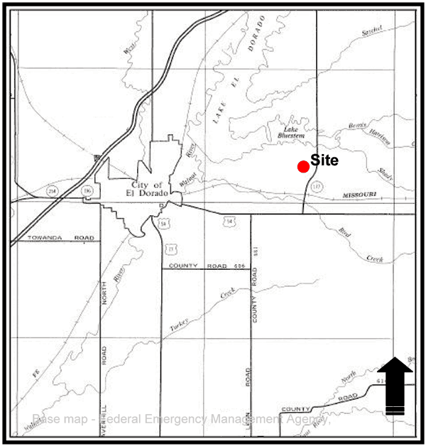
The site was approximately five miles east of the City of El Dorado, Kansas, and a mile south of El Dorado Reservoir, Figure 1. The site's global coordinates were 37° 49' 44.78" Latitude and -96° 45' 41.15" Longitude.
Based on the global coordinates, the public land survey system description was computed to be the Southwest quarter of the Northeast quarter of the Southwest quarter of Section 34, Township 25 South, Range 06 East, Butler County, Kansas, and was located approximately 1,575 feet north and 3,581 feet west of the southeast corner of the section.
Figure 1--Site Location.
The land owner first observed the feature July 2007 in a native grass hayland.
The feature's shape was circular and was six feet in diameter and 30 feet deep. The land owner backfilled the feature October 2007 and submitted a plugging report to the Kansas Department of Health and Environment (KDHE).
After a cutting of native grass in the summer 2008, the land owner observed the backfill had settled about three feet. Additionally, the land owner noted that the backfill material appeared to be churned up. The land owner contacted Sandy Koontz, Butler County Conservation District (BCCD), about the feature and a field inspection was conducted by BCCD staff July 23, 2008.
Butler_sink_report2.pdf (1 MB)
To read this file, you will need the Acrobat PDF Reader, available free from Adobe.
Kansas Geological Survey
Updated Jan. 23, 2009
Comments to webadmin@kgs.ku.edu
URL http://www.kgs.ku.edu/Publications/OFR/2009/OFR09_02/index.html