Kansas Geological Survey, Bulletin 90, Part 6, page 2 of 3
Start of report... || Next--Letters P through W...
The Cambridge anticline, extending from southeastern Gove County northward along the eastern edge of Decatur County and into Nebraska, sometimes is called Darton's arch. It has been given this non-geographic name because it was shown on maps made by N. H. Darton and published in 1905 and 1918.
This structure is a broad northward-plunging anticline that is discernible in Cretaceous rocks, especially the Dakota (Bass, 1926, p. 88, pl. 7).
The small anticline in Wabaunsee County which contains the Davis Ranch oil pool in Viola rocks is called the Davis Ranch anticline. The Davis Ranch oil field is in sec. 33, T. 13 S., and sec. 4, T. 14 S., R. 10 E.
The Davis Ranch anticline was named by Smith and Anders (1951) who believe it to be a part of a longer up-fold, extending across Wabaunsee County, which they called the Alma anticline. The Davis Ranch anticline is believed to be faulted on its east flank and to have about 100 feet of closure on the Viola limestone. It was discovered by surface mapping by Dr. C. W. Couser, and is said to have about 20 feet of closure in outcropping rocks of early Permian age.
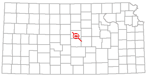
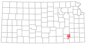
Dexter Anticline (49) |
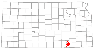 |
The Dexter is an anticlinal fold in Cowley County several miles east of and approximately parallel to the Nemaha anticline. The axis of the fold, which was shown by Bass (1929, fig. 18) by means of 10-foot contour lines on the Wreford limestone, extends from about sec. 7, T. 35 S., R. 7 E. to sec. 36, T. 34 S., R. 6 E.
According to Bass (1929, pp. 119-120): "Of all the structural features in the county [Cowley] the Dexter anticline . . . has the most pronounced expression in the surface beds. It is an asymmetric fold with its steeper flank on the east trending nearly due north for several miles near Otto, thence swinging to the northeast near Dexter." On a map showing structure on the upper surface of Mississippian rocks by means of 50-foot contour lines, Bass (1929, pl. 11) used the name Dexter-Otto anticline for a structure whose axis extends from the east part of T. 35 S., R. 6 E. to sec. 33, T. 32 S., R. 7 E. He (Bass, 1929, p. 121) stated: "These three anticlinal folds, the Dexter-Otto, Winfield, and 'granite ridge,' are the three most extensive structural units evident in the surface beds in the county, and their general features are duplicated in many other lesser folds."
Dexter-Otto Anticline (50) |
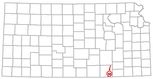 |
The names Dexter anticline and Dexter-Otto or Otto-Dexter anticline have been used more or less interchangeably in reference to a rather prominent fold in Cowley County. The structure is discussed more fully under the heading Dexter anticline.
Diamond Creek province is the name that has been applied to the northern part of the Cottonwood Falls part of the Nemaha anticline.
The names Diamond Creek province and Diamond Creek fold were first used by Prosser and Beede (1914, p. 5): "The other two provinces are limited areas, perhaps confined to this quadrangle. The more important of these may be designated the Cottonwood province . . .; the other may be called the Diamond Creek province." And "In the northern part of the quadrangle there are several small folds, but only two are of sufficient interest to be discussed here. On Fox Creek, near the northern border of the quadrangle, is one of the most abrupt folds in the area. On the western side of the creek the rocks are found to be about 80 feet higher than on the eastern side. The summit of the fold, however, is located farther west, on the township line at the divide between Fox and Diamond creeks."
Dodge City Embayment (52) |
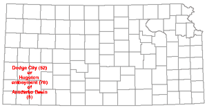 |
The name Dodge City embayment commonly is applied to a large structural province of southwestern Kansas. It was classed as a major post-Mississippian structural province by Moore and Jewett (1942).
The name Dodge City basin was applied first by McClellan (1930, p. 1550) to the synclinal area of southwestern Kansas into which rocks dip off the west flank of the Central Kansas uplift (Barton arch). At the time of McClellan's paper few wells had been drilled in western Kansas and consequently little was known about the boundaries of the "basin." Wheeler (1947, p. 37) recently applied the term Dodge City embayment to a portion of the Anadarko basin extending into parts of Stevens, Seward, Haskell, Meade, and Clark Counties, Kansas, and Beaver and parts of Texas and Ellis Counties, Oklahoma. It may be noted, however, that the Anadarko basin had for many years been regarded as extending into Kansas (Clifton, 1926). Clifton showed the Kansas part, based on "red rock," as being deepest in Comanche County. More recently Maher and Collins (1948, p. 814) stated their belief that the "embayment" extends northward and westward including the area between the Sierra Grande uplift, the Los Animas arch, and the Central Kansas uplift (Barton arch); and they proposed the term Hugoton embayment as more suitable than Dodge City.
It is to be noted also that although Wheeler's map shows the Dodge City embayment extending only about 30 miles into Kansas, he mentions the gradual thinning of the Paleozoic section toward the granite core of the Central Kansas uplift, which is many miles farther north. Hence seemingly Maher and Collins' (1948) northward extension of the embayment is not a departure from ideas previously held; and in fact the name Dodge City had been used since its introduction as the name of a structural province bordering the Barton arch or Central Kansas uplift (McClellan, 1930; Moore and Jewett, 1942; Jewett and Abernathy, 1945; Jewett, 1947, 1948, 1949).
Although as argued by Maher and Collins Hugoton lies more nearly in the center of the basinal area, it is believed that Dodge City is the more acceptable name because of priority and wide usage; and it is believed that Dodge City embayment is a better term than Dodge City basin, and the structure should be regarded as a part of the larger Anadarko basin, which is a large complex structure, all parts of which are not of equivalent ages. Hugoton trough, as defined by Maher and Collins (1948, p. 815), is regarded as a suitable name for a part of the embayment.
The name Dunkle has been applied to a synclinal fold that modifies the crest of the El Dorado anticline, Butler County. The El Dorado structure is a prominent "high" on the Nemaha anticline, which crosses Kansas from Nebraska to Oklahoma.
The Dunkle syncline was named by Fath (1921, p. 73): "Starting on the Dunkle lease in sec. 4, T. 25 S., R. 5 E., this depression trends southeastward across section 9 to the Walnut syncline and separates the Wilson and Robinson domes."
The El Dorado anticline and its parts were mapped by Fath (1921, pl. 1) by means of 10-foot contour lines with the top of the Fort Riley limestone (lower Permian) as datum.
Elbing Anticline (54) |
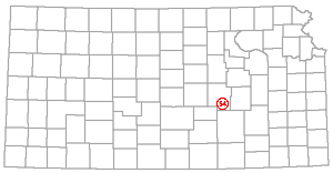 |
The name Elbing is used to designate the structure that contains the Elbing (Viola) oil pool, in Butler and Marion Counties. The Elbing field is in Ts. 22 and 23 S., R. 4 E.
Thomas (1929) showed by means of contour lines on the outcropping Herington limestone, on the buried Lansing limestone, and Ordovician rocks, an anticlinal fold with prominent domes containing respectively the Elbing, Peabody, and Covert-Sellers oil pools. He (Thomas, 1929, p. 63) referred to the Elbing anticline as one of the structures on the larger element, which essentially is the same as the Bluff City anticline (Barwick, 1928, p. 179).
The El Dorado anticline, Butler County, is one of the larger domes that lie along the axis of the Nemaha anticline. It has been mapped in detail by several geologists (McDowell, 1917, p. 294; Fath, 1921, pl. 1) and has been pictured in cross sections (Kellett, 1932; Moore, 1936, fig. 5; Jewett and Abernathy, 1945, pl. 3). Fath (1921, p. 67) showed that it is divisible into several minor domes and synclines. According to him (Fath, 1921, p. 66): "One major fold, the El Dorado anticline, extends in a somewhat sinuous line and in a southwesterly direction across the entire area embraced in this report, from the southeast corner of T. 24 S., R. 5 E. . . . The El Dorado anticline is limited on the east by the pronounced Walnut syncline."
The most prolific oil pools known in Kansas are in the El Dorado anticline. The following subordinate component parts of this structure are described in this paper: Bancroft syncline, Bishop syncline, Boyer dome, Chelsea dome, Chesney dome, Dunkle syncline, Fowler syncline, Hammond syncline, Hegberg syncline, Koogler nose, Lincoln syncline, Oil HiU dome, Ramsey syncline, Ralston syncline, Robinson dome, Shumway dome, Theta syncline, Whitewater nose, and Wilson dome.
The name Elkader dome has been used to designate a domelike anticline interpreted from dip readings on outcropping Cretaceous rocks in Logan County.
The Elkader dome was reported by Wallace Lee (Lupton, Lee, and Van Burgh, 1922, pl. 4). The axis of the fold as indicated by observations of dip extends from the central part of sec. 2 to the central part of sec. 26 with a broad westward curve through secs. 15 and 22, T. 14 S., R. 32 W. Two faults are shown. The structure was regarded as a minor structure on the Black Hills arch by the geologists who reported it. The use of the term Black Hills arch as the name of a structure extending into Kansas is discussed elsewhere in this index.
Ellis Arch (57) |
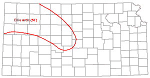 |
The Ellis arch is a major pre-Mississippian structure in central and northwestern Kansas, partly in the same area as the Barton arch or Central Kansas uplift. The Ellis arch may be regarded in part as the ancestral Barton arch. It is the western part of the most important positive early Paleozoic structural element in Kansas, comprising with the Chautauqua arch, the Central Kansas arch, which in pre-Mississippian time separated the North Kansas and Southwest Kansas basins.
The Ellis arch was named by Moore and Jewett (1942, p. 485, fig. 7): "Southwest of the North Kansas Basin, in the region now defined as belonging to the Central Kansas Uplift, Mississippian rocks are absent and lower Pennsylvanian strata rest directly on Ordovician, Cambrian, or locally on Precambrian rocks. The strike of anticlinal folds in these pre-Pennsylvanian rocks differs materially from the axis of the uplift as a whole. These folds are interpreted as pre-Mississippian in age. They are aligned with folds in the Chautauqua Arch area and they seem best interpreted as older in origin than other structural features of the Central Kansas Uplift. The area is here designated as the Ellis Arch, in order to differentiate it from the Central Kansas Uplift, main features of which are post-Mississippian in origin."
The Ellis arch was called the Ancestral Central Kansas uplift by Lee, Leatherock, and Botinelly (1948, pl. 5).
Ellsworth Anticline (58) |
 |
A structure that underlies a part of west-central Rice County is called the Ellsworth anticline.
The name Ellsworth anticline was used by Koester (1934, p. 51): "This Ellsworth anticline . . . runs through Rs. 8, 9 and 10 from the vicinity of Ellsworth to and beyond the southern limits of Rice County." And (Koester, 1935, pp. 1419-1420): "From the southwestern portion of Rice County to the vicinity of Ellsworth extends a relatively steep fold to which the name Ellsworth anticline has been given. Its position can be approximately found on the pre-Mississippian area map by the north-south Simpson band of outcrop in this area. The Chase, Ploog, and Lorraine pools are on this axis. This is an early Pennsylvanian fold. . . ." Later Ver Wiebe (1938, p. 105) wrote concerning the structures in Rice County: "Perhaps the most prominent buried structure is the Ellsworth Arch which trends toward the south through Range 9 W. On it are located the various parts of the Chase pool."
The axis of the Ellsworth anticline of Koester is nearly normal to the axis of the Ellsworth-Kanopolis anticline of Lee (1939).
An anticline in Ellsworth County whose axis is shown on several published geologic maps (Lee, 1939, pl. 1; McNeil, 1941, fig. 2; Lee, Leatherock, and Botinelly, 1948, pl. 9) is called Ellsworth-Kanopolis.
A trend on the line of this anticline was first noted by Koester (1935, p. 1419) who pointed out pre-Pennsylvanian exposures of "Siliceous lime," at Wilson and at Ellsworth in Ellsworth County. These high areas, he reported, "represent a line of pre-Mississippian warping which can be traced northwestward from the Burns dome in northern Butler County through the Peabody, Ritz-Canton, and McPherson fields." The name was applied by Lee (1939, p. 33, pl. 1) to that portion of the trend extending from Kanopolis to Wilson: "The activity of northwesterly trending folds is exemplified by the Ellsworth-Kanopolis anticline in Ellsworth county, on which Pennsylvanian, Permian and Cretaceous beds are folded."
This structure is not to be confused with the Ellsworth anticline as the name has been used by Koester (1935) and by Ver Wiebe (1938).
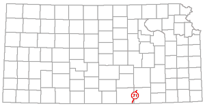
The Elmdale dome, Chase County, is one of the larger domes that lie along the axis of the Nemaha anticline.
The Elmdale dome was named by Prosser and Beede (1904, p. 5): "The Elmdale dome is a broad, low upward fold of the rocks, the center of which is about 3 miles southwest of Elmdale. The total elevation of the upper part of this fold is over 200 feet. The top has been worn away and Cottonwood River now runs through the central part of it, making the center lower than the sides. The sides form a rim around the central portion, with the rocks turned upward, sometimes as much as 3° or 4°. The east-west diameter of this fold is about 9 miles, while the north-south diameter is about 12 miles."
Pennsylvanian rocks of Desmoinesian or Missourian age are in contact with Precambrian rocks at a depth of about 1,750 feet on the Elmdale dome. A short distance to the east the basement rocks are about 1,200 feet lower. The westward dip is more gentle. The Elmdale dome is plainly represented in a cross sectional diagram by Lee, Leatherock, and Botinelly (1948, pl. 13). The Elmdale dome is separated from the Burns dome on the south by the Cedar Creek syncline.
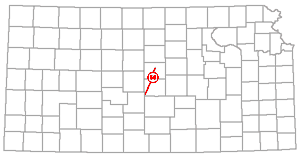
Fairport-Natoma Anticline (61) |
 |
The name Fairport-Natoma is applied to an anticline measurable in outcropping rocks on the Barton arch in Russell County.
According to Rubey and Bass (1925, p. 67): "The best developed example of the larger folds in the vicinity of Russell county is the Fairport-Natoma anticline, which is traceable in a line that runs uniformly 8° or 10° east of north for at least 20 miles along the northern half of the western border of Russell county. The dips on the west side are steeper, the rocks commonly descending at rates of 50 to 200 feet to the mile into a parallel syncline in which the beds are 100 feet or more below their elevation on the axis of the anticline. East of the axis the beds dip 15 to 40 feet to the mile. Minor domes and depressions occur on top of the anticlinal axis and in the synclines." The location of the fold is shown on plate 4 of Rubey and Bass's report.
The discovery of the Fairport-Natoma anticline is credited to V. H. McNutt, whose structural mapping occasioned the drilling of the M. M. Valerius Oil and Gas Company No. 1 Oswald well in the SW SE sec. 8, T. 12 S., R. 15 W. This is the discovery well of oil in central Kansas. Subsequent drilling led to the discovery of the Barton arch and of the Ellis arch.
Rubey and Bass (1925) described several other structures in Russell County to which names were not given.
A physiographic division and a structural basin in western Finney County have been called Finney basin. The basin has been regarded a part of a larger synclinal fold that has been called Shallow Water basin. However, it seems more proper to regard the structural term Finney as a synonym of Shallow Water.
Smith (1940, p. 138) described the Finney basin and identified it as a structural feature attributed to post-Ogallala downwarping and with an axis extending from Garden City to Scott City. Hence its axis lies along the same line as the Shallow Water basin's axis (Moss, 1933). Latta (1944, p. 21) regarded the southern part of the Shallow Water basin, as defined by Moss, as the Finney basin and the northern part as the Scott basin but stated that the two are continuous. Waite (1947, p. 18) described the Scott basin as a part of a broad synclinal trough whose axis extends from Garden City to Scott City and northward.
The name Florence-Urschel fold has been used to designate the anticlinal fold that contains the oil pool of the same name. It was mentioned by Barwick (1928, p. 179) in discussing the structures near the Nemaha anticline. The Florence-Urschel oil field is in T. 21 S., R. 5 E., Marion County.
Shea (1922, pp. 427-429, figs. 1-2) described the structure that contains the Florence-Urschel pool (p. 427) "It consists of an anticline with a long curved axis which lies immediately west of the 'Granite Ridge arch' and extends from the northeast corner of section 16 through the center of section 21 and into the northwest quarter of section 27," and (p. 429) "The subsurface structure, as defined by datum elevations on the producing horizon, shows very little conformation with the surface." The producing rock is the Viola limestone. Shea's maps show structure mapped on outcropping Permian rocks and on the Viola limestone. Thomas (1927, figs 1-3; 1929, figs. 1-3) published maps showing structure as revealed in outcropping rocks, Lansing rocks, and Ordovician rocks.
Forest City Basin (64) |
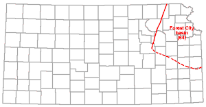 |
The term Forest City basin has come into general usage as the name of a major post-Mississippian sedimentary basin east of the Nemaha anticline in northeastern Kansas and neighboring parts of Missouri, Nebraska, and Iowa, The name is used in this manner by several geologists (McQueen and Greene, 1938, pp. 12-13; Moore and Jewett, 1942, fig. 8; Lee, 1941, 1943; Lee and Payne, 1944, p. 61; Jewett and Abernathy, 1945, p. 43, fig. 5; Lee and others, 1946; Jewett, 1947, fig. 1; 1948, fig. 1; 1950, fig. 1; Jewett and Smith, 1949, p. 86).
However, Forest City was first used as a structural term to indicate the part of a pre-Mississippian basin that lies east of the younger Nemaha anticline In this sense it is a part of what is commonly known as the North Kansas basin. It would be defined as a structural negative segment of pre-Mississippian rocks formed at different times by the uplifting of the Chautauqua arch (ancestral Ozark uplift), the Nemaha anticline, and other positive segments and by downwarping within the basin itself, for it was defined principally on the basis of present extent of Devonian and Silurian rocks, which largely is the result of pre-Chattanooga and post-Mississippian erosion. This is made clear by Ockerman (1935, pp. 8-9): "The basin was named after Forest City, Missouri, where a deep well was drilled in 1901. The correlation of this well, as given by Ulrich, indicated that there is a basin, and subsequent drilling in Kansas has fairly well defined the boundaries and outline of the southern end of the basin in eastern Kansas. The general outline of the basin is marked by the distribution of the Hunton 'lime' east of the Granite Ridge." The term "Hunton lime" refers to Silurian and Devonian beds.
Later the term was used in a different sense. According to McQueen and Greene (1938, pp. 12-13): "The area has the aspects of both a structural and depositional basin, and these factors make difficult a close definition of the limits of this regional feature . . . . The southern boundary is poorly defined and can be drawn only on the basis of a zone in which drilling has revealed the Cherokee formation to be thinner than in the Forest City basin to the north and the Oklahoma basin to the south. The Pennsylvanian beds are probably largely responsible for the general use of the name 'Forest City basin' among geologists and if a definition is to be closely drawn, it will be drawn on the basis of the thickness of the pre-Ardmore limestone portion of the Cherokee."
The zone of thinner Cherokee section, referred to by McQueen and Greene, is the Bourbon arch, which is listed and discussed in this index. The Ardmore limestone lies in the upper middle part of the Cherokee group of rocks, which is Desmoinesian in age and comprises the basal Pennsylvanian sediments of eastern Kansas.
The details of stratigraphic and structural developments within the area of the Forest City basin have been thoroughly discussed and diagrammed by Lee (1943) and Lee and others (1946), who used the term as the name of a post-Mississippian regional structure.
The present usage of the term Forest City basin is well expressed by Lee and Payne (1944, p. 13): ". . . Forest City basin, a low broad structural feature whose central area lies in northeastern Kansas and whose margins extend into the adjoining parts of Nebraska and Missouri and into Iowa. The basin was formed by regional warping of the pre-Pennsylvanian rocks, and it was originally both a topographic and structural feature in which the earliest Pennsylvanian rocks of this part of Kansas were deposited."
Forest City basin (ancestral) has been used for a structural basin in northeastern Kansas interpreted from present thicknesses of Mississippian rocks.
Lee and others (1946, sheet 5) showed the ancestral Forest City basin with an axis extending from southeastern Atchison County to southern Miami County, with its deeper parts (more than 450 feet of Mississippian limestone) in southwestern Miami County and in northeastern Johnson County and neighboring parts of Jackson County, Missouri.
The Fowler fault affects outcropping Tertiary and Quaternary rocks in Meade County.
As shown by Frye and Schoff (1942, fig. 3) and by Frye (1950, fig. 2), the Fowler fault has a strike that trends slightly east of north and is situated in northeastern Meade County. The east side is the upthrown side. Frye and Schoff stated that the initial movements along the fault took place at the close of middle Pliocene time and that they, with movements along the Crooked Creek fault, formed the ancestral Meade basin.
The Fowler fault is not to be confused with the Fowler syncline in Butler County.
The Fowler syncline is a synclinal fold that modifies the El Dorado anticline, a prominent part of the Nemaha anticline, in Butler County.
The Fowler syncline was named by Fath (1921, p. 72): "Still farther north, and located in line with the Hammond and Bishop synclines . . . is the Fowler syncline, extending from . . . sec. 1, T. 26 S., R. 4 E., into section 13 of the same township, and into sec. 6, T. 26 S., R. 5 E. The Fowler syncline separates the Shumway and Boyer domes . . ."
The El Dorado anticline was mapped in surface rocks (early Permian) by Fath (1921, pl. 1).
A dome discernible in outcropping rocks of Pennsylvanian age but much more pronounced on the upper surface of Mississippian rocks in central Wilson County is called the Fredonia dome or anticline.
According to Stryker (1925, p. 1208): "The most decided structural feature in the surface strata of the county is a dome lying 3 to 4 miles east of Fredonia, the apex being in Sec. 10, T. 29 S., R. 15 E., and is known as the Fredonia anticline, or dome. This anticline has a northwest southeast trend and is 6 or 7 miles long."
On a structural geologic map of Wilson County Stryker (1925, pl. 23) shows the Fredonia dome as having two apexes, one in sec. 34, T. 28 S., R. 15 E. and one in sec. 10, T. 29 S., R. 15 E. The whole structure is shown as having more than 200 feet of closure in the upper surface of Mississippian rocks.
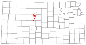
Geneseo Uplift (69) |
 |
The name Geneseo uplift is applied to the eastern part or lobe of the Barton arch in Rice, Ellsworth, and McPherson counties.
The Geneseo uplift was discussed in detail by Clark, Arnett, and Royds (1948). According to these geologists the uplift occupies a triangular area including Ts. 17 and 18 S., the west half of R. 5 and all of Rs. 6, 7, and 8 W. It contains the Bornholdt, Edwards, Geneseo, Smyres, Welch, and Wherry oil pools, and the Lyons gas pool. The Edwards, Geneseo, and Lyons pools are on higher parts of the structure along its general axis. The other pools are in stratigraphic traps on the southeastern flank of the dome. As shown by contours drawn on the Arbuckle limestone, the smaller structure that contains the Geneseo oil pool has about 125 feet of closure, but in shallow Permian rocks the closure is only about 30 feet. The dome that contains the Edwards pool, as measured on the eroded surface of Arbuckle rocks, has about the same height, and the Lyons gas pool is in a somewhat higher dome. Rocks ranging from early Ordovician (Arbuckle) to Mississippian age are truncated by post-Mississippian erosion and are overstepped by Pennsylvanian deposits.
The name Gorham structure has been used for an anticlinal structure containing the Gorham oil pool, Russell County. The structure is in the Barton arch area.
An example of usage is by Hintze (1928) who mentions the discovery of the Gorham structure by J. S. Irwin in 1923 following the discovery of oil in Russell County. The Gorham oil field is in the southern part of T. 13 S., R. 15 W.; the northwest part of T. 14 S., R. 14 W.; and the northeast part of T. 14 S., R. 15 W. Oil is produced from Pennsylvanian rocks known as the "Oswald" and "Gorham" zones. The discovery well was drilled in 1926.
Graham Anticline (71) |
 |
This is an anticlinal or domelike structure that contains the Graham oil pool, Cowley County. The Graham field is in the north-central part of T. 33 S., R. 3 E. The structure mapped on the upper surface of Mississippian limestone was shown by Bass (1929, fig. 13). More than 50 feet of closure is indicated.
Graham was used as a structural name by Snow and Dean (1929, p. 54): "Along this general axis of folding, isolated structures of several types occur, of which the Graham and Rainbow structures are fair types." The axis of folding referred to in the quotation extends southward from the Clark oil field, Cowley County, to the Blackwell, Oklahoma, field and probably beyond. It seemingly is a short distance east of and approximately parallel to the axis of the Nemaha anticline.
The terms granite ridge, granite ridge uplift, Nemaha granite ridge, and Nemaha granite mountains have been used widely, especially in papers that were published during the two decades that followed 1917. These names indicate the major uplift properly called the Nemaha anticline which is listed and discussed in this paper.
Halstead-Graber Structural Trend (73) |
 |
The Halstead-Graber structural trend is an anticline in McPherson and Harvey Counties approximately parallel to and about 10 miles east of the Voshell anticline. It contains Mississippian limestone oil pools.
The name Halstead-Graber was introduced as a structural term by Lee (1939, p. 35). The axis of the anticlinal fold extends from T. 21 S., R. 1 W. to T. 23 S,, R. 2 W.
The Hammond syncline is a deep sharp syncline that modifies the southern part of the El Dorado anticline in Butler County.
The Hammond syncline was named by Fath (1921, p. 72, pl. 1): "This depression centers in sec. 34, T. 26 S., R. 4 E., and its southeastward extension, according to McDowell, separates the south extension of the Eldorado anticline from the North Augusta anticline . . . the sharpness of this depression has resulted in a marked reversal of dip on the west, producing there a plunging anticlinal flexure, the Whitewater nose, which is a southwesterly offshoot from the Shumway dome."
Inclination of strata on either flank of the Hammond syncline amounts to about 100 feet within a half mile. This structure probably lies above a graben in deeper rocks.
The name Harvey-Reno County basin was used to designate a structural feature by Rich (1933, p. 798) in a discussion of post-Mississippian crustal movements: "Such a change [an increase in the southward dip of pre-Mississippian formations] is indicated by the greater depth to the pre-Mississippian rocks on the subsidiary arch south of the Harvey-Reno County basin."
Hegberg syncline is the name of a small synclinal modification of the El Dorado anticline, a pronounced "high" on the Nemaha anticline, which crosses Kansas from north to south and extends into Oklahoma and Nebraska.
The Hegberg syncline was named by Fath (1921, p. 73): "This depression. . . separates the Oil Hill and Chesney domes." It is principally in the NE sec. 28, T. 25 S., R. 5 E.
Hell Creek structure is the name given to a large domelike structure interpreted from local dip readings on outcropping Niobrara chalk in southern Gove, southeastern Logan, and northeastern Scott Counties.
A map of the Hell Creek structure sketched from dips by Lee (Lupton, Lee, and Van Burgh, 1922, pl. 6) shows the center of the dome near the Cen. S. line SW sec. 27, T. 15 S., R. 31 W., Gove County. The structure was regarded by the geologists as being a minor dome on a larger structure that they regarded as the southern extension of the Black Hills uplift (Cambridge arch). Use of the names Black Hills uplift and Cambridge arch is discussed elsewhere in this index.
Hugoton Embayment (78) |
|
The name Hugoton embayment was proposed by Maher and Collins (1948) to replace Dodge City embayment as used by Wheeler (1947) and Dodge City basin as used by McClellan (1930).
As stated under the discussion of Dodge City basin in this index, the term Dodge City is believed to be more acceptable because of priority and long usage. Furthermore, Maher and Collins in the same paper coined the name Hugoton trough for a part of the structure they called Hugoton embayment. It is held here that employment of the same name for both a structural unit and one of its component parts is not consistent with good usage.
The name Hugoton trough was given by Maher and Collins (1948) to the deeper part of the Hugoton (Dodge City) embayment as defined in Mississippian rocks.
According to Maher and Collins (1948, p. 815): "The axis of the trough extends northwestward across the southwestern corner of Kansas near the town of Hugoton, which is about 85 miles southwest of Dodge City . . ." The part of the large Anadarko basin (mostly in Oklahoma) that extends into southwestern Kansas is called the Dodge City basin or embayment or by some geologists the Hugoton embayment. Hence the Hugoton trough is, as far as is known, the deepest part of the Kansas part of the Anadarko basin.
Humboldt Fault (80) |
 |
The Humboldt fault is on the east flank of the Table Rock anticline, cutting outcropping rocks in the vicinity of the Kansas-Nebraska line in Nemaha County. The Table Rock anticline is the northern extension of the Nemaha anticline of Kansas.
The Humboldt fault was named and described by Condra (1927, p. 15): "Humboldt Fault. The steep dip of the beds in the east flank of the Table Rock Anticline passes into a fault at places. The maximum displacement is just northwest of Humboldt where there is an upthrow of more than 100 feet on the west." Humboldt is about 12 miles north of the center of R. 13 E. on the state line. Condra and Reed (1943, figs. 1-2) showed the fault extending into Kansas and as the fault that bounds the Nemaha ridge on the east. Humboldt may be regarded as the proper name for the fault that is believed to be present intermittently in the east flank of the Nemaha anticline along much of its length across Kansas.
A synclinal fold east of the Barneston or Abilene anticline and west of the Table Rock or Nemaha anticline in northern Kansas is called Irving.
The Irving syncline was named by Condra and Upp (1931, p. 10): "The narrow trough between the Barneston arch and the Table Rock arch is herein named the Irving syncline from Irving, Kansas." Irving is in southern Marshall County. The axis of the syncline is shown extending from about the Riley-Marshall County line near Big Blue River northward a short distance into Nebraska.
A basinal area that seemingly is structural in Meade County is called Jones Ranch.
According to Smith (1840, p. 136): "The basin in which the 'Jones Ranch beds' were deposited lies east of the Meade trough, and seems to represent an isolated structural depression. . . . not necessarily much greater than 3 miles in diameter, it may be satisfactorily explained as of solution-and-collapse origin." Elsewhere he (Smith, 1940, p. 110) stated that the "Jones Ranch beds" occur in the southern part of T. 32 S. and the northern part of T. 33 S., R. 27 W.
The Joplin anticline, principally in southwestern Missouri, lies partly in northeastern Cherokee County, Kansas.
The Joplin anticline was named by Smith and Siebenthal (1907, p. 9): "The principal orogenic feature of the Joplin district . . . is the pronounced anticline which enters the district from the south just east of Shoal Creek and bears northwestward to the vicinity of Waco." Waco is in Missouri, 1 mile east of the State line. According to Pierce and Courtier (1938, p. 55): "The Lawton. trough . . . is just southwest of and parallel to the Joplin anticline." The axis of the Joplin structure may be regarded as extending into Kansas, but interrupted by depressions. This fold is discernible in outcropping Mississippian and Pennsylvanian rocks.
The name Keyes dome is applied to a geologic structure that extends into Morton County, Kansas, from Baca County, Colorado, and Cimarron and Texas Counties, Oklahoma. An example of this usage is shown by Maher and Collins (1948, fig. 1) on a map showing structural features of Mississippian rocks in southwestern Kansas, southeastern Colorado, and the Oklahoma panhandle. These geologists state (p. 814): ". . . the Keyes dome and the undefined anticlinal features east of Liberal, Kansas, may be considered within the [Hugoton] embayment."
An elongated anticline trending in a northwest-southeast direction in Barton County in the Barton arch or Central Kansas uplift area is called the Kraft-Prusa structure. An example of usage of the term is by Lalicker (1949, p. 255). The structure contains the Kraft-Prusa and neighboring oil pools.
An extremely comprehensive discussion of the stratigraphy, structure, and geologic history of the Kraft-Prusa oil district is found in papers by Walters (1946) and by Walters and Price (1948). The outstanding features of the structure are six buried hills of Precambrian rocks. Pennsylvanian sediments are in contact with ancient crystalline rocks on the hills and the Pennsylvanian beds are gently arched above them. The unconformable contact of Pennsylvanian deposits and Cambro-Ordovician beds is gently arched on the flanks of the hills.
Walters (1946, p. 671) named six buried hills of Precambrian quartzite in the Kraft-Prusa structure. The names given by him are: Beaver hill, Beaver Northwest hill, Breford hill, Krier hill, Prusa hill, and Prusa North hill.
The name Krier hill was given by Walters (1946, p. 671) to a buried hill of Precambrian quartzite in the southwestern part of T. 16 S., R. 11 W. and the southeastern part of T. 16 S., R. 12 W., Barton County.
Six buried hills in the Kraft-Prusa oil district were described in detail by Walters (1946) and by Walters and Price (1948). The hills and the overlying arched Pennsylvanian beds with gently arched Cambro-Ordovician strata on their flanks are here regarded as geologic structures within the larger Kraft-Prusa structure of the Barton arch and Ellis arch area.
Lawton trough is the name of a small synclinal fold in Cherokee County. It is recognized in Mississippian and basal Pennsylvanian rocks.
According to Pierce and Courtier (1937, p. 55): "The two most pronounced northwestward-trending features are the troughs near Lawton and Treece. The Lawton trough, which extends southeastward into Missouri, is just southwest of and parallel to the Joplin anticline. It continues with some interruptions beyond the Miami trough."
Lincoln syncline is the name that has been given to a structural depression on the El Dorado anticline. It marks the north and northwestern boundary of the Chelsea dome. The El Dorado structures are on the Nemaha anticline in Butler County.
The Lincoln syncline was named by Fath (1921, p. 73): "It is located principally in Lincoln (political) township, which extends across sec. 25, T. 24 S., R. 5 E. and sees. 30, 31, 32 and 29, T. 24 S., R. 6 E."
The El Dorado anticline was mapped by Fath (1921, pl. 1). The Lincoln syncline and several other structures are shown by means of 10-foot contour lines, with the top of the Fort Riley limestone as datum.
Longton Ridge (89) |
 |
The name Longton ridge has been given to a subsurface anticline in Elk and Chautauqua Counties.
According to Ley (1924, p. 449): "Other regional features, as the buried Longton ridge, are not evident at the surface, though it is true that there are surface 'wrinkles' scattered along its axis" and "The Longton ridge of Elk and Chautauqua Counties has been outlined for a distance of about 25 miles. The highest part of the ridge is found in Sec. 33, T. 31 S., R. 12 E. From this point east, the base of the Pennsylvanian system drops fully 250 feet to the axis of the southeast plunging syncline in Sec. 31, T. 31 S., R. 13 E."
The name McLouth anticline is applied to a small more or less domelike fold in Jefferson and Leavenworth Counties. It was first mapped in outcropping Pennsylvanian rocks. This structure, which is faulted in Mississippian and lower rocks, contains oil and gas pools of the McLouth field.
This structure was discovered by Huntsman Haworth (Lee, 1941, p. 266): "Haworth's map indicates a broad, somewhat irregular, plunging anticline that is about 9 miles long and 2 to 4 miles wide. The axis of the anticline trends northwestward and extends from sec. 1, T. 10 S., R. 20 E., to sec. 7, T. 9 S., R. 20 E. . . . Several domes with closures of 5 to 20 feet occur on the crests and flanks of the above-described anticline." Elsewhere Lee (1941, p. 278) referred to the structure as the "McLouth anticline." Ackerland and McLouth North were used as names for other anticlines in the same area.
The McLouth North anticline is in eastern Jefferson County. It contains the oil and gas pools of the McLouth North field.
The structural name McLouth North was first used by Lee and Payne (1944, p. 74). The crest of the fold, as indicated by contours on outcropping Pennsylvanian rocks, lies along a line extending from sec. 7 to sec. 27, T. 9 S., R. 20 E. (Lee and Payne, 1944, pl. 2).
The name McPherson anticline is sometimes used in the same sense as Voshell anticline. An example is shown by Koester (1935, p. 1421); "The lowest part of the Salina basin . . . is demonstrated by the contours in Mitchell County. The low area west of the McPherson anticline, or Voshell trend, here named the Conway syncline, is evident in western McPherson County and northwestern Reno County." The Voshell anticline and Conway syncline are listed elsewhere in this index.
The name Maywood anticline is applied to a somewhat prominent, though minor, anticline or elongated dome that is measured in rocks of Missourian age in western Wyandotte County.
This structure was referred to as the Maywood anticline by Jewett and Newell (1935, p. ISO): "Such an anticline extends nearly across the county from southwest to northeast, from near Bonner Springs to sec. 25, T. 10 S., R. 23 E."
This anticline was mapped in outcropping rocks and has about 25 feet of closure (Jewett and Newell, 1935, pl. 21). It is one of several small folds that can be measured in outcropping rocks in the lower Kansas River Valley.
The Meade basin, chiefly in Meade County, may be regarded as a physiographic and structural basin. It sometimes is called the Meade artesian basin.
Ground-water conditions in the Meade basin were discussed by Frye (1940) and the stratigraphy was discussed by Frye and Hibbard (1941). Later Frye and Schoff (1942, p. 36) wrote: "Recent studies have indicated that the Meade artesian basin is partly structural in origin, but that many nearly filled depressions to the east of the basin appear to be due wholly to solution and subsidence." Cross sections through the basin (Frye and Hibbard, 1941, fig. 2; Frye and Schoff, 1942, fig. 3; Frye, 1950, fig. 2) show the basin bounded by faults on two sides. According to Frye and Schoff (1942, p. 36): "At the close of middle Pliocene time, the first movement occurred along the Crooked Creek and Fowler faults displacing Permian and Pliocene beds and thus giving rise to a basin, here termed the ancestral Meade basin . . . ." Frye and Hibbard (1941, fig. 2) showed the faults as on the east and west sides of the basin and about 4 miles apart. It is assumed that the basin, bounded by the faults that have been mapped in western Meade County, is regarded as extending northwestward into Ford County.
Ancestral Meade basin appears as the name of the Tertiary structure that exists in the Meade basin, seemingly in reference to the Meade basin being a recent physiographic feature. The Meade basin chiefly is in Meade County.
According to Frye and Schoff (1942, p. 35): "At the close of middle Pliocene time, the first movement occurred along the Crooked Creek and Fowler faults displacing Permian and Pliocene beds and thus giving rise to a basin, here termed the ancestral Meade basin."
The Miami trough is a structural fold in Cherokee County, discernible in the basal part of the Cherokee shale which crops out there (the basal Pennsylvanian rock of the region, of Desmoinesian age).
According to Pierce and Courtier (1938, p. 55): "The sharp northwestward trending depression that extends from Commerce, Oklahoma, through Picher and into Kansas has been variously termed 'Commerce trough.' 'Miami fault,' 'Miami trough,' 'Miami syncline,' and 'Miami shear trough.' The name 'Miami trough' is here used for this feature, which seems to represent along its extent a combination of three features--folding, faulting, and solution followed by collapse."
A small uplift in southern Anderson and northern Allen Counties is called the Mildred dome.
According to Charles (1927, p. 30): "Two and a half miles south of Kincaid and on the southern edge of the county is a very pronounced structure known as the Mildred dome. Its axis is oriented about N. 65° W. The steep-dipping flanks form a closure of at least 30 feet." Charles (1927, pp. 28-30) described several other small structures in Anderson County to which he did not apply names.
The Morris anticline is a minor anticline or dome in the vicinity of Morris, Wyandotte County. It is observed in outcropping rocks of Missourian age.
The Morris anticline was named by Jewett and Newell (1935, p. 190): "Another conspicuous upfold is near Morris . . . and probably extends into Johnson County. The Morris anticline brings the Winterset limestone high above the flood plain of the river and has a dip of nearly forty feet to the north and northwest within a quarter of a mile."
This structure is one of several anticlinal folds that can be measured in outcropping rocks in the lower Kansas River Valley. As indicated from distribution of rock outcrops and structural contour lines based on elevations of the Argentine limestone (Jewett and Newell, 1935, pls. 13, 21) the Morris anticline is a local fold whose axis extends northeastward from the W2 sec. 27, T. 11 S., R. 24 E., with steep dips to the northwest and more gentle dips to the southeast.
It is perhaps of some significance that in the lower Kansas River Valley, where there are several local folds, the overall or regional westward dip of outcropping rocks amounts to only about 10 feet per mile (Jewett and Newell, 1935, p. 188) and is much less than the common regional inclination of outcropping rocks in eastern Kansas.
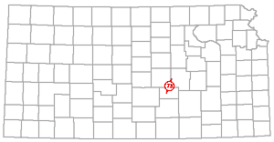
The name Mound City dome is applied to a rather pronounced structural high in Linn County; it is discernible in outcropping rocks of middle Pennsylvanian age.
The name Mound City was first used as a structural name by Jewett (1949, p. 215): "The smaller Mound City oil pool, in the 'Squirrel sand,' is on a structural dome that is rather large in comparison to most eastern Kansas structures. Seemingly the apex of the dome . . . lies a short distance north and east of Mound City. . . . The Evans et al. No. 1 Charles Cook well in the SE SE NW sec. 4, T. 22 S., R. 24 E., was drilled on the Mound City structure in 1938. . . . The top of Mississippian limestone was encountered at 455 feet."
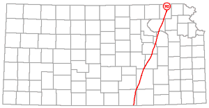
Nemaha Anticline (100) |
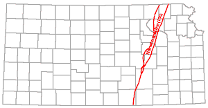 |
The Nemaha anticline, or uplift, is a major post-Mississippian element that crosses Kansas from Nemaha County to Sumner County and extends into Nebraska and Oklahoma. It is discernible in surface rocks along most of its length but is much more pronounced in the subsurface and is believed to be faulted in many places along its eastern steeper flank (Kellett, 1932; Moore, 1936; Jewett and Abernathy, 1945, pls. 1-3; Jewett, 1949, pl. 3). A fault flanking the northern part is called the Humboldt fault.
In many papers the Nemaha anticline has been referred to as "Nemaha mountains," the "Nemaha granite ridge," or the "granite ridge." This is because Precambrian crystalline rocks are at comparatively shallow depths along the axis of the uplift. The anticline was first recognized as an uplift of great length and the name Nemaha first used as a structural term by Moore and Haynes (1917, p. 168): ". . . it is proposed to name the buried granite mountain ridge of central Kansas the Nemaha mountains." However, comparatively prominent anticlines or domes along the axis of the uplift had been recognized earlier. Prosser and Beede (1904) named the Burns dome, Diamond Creek anticline, Elmdale anticline, and Cottonwood province, which now are recognized as parts of the larger structural unit. Condra and Bengston (1915, pp. 25, 39) used the term "Table Rock anticline" for the part of the structure in the vicinity of the Kansas-Nebraska line. The great length of the uplift is emphasized by the use of the name Nemaha-Oklahoma City uplift by some geologists.
Lee (1943, pp. 115-119) discussed in detail the structural history of the Nemaha anticline and the development of geologic thought concerning it. It is now commonly thought that '"mountains" is an unsuitable term to describe any stage of the uplift. The present concept includes deductions that were presented by Ley (1926, p. 96), Moore (1926, fig. 2), McClellan (1930, p. 1553), Rich (1931, p. 1437), and Lee (1943). This may be summarized: Mississippian and older rocks are tilted and eroded on the flanks. Pennsylvanian strata on the anticline overstep and overlap rocks ranging in age from Precambrian to Mississippian. Pennsylvanian beds lie on Precambrian rocks in a belt extending in a northwestward-trending direction from a point in T. 10 S., R. 10 E. to the Nebraska line and in isolated areas farther south. The northern part of the ridge, which had been eroded down and into the crystalline rocks, was not covered by Pennsylvanian sediments until Virgilian or late Missourian time. Older Pennsylvanian beds overstep and overlap Precambrian and Paleozoic rocks along the southern part of the axis of the uplift.
It is probable that the first report of crystalline rock at shallow depth in the Nemaha anticline was that of Russell (1888) who reported crystalline rock at 552 feet in Pawnee County, Nebraska. In 1905 Darton (p. 284) stated that the rock in the Nebraska well possibly was Precambrian in age.
Nemaha mountains and Nemaha granite mountains were used widely, especially in the 1920's and 1930's, to designate the Nemaha anticline or more specifically its core of Precambrian crystalline rocks. The names granite ridge and Nemaha granite ridge have been used in many publications in the same sense.
The Nemaha anticline was first recognized as an uplift of great length and with a comparatively shallow crystalline rock core by Moore and Haynes (1917) and they coined the name "Nemaha mountains."
Nemaha-Oklahoma City uplift is used by some geologists to designate the elongated Nemaha anticline indicating that it includes in its southern part the Oklahoma City structure. The name is used in this manner by Wheeler (1947, fig. 1). It is shown on Wheeler's maps as the eastern boundary of the Anadarko basin in southern Oklahoma.
According to Wheeler (1947, p. 38): "The Nemaha Ridge culminates southward in the Oklahoma City Uplift, properly described as a buried mountain comparable in magnitude with segments of the Arbuckle Mountains to which it is closely related in age and mechanics of structure. In fact, the Oklahoma City Uplift is connected with the northern Arbuckle, Pauls Valley Uplift, by an extensive plateau which separates the Anadarko Basin from the McAlester Basin . . . ."
An elliptical dome having a general north and northeast trend in the southeast part of sec. 8, T. 24 S., R. 17 E. and parts of neighboring sections, northeastern Woodson County, is called Neosho Falls dome.
According to Knight and Landes (1932, p. 8): "The Neosho Falls dome lies about 1 mile west and 1.5 miles south of the town of Neosho Falls." Mapping on the top of Mississippian beds by those geologists shows more than 20 feet of closure in an area about half a mile long and a quarter of a mile wide. The Vernon oil field covers an area that includes the Neosho Falls dome.
Knight and Landes (1932) expressed the opinion that the Neosho Falls, Rose, and Silver City domes (all in Woodson County) are the results of arching of sedimentary rocks above laccoliths.
Norcatur "high" is used to designate a pre-Mississippian structural feature on the Ellis arch in Norton and Decatur Counties and extending into Nebraska.
Referring to a map showing pre-Mississippian areal geology, Koester (1935, fig. 2, p. 1420) stated: ". . . wells in Nebraska along the Cambridge anticline have found Precambrian underlying the Permian or upper Pennsylvanian, so it seems there may be a broad area in northern Kansas with little or no pre-Pennsylvanian sediments. The Norcatur 'high' apparently is a continuation of the Rush rib." Koester's term Rush rib is listed in this index.
Northern (Anadarko) Basin Shelf (105) |
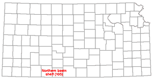 |
Northern (Anadarko) basin shelf is the name applied by Wheeler (1947, p. 41, fig. 1) to a somewhat indefinitely limited area along the northwest flank of the Anadarko basin, extending from Oklahoma into Clark, Comanche, and Barber counties, Kansas.
According to Wheeler (p. 41): "Thus, although the Ordovician rocks rise northward into Kansas with only a gradual flattening, the Mississippian and particularly the Pennsylvanian rocks tend to show an abrupt decrease in the rate of thinning, suggestive of a northern basin platform. As a consequence, facies changes from basinal sands to platform limestones in the Pennsylvanian create an unusual class of oil possibilities."
North Kansas Basin (106) |
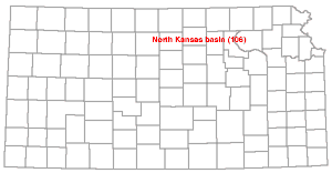 |
The North Kansas basin is a large pre-Mississippian basin north of the Chautauqua arch and north and east of the Ellis arch. The name was first used by Rich (1933, p. 796, fig. 2).
Location of the North Kansas basin is shown by Rich (1933, fig. 2); Moore and Jewett (1942, fig. 7); Jewett and Abernathy (1945, fig. 3); Lee, Leatherock, and Botinelly (1948, fig. 2); and Jewett (1949, fig. 11). The basin is regarded as one of the major structures that shaped the framework of Kansas before the development of the Nemaha uplift and other post-Mississippian major structural elements. The name Ancestral North Kansas basin has been used for the pre-Devonian stage of essentially the same structure (Lee and others, 1946, sheet 2), but later Lee, Leatherock, and Botinelly (1948, p. 124) wrote: "After St. Peter time a broad area in southeastern Nebraska and northeastern Kansas known as the North Kansas basin which had previously been a positive area (the Southeast Nebraska arch) began a long period of differential subsidence. Also at this time the Ozark region of Missouri rose and the Chautauqua arch and the Central Kansas uplift began their upward movement."
The name Ancestral North Kansas basin has been used to designate a large pre-Devonian basin in northeastern Kansas and southeastern Nebraska.
Lee and others (1946, sheet 2) showed a structure called the Ancestral North Kansas basin by means of isopachus lines. The line indicating 700 feet of rock section between the base of the St. Peter sandstone (upper early Ordovician) and the base of Devonian limestone passes through central Marshall and Nemaha Counties, Kansas, and encloses the basin by passing through Cass County, Nebraska, about 100 miles to the north. As explained in the discussion 6f the North Kansas basin in this index. Lee and his associates later dropped the prefix ancestral.
The Oil Hill dome is one of the parts of the El Dorado dome, a local "high" on the Nemaha anticline in Butler County. It has been very prolific in oil production from the upper part of beveled Ordovician beds that lie next below Pennsylvanian rocks.
The Oil Hill dome was named by Fath (1921, p. 69): "The Oil Hill dome is slightly elongated in a northwesterly direction and centers in the north-central part of sec. 33, T. 25 S., R. 5 E. . . . . The Oil Hill dome is separated by the Bancroft syncline from both the Boyer and Shumway domes and its apex lies at the same elevation as that of the Boyer dome, about 1,440 feet above sea level. Its closure amounts to over 25 feet."
An anticlinal fold containing several prominent domelike parts extending from the vicinity of Otto in southeastern Cowley County to near Beaumont in southeastern Butler County, a distance of about 50 miles or more, is sometimes referred to as the Otto-Beaumont anticline. An example of the usage is by Condra and Upp (1931, fig. 1) who showed the position of the axis of the anticline. The Dexter or Dexter-Otto and the Beaumont anticlines are discussed elsewhere in this index. Attention is also called to the term Beaumont anticline seemingly being used for the same extensive trend of anticlinal structures. However, Moore and Landes (1927, fig. 69) published a map of Cowley County showing the axis of the Beaumont anticline about 6 miles west of the axis of the Dexter anticline, and the axis of the Beaumont structure is shown passing through the southeast corner of Butler County and across Greenwood County through Beaumont, Eureka, and Virgil (Moore and Landes, 1927, figs. 61, 75).
The southern part of this structure was mapped by Bass (1929, fig. 18) who employed contour lines spaced at 10-foot intervals and on the Wreford limestone. A high part is shown in the vicinity of Dexter, in secs. 7 and 18, T. 33 S., R. 7 E. and in secs. 24 and 25, T. 33 S., R. 6 E. Another high part has its center in sec. 13, T. 34 S., R. 6 E. and another is in secs. 35 and 36, T. 34 S., R. 6 E. Bass referred to the structure both as the Dexter and the Dexter-Otto anticline.
Otto-Dexter Anticline (110) |
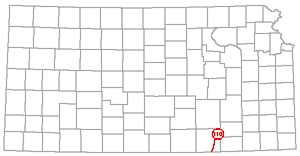 |
The anticline in Cowley County that in this index is discussed more fully under the heading Dexter anticline, sometimes is referred to as the Otto-Dexter anticline. An example of this usage is by Condra and Upp (1931, p. 10). The Otto and Dexter folds, in restricted sense, are in an anticlinal trend that has been called Otto-Beaumont and Beaumont.
The name Ozark basin has been used for a large pre-St. Peter basin whose axis extended from south-central Missouri to southeastern Iowa. It was formed by synclinal movements that were active during late Cambrian and early Ordovician time. Eastern Kansas is on the western flank of the basin.
According to Lee, Leatherock, and Botinelly (1948, p. 122): "That a subsiding basin, the Ozark basin, prior to St. Peter time extended from south-central Missouri northward into eastern Iowa is indicated by maps showing the thickness of the rocks between the top of the Roubidoux and the Precambrian in southern Missouri . . . , and between the base of the St. Peter and the Precambrian in northern Missouri."
In discussing the development of the Southeast Nebraska arch and the Ozark basin Lee (1943, pp. 102-103) wrote: "These structural movements are the first known to have deformed the sedimentary rocks of northeastern Kansas."
Ozark Monocline (112) |
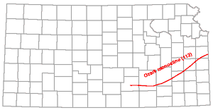 |
Ozark monocline refers to a pre-Mississippian principal structural element in eastern Kansas.
The name Ozark monocline was used by Rich (1933, p. 796): ". . . the Ozark monocline, comprising the eastern part of the state where the pre-Chattanooga dip was primarily west-northwestward into the North Kansas basin. The Ozark monocline had a very gentle westward inclination and was broken by a number of low domes whose extent and trend can not yet be determined definitely. . . . The most prominent of these interruptions to the general monoclinal dip into the North Kansas basin are found in central Osage and northern Lyon counties . . . and in northeastern Greenwood county."
The Kansas part of the Ozark monocline is interpreted as the northwest flank of the Chautauqua arch.
The Ozark uplift or dome, a large post-Pennsylvanian structure, is regarded as lying partly in southeastern Kansas. The exposed line of contact between Mississippian and Pennsylvanian rocks in Cherokee County may there be regarded as the boundary of the structure as well as the land form, the Ozark plateau. However, westward- and northwestward-dipping Pennsylvanian beds in eastern Kansas, comprising a part of the structural province known as the Prairie Plains monocline, in reality represent the northwest flank of the Ozark uplift.
The Ozark uplift has been described by Siebenthal (1915, p. 23) more as a land form than a geologic structure: "The Ozark uplift is a low asymmetric dome with rudely elliptical outline, lying in southern Missouri, northern Arkansas, southeastern Kansas, and northeastern Oklahoma. It is roughly bounded on the north and northeast by Missouri and Mississippi rivers, on the west by Spring and Neosho (Grand) rivers, on the west and south by Arkansas River, and on the southeast by Black River and some of its tributaries. To the north and west it merges into the Prairie Plains; to the east and southeast it passes into the low-lying Gulf Costal Plain; on the south it is separated from the Ouachita Mountains by the valley of Arkansas River. . . . Near and parallel to its southern margin the uplift culminates topographically in the Boston Mountains, a long, narrow plateau rising to an elevation of 2,000 feet." Siebenthal (1915, p. 29), however, defined the Ozark uplift as a broad geanticline. The structural crest of the uplift is in southeastern Missouri where crystalline rocks of Precambrian age are exposed.
Although the extension of the ancestral Ozark uplift in southeastern Kansas and northeastern Oklahoma is called the Chautauqua arch, the pre- and post-Mississippian structures in the main part of the Ozark region commonly are not differentiated. According to Wilson (1922, p. 28): "The dome [Ozark] is the result of uplift during several periods of crustal elevation which took place slowly at widely separated intervals."
Start of report... || Next--Letters P through W...
Kansas Geological Survey, Geology
Placed on web July 15, 2005; originally published in 1951.
Comments to webadmin@kgs.ku.edu
The URL for this page is http://www.kgs.ku.edu/Publications/Bulletins/90_6/page2.html