|
Original published in D.F. Merriam, ed., 1964, Symposium on cyclic sedimentation: Kansas Geological Survey, Bulletin 169, pp. 381-398 | |
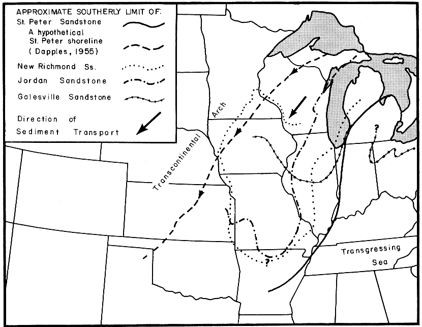
Figure 3--Map indicating approximately southerly limit of occurrence of quartzarenites. Limit is interpreted to indicate approximately shoreline configuration at time of deposition of sands which formed earliest deposits of these formations. Dominant transport directions, as determined from current lineation and crossbedding measurement, are indicated by arrows. Limits of Galesville, New Richmond, and St. Peter Sandstones modified from Workman and Bell (1948), Emrich (1962), Powers (1935), and Dapples (1955).