|
Original published in D.F. Merriam, ed., 1964, Symposium on cyclic sedimentation: Kansas Geological Survey, Bulletin 169, pp. 219-238 | |
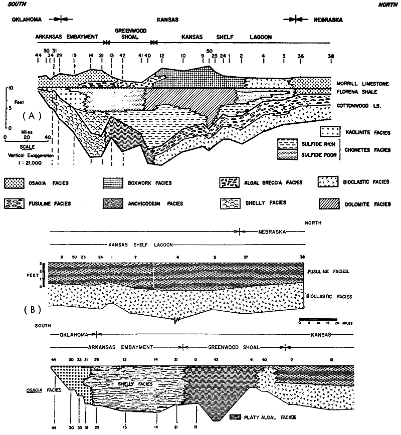
Figure 2--A, Restored stratigraphic cross section showing facies distribution in Beattie Limestone along line of outcrop from Nemaha County, Nebraska, to Osage County, Oklahoma. Datum is top of Florena Shale. Facies boundaries determined from data obtained in foot-by-foot sampling at each of 24 measured sections. For description of facies, see text. For location of sections, see Figure 3 (from Imbrie, Laporte, and Merriam, 1959). B, Restored section of Cottonwood Limestone showing areal distribution of facies. Datum is top of Cottonwood Limestone (Laporte, 1962).