![]()
Prev Page--Geography || Next Page--Rocks Not Exposed
Stratigraphy
All the bedrock formations in Mitchell and Osborne counties are Upper Cretaceous in age. Due to the gradual increase in elevation from the eastern edge of Mitchell County to the western edge of Osborne County and the nearly horizontal rock structure the older formations occur to the east and the younger to the west. The surface rocks in Mitchell County are largely members of the Greenhorn and Carlile formations, while the greater part of Osborne County is covered by rocks of Niobrara age. Only a relatively small part of the two counties is covered by Tertiary and Quaternary sediments.
Table of rock formations exposed in Mitchell and Osborne counties, Kansas.
| System and series | Formation and member | Lithologic character | Thickness in feet |
||
|---|---|---|---|---|---|
| Quaternary | Recent | Modern stream deposits; Terrace deposits Soil and talus Spring deposits |
0-50 | ||
| Pleistocene (?) | Intermediate sand and gravel deposits. Loess. |
||||
| U. C. Tertiary | Ogallala | Unconsolidated sediments on divides. "Mortar" beds. | |||
| Cretaceous | Upper Cretaceous |
Niobrara formation |
Smoky Hill chalk member | Chalk and chalky shale | 0-115 |
| Fort Hays limestone member | Massive chalk alternating with thin chalky shale beds | 60 | |||
| Carlisle shale |
Blue Hill shale member | Gray, fissile clay shale with sandstone at top and concretions in upper part | 200 | ||
| Fairport shale member | Chalky shale with thin limestone beds in lower part | 103 | |||
| Greenhorn limestone |
Pfeiffer member | Chalky limestone and shale | 18 | ||
| Jetmore member | "Shell" limestones and chalky shale | 17 | |||
| Hartland shale member | Bluish-gray chalky shale with a few thin limestone and bentonite beds | 22-27 | |||
| Lincoln member | Chalky shale and thin, hard crystalline limestone beds | 25 | |||
| Graneros shale | Dark bluish gray shale with sandy streaks | 26 | |||
| Dakota sandstone | Sandstone with variegated shale | 30+ | |||
Quaternary System
Recent Deposits
The stream valleys, especially Solomon river and its forks and Salt creek, are floored with alluvium of Recent age. This material is a sandy loam which may also contain locally derived chalk pebbles. The terraces are of similar composition and only slightly greater age. The soil at the surface of both the flood plain and the terraces yields prolific crops.
Of very recent age is the deposit of calcareous tufa composing the low cone or mound built by the waters of Great Spirit spring at Waconda, about two and one-half miles southeast of Cawker City. As the water, under slight artesian pressure, overflows from the orifice of the spring it evaporates to such an extent that some of the mineral matter in solution, especially calcium carbonate, is precipitated. The same method of cone-building is observed in the hot springs and geysers of Yellowstone Park. The cones are not built by volcanic eruption. The rock deposited at Great Spirit springs varies in color from white or gray to yellowish brown, and is layered because of periodic rather than steady overflow. There are quite noticeable open spaces between some of the layers which give the rock a high porosity and allow escape of most of the water through the sides of the cone. As is generally the case in spring deposits of this type, the precipitated material tends to form countless small spheroids, called pisolites.
Pleistocene (?) Deposits
Sand and gravel deposits which occur at a position intermediate between the river terraces and the high Tertiary gravel beds are tentatively placed in the Pleistocene. They were formed by streams which have either disappeared or have shifted and deepened their channels so as to leave isolated sand and gravel deposits on the flanks of the present valleys. Erosion by tributary creeks has destroyed most of these abandoned channel deposits, so that now there is but a patch of them here and there to furnish a clue to the drainage pattern of the past. Solomon river at one time followed a course through Mitchell County about two miles north of its present channel and along this belt is a row of sand and gravel deposits. Other Pleistocene (?) deposits occur in southwestern Mitchell County and in northeastern, northern, western, and southwestern Osborne County. These isolated deposits and those formed by the ancestral Solomon river are described more fully under the heading "Sand and Gravel."
Also of probable Pleistocene age is the conglomerate on Salt creek, which is well exposed in the southeast quarter of sec. 14, T. 9 S., R. 8 W., on the north bank of Salt creek. It consists of cement and gravel similar in appearance to the "mortar beds" belonging to the Ogallala formation. However, this exposure is over twenty miles east of the nearest known Ogallala outcrop and is different in composition. Most of its pebbles have been derived from the slightly higher limestones belonging to the Lincoln "marble" of the lower Greenhorn formation. The gravel toward the top of the crop is not cemented and forms a flat terrace which lies 18 to 20 feet above the present Salt creek flood plain. It is probable that this gravel was washed into the valley from the surrounding bedrock terrain in Pleistocene times, and since then it has become partially consolidated through cementation.
Deposits of loess, a fine sandy loam of probable wind origin, are not as abundant in Mitchell and Osborne counties as in some of the adjacent counties, such as Cloud County. A few relatively thin loess deposits have been noted in southwestern Osborne and northeastern Mitchell counties.
Tertiary System
Ogallala formation
No deposits of undoubted Tertiary age occur in Mitchell County or in eastern Osborne County. Two narrow fingers of Tertiary rocks extend from the less dissected high plains of southern Rooks County into southwestern Osborne County. Out beyond the two fingers are a few small outliers, the easternmost one of which lies in sec. 27, T. 9 S., R. 13 W., in the south-central part of the county. These fingers and outliers are found only along the tops of the highest hills and ridges, the elevation of the bottom of the Tertiary deposits ranging between 2,060 feet along the Graham county line and 2,020 feet feet at the easternmost outlier.
Plate IV--Hill capped by "mortar beds" of the Ogallala formation, sec. 22, T. 9 S., R. 13 W., Osborne County.
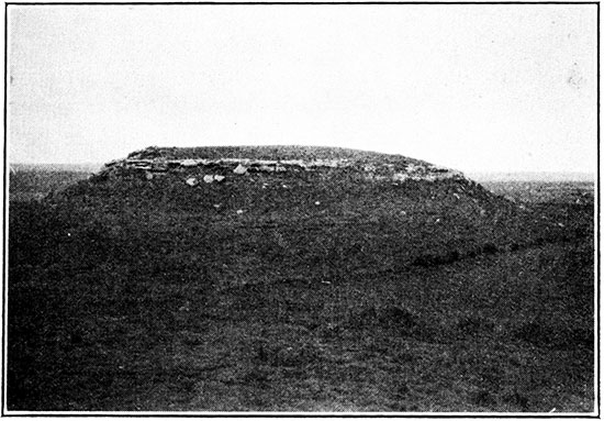
Because of studies made elsewhere in western Kansas" these Tertiary rocks are assigned to the Ogallala formation of late Miocene-Pliocene age (Bass, 1926, p. 16-18). The Ogallala was deposited by ancient and relatively swift streams which flowed eastward from the Rocky Mountains to the ancestral Mississippi. The formation is composed of clay, sand and gravel, and calcium carbonate. Secondary precipitation of calcium carbonate by ground water in the otherwise unconsolidated. Tertiary material has caused some of it to be cemented into hard rocks, which due to their appearance are locally called "mortar beds."
| Section of the Tertiary rocks occurring near the SW corner of sec. 22, T. 9 S., R. 13 W. Section measured by R. G. Moss. | Feet | |
|---|---|---|
| Ogallala formation | ||
| Hard mortar bed | 10 | |
| Friable, soft silty sandstone. This bed has been quarried for, building sand and fragments of large vertebrate fossils are reported to have been found within it | 8 | |
| Hard mortar beds; alternating hard and soft layers; some of the harder layers have been finely silicified | 10 | |
| Soft sand and mortar beds; lower part made up chiefly of recemented Smoky Hill chalk pebbles. Rests on eroded surface of Smoky Hill chalk | 16 | |
| Total exposed thickness | 44 | |
Cretaceous System
With the exception of the "mortar beds" all of the consolidated rocks in Mitchell and Osborne counties are of Upper Cretaceous age. Furthermore, all of the Upper Cretaceous formations of Kansas are represented in these two counties with the exception of the Pierre shale, which overlies the Niobrara formation in the western end of the state.
Niobrara Limestone
The Niobrara formation, which is the highest and youngest part of the Cretaceous exposed in Mitchell or Osborne counties, is subdivided in Kansas into an upper member, the Smoky Hill chalk, and a lower, the Fort Hays limestone. The Smoky Hill chalk member is 700 to 800 feet thick in the western end of the state, but only the lower part is present in Osborne County as a thin veneer overlying the more resistant Fort Hays limestone, and in Mitchell County it has been eroded altogether. The maximum thickness of Smoky Hill chalk known to be present in Osborne County is 115 feet, measured in sec. 7, T. 9 S., R. 15 W. The member is composed of alternating thin-bedded chalk and tan weathering chalky shale. Because of its soft character, the Smoky Hill chalk is generally eroded away except where it is protected by a cap of "mortar beds," and even there the slopes are so gentle that the chalk is exposed only, in ravines and road cuts. A characteristic feature of the Smoky Hill member is the presence of discoidal concretions, often circularly furrowed, which are composed of pyrite and limonite. Large fossil shells of Inoceramus (Haploscapha) grandis are common. These shells are usually covered by the relatively small shells of the Ostrea congesta.
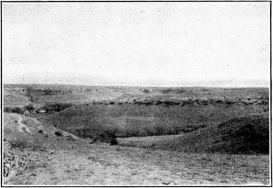
The Fort Hays limestone is much the more prominent member of the Niobrara formation in Mitchell and Osborne counties. It extends into the latter county from Rooks County in two long points, one north and the other south of the south fork of Solomon river. These points are intricately dissected by tributaries of the Solomon. The valley end of the tributary divides is generally marked by outliers, and other outliers occur to the east beyond the tip of the Fort Hays points. The only Fort Hays Limestone in Mitchell County occurs as outliers capping the Blue Hills and near-by buttes. Because of the greater hardness of this limestone, it forms steep slopes and cliffs. Where no Smoky Hill chalk veneer is present above the Fort Hays the rock makes a fairly smooth plateau surface which is generally covered by an abundance of white residual limestone fragments. Superficial faults caused by landsliding are common in the outcrop area of this member, especially where a long point extends out along the top of a ridge. Large jointed blocks tend to slide over or perhaps even squeeze out some of the underlying shale so that the lower surface of the Fort Hays limestone may be considerably lower in elevation than is normal, or the blocks may be tilted to give abnormal and, of course, entirely superficial dips.
Plate V--Fort Hays capped hills in sec. 13, T. 7 S., R. 15 W., Osborne County. Bushes are about at contact between Fort Hays limestone and Blue Hill shale.
The Fort Hays limestone differs from the overlying Smoky Hill chalk largely in its proportion of massive chalk to chalky shale. This proportion in the Smoky Hill member runs about one to one, but the Fort Hays member contains at least six times as much massive chalk as chalky shale. Also, the Fort Hays is not as thinbedded as the Smoky Hill, for in the former many of the beds are from 2 to 3 feet thick. The color ranges from creamy white through yellow to light brown. Mud cracks were observed in a bed lying about 25 feet above the base in sec. 13, T. 7 S., R. 15 W. The thickness of the Fort Hays limestone is about 60 feet.
| Section of the lower 40 feet of the Fort Hays limestone member of the Niobrara chalk in sec. 13, T. 7 S., R. 15 W. All of the chalk is light yellow to white; the shale is light gray to yellow. Section measured by R. G. Moss. | Feet | Inches |
|---|---|---|
| Broken chalk (top of bluff) | 8 | 0 |
| Shale | 2 | |
| Chalk | 1 | 3 |
| Shale | 2 | |
| Chalk | 10 | |
| Shale | 1 | |
| Chalk | 2 | 8 |
| Shale | 1 | |
| Chalk | 7 | |
| Shale | 2 | |
| Chalk | 2 | 8 |
| Shale | 1 | |
| Chalk | 2 | 11 |
| Shale | 1 | |
| Chalk | 1 | 9 |
| Shale, containing mud cracks and weathering orange-tan | 6 | |
| Chalk partings | 1 | 6 |
| Chalk | 2 | 0 |
| Shale | 2 | |
| Chalk | 4 | |
| Shale | 1 | |
| Chalk | 2 | 0 |
| Shale | 3 | |
| Chalk with partings 4 inches below top | 1 | 6 |
| Shale | 1 | |
| Chalk | 2 | 9 |
| Shale | 2 | |
| Chalk | 4 | 5 |
| Shale | 1 | |
| Chalk | 3 | 0 |
| Sandy gray shale (Blue Hill) | ||
| Total | 40 | 4 |
Carlile Shale
The Carlile shale is divided into two members, the Blue Hill shale above and the Fairport shale below. The essential difference between the two is the absence of calcareous material in the former, whereas the Fairport is highly calcareous. Because of this difference in chemical constitution, the Blue Hill soils are very much less fertile than those produced by the weathering of the Fairport. Inasmuch as both members of the Carlile are shaly, there is no distinct break between them, and the contact is hard to find., Testing for calcium carbonate is not reliable because leaching by surface waters tends to remove this compound from the exposed rocks, or fragments of Niobrara limestone which have been washed or let down from their original position may be present so that calcium carbonate is added to the surface and near-surface rocks. However, where fresh exposures occur the distinction can be readily made between the two Carlile members, for the Blue Hill is black while the Fairport is gray to light yellow. Exposures of Carlile shale are too rare in Mitchell County to permit separate mapping of the two members, but it was possible in Osborne County, due to the more rugged topography, to map the contact between the Blue Hill and Fairport.
Blue Hill Shale Member. The Blue Hill shale crops out around the Blue Hills and other Fort Hays outliers in southwestern Mitchell County. It covers a very large area in Osborne- county, occupying the steep slopes beneath the Fort Hays escarpment. The elevation of the Fairport-Blue Hill contact in southwestern Osborne County is about 1,800 feet, while in the Blue Hills region it is approximately 1,600 feet. The Blue Hill member is about 200 feet thick. A variable sandstone or sandy shale zone lies at the top and was named the Codell sandstone by Bass (Bass, 1926, p. 28). At the north end of the Blue Hills this unit consists of 42 inches of gray, friable sandstone which weathers to a mottled yellow and which lies directly beneath a thick scarp-making Fort Hays limestone bed. On the other hand, in sec. 24, T. 8 S., R. 13 W., Osborne County, it consists solely of a gray argillaceous sandstone only two inches thick which is limy at the top and weathers to an orange tan or buff color. Farther southwest the sandstone thickens again, as may be seen in the accompanying section.
| Section of Codell sandstone exposed in the southwest corner of sec. 6, T. 10 S., R. 14 W., Osborne County, Kansas. | Feet | Inches | |||
|---|---|---|---|---|---|
| Niobrara chalk | |||||
| Fort Hays limestone member | |||||
| Carlile shale: | |||||
| Blue Hill shale member: | |||||
| Codell sandstone: | |||||
| Argillaceous sandstone, weathering brown | 1 | 0 | |||
| Soft, fissile, blue-green shale | 3 | 0 | |||
| Soft, massive cream-colored argillaceous sandstone. Contains calcareous sandstone concretions up to 8 feet in diameter | 25 | 6 | |||
| Total thickness of Codell sandstone | 29 | 6 | |||
| Blue-gray fissile shale. | |||||
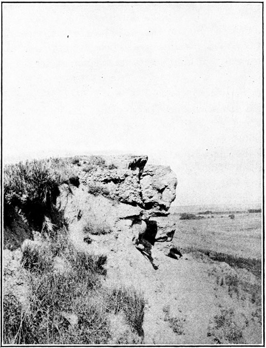
The remainder of the Blue Hill member consists of very fissile blue-gray noncalcareous shale with several zones of septaria concretions. The cleavage fragments of this shale may be paper thin. Gypsum (locally but erroneously called mica) in characteristic diamond-shaped crystals is abundant at several horizons. The concretions in the sandy zone near the top of the Blue Hill member may have diameters as great as 8 feet. The shale concretions range in diameter from a few inches to 4 feet, with a great many between 12 and 18 inches. They are spherical, discoidal, or lemon-shaped in form and contain cross-cutting veins of calcite. The concretions occur in zones which may be persistent for a considerable distance laterally, in which case they may be utilized for structural mapping. The concretions are sufficiently abundant in some places to make a resistant layer which caps buttes, as in eastern Osborne County.
Plate VI--Sandstone concretions in upper Blue Hill shale capping hill in sec. 11, T. 10 S., R. 13 W., Osborne County.
Fairport Chalky Shale Member. About 100 feet of chalky shale occupies the lower third of the Carlile formation. The contact with the overlying Blue Hill shale is generally obscured by soil or talus covering, but the lower contact with the Greenhorn limestone is often visible. The Fairport in Osborne County occupies a narrow belt along the south boundary in the drainage of Wolf creek, and short wedges extend up the two forks of Solomon river. The calcium carbonate content of this member is high and in the basal 20 feet there are a number of thin but persistent limestones. In fact there is no great lithologic difference between the lowermost Fairport and the uppermost Greenhorn, but the line is drawn at the top of the "post rock" largely because of a distinct faunal break at that point. The shale in the Fairport is coarsely laminated and gray when fresh, weathering to cream or tan. Minute white crystals of calcite are scattered through the shale, giving it a speckled appearance. Gypsum crystals ranging from 1,4 inch to ¥2 inch in length were observed at one locality, but these were probably deposited by ground waters that had dissolved the calcium sulphate from the Blue Hill shale before that member was removed by erosion. The limestones of the lower Fairport range in color from a chalky white to a pink or pale red.
| Complete section of the Fairport member of the Carlile shale measured in eastern Osborne County, Kansas. Measured by R. G. Moss. | Feet | Inches | |
|---|---|---|---|
| Near east quarter-corner sec. 14, T. 8 S., R. 12 W. | |||
| Blue Hill shale | |||
| Fairport shale member | |||
| 40. Gray, limy, fossiliferous shale | 7 | 0 | |
| 39. Gray, silty, fossiliferous chalk bed; somewhat discontinuous | 6 | ||
| 38. Gray, fossiliferous chalky shale. Contains 1,4-inch bentonitic clay bed 12 feet 4 inches above base | 14 | 6 | |
| 37. Gray, silty, fossiliferous chalk bed | 5 | ||
| Near south quarter-corner, sec. 3, T. 9 S., R. 12 W. | |||
| 36. Gray, limy, fossiliferous shale. Contains white bentonitic clay bed 5 feet above base | 6 | 0 | |
| 35. Gray, fossiliferous chalk bed | 5 | ||
| 34. Gray, limy, fossiliferous shale. Contains a one inch bed of white bentonitic clay 3 feet above base and a pyritic, concretionary zone 2 feet above base. Pyrite concretions oxidize to limonite, leaving casts of pyrite crystals. Shale contains Ostrea congesta and Serpula sp. | 4 | 9 | |
| 33. Gray, silty, fossiliferous chalk bed, lenticular | 3 | ||
| Near northwest corner, sec. 31, T. 7 S., R. 11 W. | |||
| 32. Gray, fissile, limy shale containing abundant Ostrea congesta. Contains lenticular chalk bed up to 6 inches thick 1 foot above base | 6 | 6 | |
| 31. Yellow-tan to white bentonitic clay bed containing numerous discoidal pyritic and limonitic concretions | 1 | ||
| 30. Gray, argillaceous chalk bed | 3 | ||
| 29. Fissile, dark gray, limy shale containing a thin bed of limonitic clay | 4 | 3 | |
| 28. Gray pyritic and limonitic shale containing selenite | 2 | ||
| 27. Gray, fossiliferous limy shale | 3 | 4 | |
| 26. Gray, argillaceous chalk | 7 | ||
| 25. Gray, fossiliferous, limy shale | 1 | 4 | |
| 24. Gray, fossiliferous, argillaceous chalk | 5 | ||
| Sec. 1, T. 8 S., R. 12 W. | |||
| 23. Gray, fissile, limy shale containing limonitic concretions | 7 | 2 | |
| 22. Zone of two bentonitic clay beds separated by 2 inches of gray shale | 4 | ||
| 21. Gray, fissile, limy, fossiliferous shale | 4 | 2 | |
| 20. Gray, argillaceous, fossiliferous chalk | 4 | ||
| Secs. 25 and 26, T. 7 S., R. 11 W. | |||
| 19. Gray, limy shale | 1 | 10 | |
| 18. Soft, gray, argillaceous chalk | 4 | ||
| 17. Gray, limy shale | 4 | 5 | |
| 16. Sulphur-yellow bentonitic clay containing limonitic concretions | 3 | ||
| 15. Gray, fossiliferous, limy shale | 2 | 2 | |
| 14. White, bentonitic clay. Weathers to orange-tan color | 1 | ||
| 13. Gray, fossiliferous, limy shale | 3 | 2 | |
| 12. White, bentonitic clay | 1 | ||
| 11. Gray, limy shale | 3 | 5 | |
| 10. Soft, gray, silty chalk | 5 | ||
| 9. Gray, limy shale | 2 | 4 | |
| 8. Gray, argillaceous, soft chalk, weathers to light reddish brown | 4 | ||
| 7. Gray, limy shale containing Ostrea congesta | 2 | 4 | |
| 6. Gray, silty chalk bed, with parting in middle. Weathers to light reddish brown. "Pink lime" | 4 | ||
| 5. Gray, limy shale containing Ostrea congesta | 5 | 7 | |
| 4. Gray chalk. Weathers to light tan color | 3 | ||
| 3. Gray, limy shale containing abundant Ostrea congesta near top | 7 | 6 | |
| 2. Soft gray chalk | 6 | ||
| 1. Fissile, limy shale with 3-inch bentonitic clay at top and containing three zones of hard limestone concretions; 1 foot above base, 2 1/2 feet above base and 3 1/2 feet above base | 4 | 9 | |
| Total thickness of Fairport shale member | 102 | 10 | |
| Greenhorn limestone | |||
| "Fence post" limestone | |||
The three zones of concretions in the botton 5 feet of the Fairport are the only ones in the member. The chalky limestone (bed 2), 4 feet, 9 inches above the "post rock" in this section, is remarkably persistent, but the interval between it and the "post rock" varies from 3 1/2 to 5 1/2 feet, the latter extreme being the more common. Also this bed is usually much harder than indicated in this section. Another unusually persistent layer is the bentonitic seam at the top of bed 1, although in some places it contains a high percentage of granular calcite and looks, like the so-called "sugar sand" which lies at about an equal distance below the "post rock." Other limestones that are sufficiently persistent to be used in structure mapping occur at approximately 13, 19, and 21 feet above the "post rock." These all weather to a reddish brown or pink color, especially the 19-foot limestone (bed 6), which is called the "pink lime" by oil geologists. The 13-foot limestone (bed 4) is more brick-colored, cleaves in the middle like the "post rock," and has a dense ground mass which is speckled with minute white calcite grains. The small fossil oyster, Ostrea congesta, so common in the Niobrara, is likewise abundant in the Fairport except in the basal portion, which in all probability was deposited before this fossil species developed.
Greenhorn Limestone
The Greenhorn formation is unimportant in Osborne County, appearing only in the river bottoms at the eastern and southern edges of the county, but it is of considerable importance in Mitchell County, where it occupies most of the valley slopes. It is divided into four members, named in downward order the Pfeiffer, Jetmore, Hartland, and Lincoln. Although all are composed of limestone and limy shale, massive limestones are much more prominent in the upper two members than in the Hartland and Lincoln. The total thickness of the Greenhorn in Mitchell County is about 82 feet.
Pfeiffer Member. The Pfeiffer is the top member of the Greenhorn and outcrops immediately beneath the upland surface. It is composed of beds of massive white limestone and shale that is blue when fresh, but is generally buff in color on the outcrop. The limestones contain scattered Inoceramus shells. The shale zones are thicker than the limestone beds, especially in the lower part of the section, so that part of the member below the topmost limestone (the "post rock") is poorly exposed as a rule.
| Typical section of the Pfeiffer member of the Greenhorn limestone exposed in road cut in the east center of sec. 20, T. 7 S., R. 7 W., Mitchell County, Kansas. | Feet | Inches | ||
|---|---|---|---|---|
| Fairport chalk | ||||
| Greenhorn limestone | ||||
| Pfeiffer member | ||||
| 8. "Post rock" or "fence post" limestone. Dense, hard chalk containing a few shell fragments and an ever-present ironstained band at center. Cleaves along this band. Makes slight shoulder | 10 | |||
| 7. Chalky gray to buff fissile shale. Contains 3/4-inch dark gray to black soapy shale 3 inches below top and zones of discoidal limestone concretions at distances of 1 and 2 1/2 feet below top. Some thin limestones occur between lower concretion zone and bottom of shale | 5 | |||
| 6. Densely crystalline limestone | 3 | |||
| 5. White, chalky shale, locally stained yellow. Contains three persistant concretionary zones | 6 | |||
| 4. Hard, fine crystalline limestone | 2 1/2 | |||
| 3. Chalky shale containing five thin concretionary zones | 2 | 6 | ||
| 2. Fine crystalline cream-colored limestone | 2 | |||
| 1. Chalky shale containing two zones of limestone concretions | 3 | |||
| Total thickness of Pfeiffer member | 17 | 11 1/2 | ||
| Jetmore member: "Shell" limestone | ||||
The "post rock" is the most prominent bed in the Pfeiffer member. It crops out at the tops of the bluffs facing Solomon river and Salt and Rock creeks and continues for long distances up the tributary valleys. It ranges in thickness from 8 to 10 inches and invariably has an iron seam (limonite-stained chalk) at or near the center. Because of this feature and the fact that it has been extensively quarried it is an easy bed to follow and is ideal for detailing structure. The abandoned quarries can be recognized by the presence of a shallow trench and mounds of the stripped-off over-burden. In the southeastern part of Mitchell County and in Cloud County the "post rock" becomes thinner and softer and consequently less prominent (M. E. Wing, informal communication). The concretions in the shale immediately beneath the "post rock" may locally thicken into massive bench-making limestones. Four feet below the "post rock" a hard dense yellow-cream limestone 3 to 4 inches in thickness and banded with thin iron-stained streaks was observed in a number of sections. Immediately beneath the 3-inch limestone 5 feet below the "post rock" there may be an incoherent granular limestone known as the "sugar sand" bed by drillers in counties to the southwest. Midway between the "post rock" and the "shell bed" of the Jetmore a limestone is seen in many places, which contains more Inoceramus shells than the usual Pfeiffer limestone and which either makes a bench or a prominent line of float. This limestone in the section given is concretionary (bed 5), but in other localities it appears as a massive limestone and could be used for detailing structure.
Jetmore Member. The Jetmore member of the Greenhorn limestone is composed of two very prominent limestone beds, a number of thinner chalky limestone beds, and zones of limy shale. The shale generally weathers to a white or tan color, which aids in distinguishing this member from the underlying Hartland, in which the shale is predominantly blue, even when weathered. The limestone beds are highly fossiliferous, more so than those in the overlying Pfeiffer, and are most prominent at and near the top of the member. They become thinner and softer toward the base and cease abruptly at the contact with the Hartland. The separation of the Jetmore member is easy, for from 3 to 5 feet of shale immediately overlie and underlie it. The top of the member makes a distinct bench, while the slope beneath is generally steep and rocky. The Jetmore crops out along the sides of the valleys in central arid eastern Mitchell County and in southern Osborne County.
| Section of the Jetmore member of the Greenhorn limestone measured along a bluff on south side of Solomon river, south of Solomon Rapids, Kansas. | Feet | Inches | ||
|---|---|---|---|---|
| Greenhorn limestone | ||||
| Jetmore member | ||||
| "Shell bed" | 1 | |||
| Tan-colored shale | 1 | |||
| Concretionary zone | 2 | |||
| Shale with concretionary zone midway | 1 | 3 | ||
| Hard gray fossiliferous limestone ("subshell") | 4 | |||
| Shale | 11 | |||
| Hard gray limestone | 5 | |||
| Shale with 14-inch bentonite at base | 11 | |||
| Hard, gray, crystalline limestone | 5 | |||
| Thick-bedded blue shale | 9 | |||
| Soft, shaly chalk | 2 | |||
| Light tan shale | 6 | |||
| Chalky limestone | 4 | |||
| Light tan chalky shale | 8 | |||
| Cream-colored limestone | 3 | |||
| Limy shale | 1 | 6 | ||
| Hard, dense limestone | 6 | |||
| Shale | 8 | |||
| Soft limestone | 3 | |||
| Fine-bedded blue shale | 1 | 8 | ||
| Soft, white limestone | 4 | |||
| Blue shale | 9 | |||
| Soft limestone | 2 | |||
| Shale | 8 | |||
| Soft, shaly limestone | 3 | |||
| Total thickness of Jetmore member exposed | 15 | 10 | ||
| Section of the Jetmore member of the Greenhorn limestone measured in the NW cor. sec. 35, T. 10 S., R. 12 W. southeastern Osborne County, Kansas. Section measured by R. G. Moss. | Feet | Inches | ||
|---|---|---|---|---|
| Greenhorn limestone | ||||
| Jetmore member | ||||
| "Shell bed." Lower 9 inches hard, fossiliferous, chalky limestone; upper 6 inches concretionary | 1 | 3 | ||
| Shale | 1 | 1 | ||
| Chalky limestone | 4 | |||
| Shale | 11 | |||
| Chalky limestone | 5 | |||
| Shale | 8 | |||
| Chalky limestone | 2 | |||
| Shale | 1 | 1 | ||
| Chalky limestone | 2 | |||
| Shale | 11 | |||
| Chalky limestone | 4 | |||
| Shale | 2 | 1 | ||
| Chalky limestone | 5 | |||
| Shale | 1 | |||
| Chalky limestone | 3 | |||
| Shale | 11 | |||
| Chalky limestone | 3 | |||
| Shale | 10 | |||
| Chalky limestone | 4 | |||
| Shale | 1 | 2 | ||
| Chalky limestone | 2 | |||
| Shale | 1 | 3 | ||
| Crystalline limestone | 2 | |||
| Shale, weathers light tan | 5 | |||
| Chalky limestone | 5 | |||
| Total thickness of the Jetmore member exposed | 17 | |||
The so-called "shell bed" consists of two parts. The upper is concretionary in Osborne and Russell counties, but in Mitchell County it is a consistent dense limestone ranging from white to yellowish cream in color. It contains a very few flat Inoceramus shells. The lower and thicker portion of the "shell bed" contains a mass of oyster shells (Inoceramus labiatus) with the individual valves from 4 to 8 inches in length. Coiled ammonite shells, 2 to 8 inches in diameter, may also be present. The two slabs of the "shell bed" are generally eroded unevenly so that the outcrop is terraced. This limestone is quarried in southeastern Mitchell County and in Cloud County for fence posts and buildings. The only other distinctive limestone in the Jetmore is the "subshell bed," the top of which lies about 2 1/2 feet below the base of the "shell." Although only 4 to 5 inches in thickness, this limestone is very resistant to erosion, and generally makes a separate bench. It is fully as fossiliferous as the "shell bed," but it is darker in color.
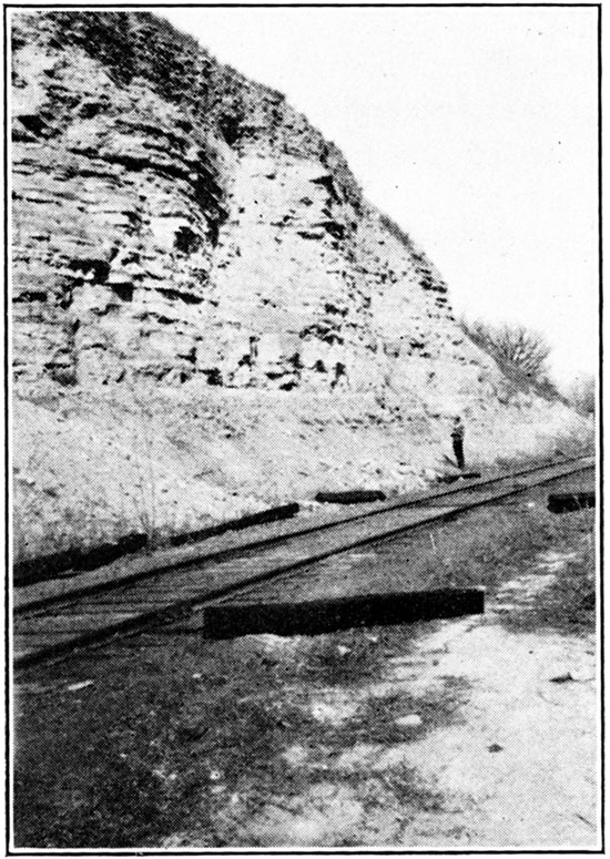
Plate VII--Jetmore and upper Hartland (members of the Greenhorn formation) exposed in railroad cut, Glen Elder.
Hartland Member. The Hartland member of the Greenhorn limestone consists largely of shale, with a few thin beds of crystalline limestone and a number of bentonite seams. The thickness ranges from 22 feet in north central Mitchell County to 27 feet in the southeastern corner of the county. The shale ranges in color from light bluish gray to tan, whereas in the underlying Lincoln the shale is predominately yellow. The shale is soft and limy and is reported to contain abundant Globigerina (J. B. Reeside, Jr., informal communication). Three thin beds of crystalline limestone appear in the lower half of the Hartland, which may give a petroleum odor on fresh fracture, just as do the beds of so-called "marble" at the top and bottom of the Lincoln member. The highest of these at the eastern edge of Mitchell County is 8 inches thick, has a slabby fracture, and is very similar in appearance to the top bed of the Lincoln, but differs from that limestone in having thin, chalky stringers. Farther west this bed disappears and is replaced in the Solomon Rapids section by a 3 1/2 inch very dense gray limestone which contains a few small pelecypods and scattered shell fragments. The Hartland bentonite seams are typically yellow at the surface and range in thickness from 1 to 6 inches. Because of the soft character of the rocks in the Hartland, exposures are rare. The member outcrops in the Solomon and Salt creek valleys in Mitchell County and near the bottom of a few valleys in southern Osborne County.
| Section of the Hartland member of the Greenhorn limestone near Solomon Rapids, Kansas. | Feet | Inches | ||
|---|---|---|---|---|
| Greenhorn limestone | ||||
| Jetmore member (section given above) | ||||
| Hartland member | ||||
| Bentonite | 1 | |||
| Blue shale | 4 | 6 | ||
| Soft cream limestone | 4 | |||
| Shale, 1/4-inch iron seam at base | 10 | |||
| Blue shale | 2 | 0 | ||
| Bentonite | 6 | |||
| Slabby limestone | 4 | |||
| Blue shale. Lower 6 inches strongly iron-stained | 2 | 10 | ||
| Resistant gray limestone | 3 1/2 | |||
| Shale, iron-stained at top | 10 | |||
| Bentonite | 2 | |||
| Blue shale, with hard zones | 5 1/2 | |||
| Petroliferous limestone zone | 1 | 4 | ||
| Shale | 1 | 3 | ||
| Petroliferous limestone | 1 | |||
| Shale | 2 | 0 | ||
| Bentonite | 1 1/2 | |||
| Shale | 1 | 0 | ||
| Bentonite | 1 1/2 | |||
| Shale | 3 | 0 | ||
| Total thickness of Hartland member exposed | 22 | 1 | ||
Lincoln Member. The Lincoln limestone and shale lies immediately beneath the Hartland, but due to the soft nature of most of the rock and its usual position near the bottom of the valleys actual exposures are few. However, the limestone bed lying at the top of the member is fairly resistant and may form a bench, the position of which is midway between benches made by the sandstone at the top of the Dakota and the "shell bed" at the top of the Jetmore. The Lincoln member contains another prominent limestone at the base, while the 22 to 24 feet of intervening space is occupied by shale, with a very few thin limestones and three or four bentonite seams. The limestone beds of the Lincoln are either finely or coarsely crystalline (hence are often called "marble") and contain numerous shells and shell fragments. The color is generally some shade of brown. A freshly exposed surface invariably gives off a petroleum odor, and oil was proven to be present in small amounts by the chloroform test. The limestone at the top of the member is 9 to 12 inches thick and weathers into a series of slabs 1/2 to 2 inches thick. The basal Lincoln limestone is very coarsely crystalline and dark brown in color, with red or lavender streaks often present. The shale, which composes most of the member, is in part chalky but mostly yellow, so that roads constructed across the outcrop have a distinctive tan color. In common with the other Greenhorn shale beds the calcium carbonate content is high. The bentonites in the Lincoln are no different from those in the Hartland. A complete Lincoln section was not measured in Mitchell County.
| Section of the upper part of the Lincoln member of the Greenhorn limestone, exposed near Solomon Rapids, Kansas. | Feet | Inches | ||
|---|---|---|---|---|
| Greenhorn limestone | ||||
| Hartland member (section given) | ||||
| Lincoln member | ||||
| Limestone with partings, petroliferous. Half-inch bentonite at base | 1 | |||
| Shale | 5 | |||
| Bentonite | 3 | |||
| Shale. Lower 2 inches may be bentonitic | 6 | |||
| Limestone, petroliferous | 2 | |||
| Shale | 2 | 9 | ||
| Bentonite | 5 | |||
| Shale | 9+ | |||
| Total thickness of the Lincoln member exposed | 14 | 6 | ||
From observations made in south-central Republic county, northeast of Mitchell County, the remaining 11 feet of Lincoln section is composed of alternating beds of shale and thin crystalline limestones with a 14-inch bentonite bed lying just above the basal "marble."
Graneros Shale
The Graneros shale crops out only in the valley of the Solomon at the eastern end of Mitchell County and adjacent to Salt creek near the southern boundary. It is soft and consequently but rarely exposed. The formation is composed largely of dark-colored shale which differs from that in the overlying Greenhorn by being noncalcareous. This shale weathers to a gumbo clay soil which caps the low Dakota hills north of Asherville. Thin ferruginous sandstone layers may be present. The thickness of the Graneros is 26 feet at a point south of Simpson. This is 14 feet less than has been recorded in Russell County, so evidently the formation thins to the northeast (Rubey and Bass, 1925, p. 51).
Dakota Sandstone
Only the top 30 feet of the Dakota, including a sandstone and a few feet of underlying shale, crop out in Mitchell County, and the formation is entirely buried in Osborne County. The top member is sufficiently resistant to form a bench which extends up both sides of Solomon river valley to a point between Asherville and Beloit, where it disappears beneath the flood plain. It also extends up the tributary valleys at the east end of the county, especially those to the south. The Dakota bench extends upstream in Salt creek valley as far as the forks with Rock creek and is unusually prominent on the south side of the valley. The top sandstone is buff or red and is cross-bedded. It exhibits a highly porous texture on weathered surfaces. The underlying shale was exposed at only one place and there it was buff and arenaceous.
Prev Page--Geography || Next Page--Rocks Not Exposed
Kansas Geological Survey, Geology
Comments to webadmin@kgs.ku.edu
The URL for this page is http://www.kgs.ku.edu/Publications/Bulletins/16/04_strat.html