Kansas Geological Survey, Bulletin 142, part 5, originally published in 1960
Back to Depositional Environment...
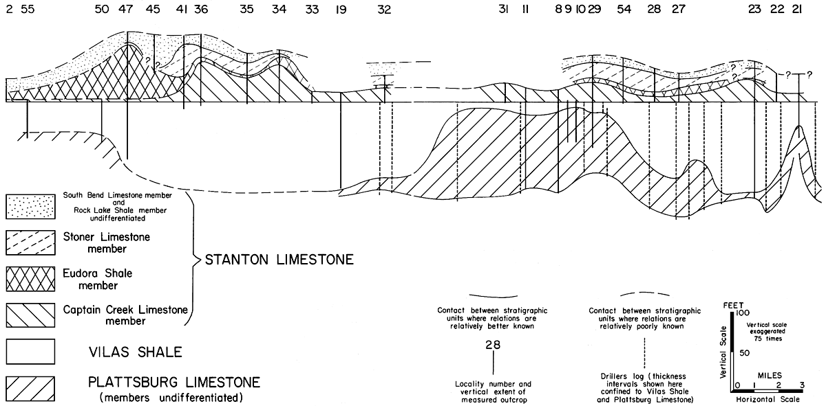
Figure 17--Geologic cross section showing thickness variations in divisions of Lansing Group in Wilson -Montgomery County area. Base of Captain Creek member has been plotted as arbitrary horizontal datum. Numbers denote measured sections shown in Figure 16, which also shows line of cross section.
Back to Depositional Environment...
Kansas Geological Survey, Marine Bank Limestones of Lansing Group, Southeast Kansas
Placed on web Feb. 19, 2009; originally published in Dec. 1960.
Comments to webadmin@kgs.ku.edu
The URL for this page is http://www.kgs.ku.edu/Publications/Bulletins/142_5/fig17.html