![]()
Prev Page--Rocks Exposed, Cenozoic || Next Page--Rocks Exposed, More on Mesozoic
Rocks Exposed, continued
Mesozoic
Cretaceous
Niobrara Formation
The Niobrara formation, consisting of a series of chalky beds, crops out only in the extreme northwest corner of Russell County, where a maximum thickness of about 100 feet remains uneroded. The lower part consists of massive beds of chalk containing few impurities, white and rather soft above and tan and harder below; the upper part consists of beds of soft chalk and chalky marl, silty and iron-stained.
The stratigraphic position, lithology and fossils of this formation establish its correlation with the Niobrara of Colorado, Wyoming, South Dakota and Nebraska, and make highly probable its correlation with the Austin chalk of Texas. [Stanton, T. W.; Later Mesozoic invertebrate faunas: Jour. Geology, vol. 17, p, 419; 1909.]
The formation was named by Meek and Hayden, in 1861, from exposures near the mouth of Niobrara river in northeastern Nebraska. [Meek, F. B., and Hayden, F. V.; Descriptions of new lower Silurian (Primordial), Jurassic, Cretaceous and Tertiary fossils collected in Nebraska Territory [etc.): Phila. Acad, Nat. Sci. Proc. for 1861, vol. 13. pp. 419-42; 1862.] The Niobrara formation in Kansas has been subdivided into the Smoky Hill chalk member above and the Fort Hays limestone member below.
Smoky Hill Chalk Member
Character and distribution--The argillaceous Smoky Hill chalk member of the Niobrara formation occurs only as thin remnants capping the higher hills in the northwestern part of the county. It consists of soft beds of chalky marl containing scattered ferruginous concretions and alternating thin beds of chalk rock, which together reach a maximum thickness of nearly 50 feet in Russell County.
Clear exposures of this member were not found in Russell County, but the exposures seen indicate that its composition is similar to that of beds found 30 miles to the west, in sec. 17, T. 11 S., R. 20 W., Ellis County, where the lower 90 feet or so of the Smoky Hill member--a soft chalky shale and alternating harder beds of chalk, and some very thin layers of clay--is exposed. Flat, more or less circular, impure limonitic concretions, many of which are about a foot in diameter in the plane of bedding and 3 or 4 inches thick, occur throughout the member, but are most abundant in the lower 30 feet. These concretions contain a central core of slightly weathered pyrite several inches in diameter and an inch thick, and at least some of them contain nuclei of thick Inoceramus shells. The cubical faces of the pyrite crystals are commonly a half to a quarter of an inch in diameter. G. E. Patrick found that chalk beds of this member contain 84 to 98 per cent of calcium carbonate, and crude quantitative analyses made by the senior author show that some of the marly beds contain about 50 per cent of lime. [Patrick, G. E.; Kansas chalk: Kansas Acad. Sci. Trans., vol. 4, pp. 13-15; 1875.]
The marly parts of the Smoky Hill member are separated into thin beds by clayey partings, but the harder and less numerous chalk beds are commonly massive. The marly beds appear to soften and the chalk rocks to harden somewhat on weathering, so that on the freshest surfaces the two types are almost indistinguishable. Fresh exposures of the rocks are white, pale cream, or bluish gray, but weathered surfaces have a yellowish tint, which ranges from a bright tan to a light cream. The concretions weather to a conspicuously darker rusty brown.
Joints are not readily recognizable in the member because of poor exposures, but at some localities outside of Russell County faults with displacements ranging from a fraction of an inch to a few feet are conspicuously marked by slickensided, coarsely crystalline veins of calcite, 1 to 6 inches thick. Mudge mentions the occurrence of crystals of barite in some of these veins. [8. Mudge, B. F.; Notes on the Tertiary and Cretaceous periods of Kansas: U. S. Geol. and Geog, Survey Terr., Bull. 2, p. 215; 1876.]
Fossils [The discussion of fossils is based on identifications made by J. B. Reeside, Jr.]--Large, thick, rather flat and coarsely ribbed shells, formerly referred to the genus Haploscapha Conrad, but now placed in the genus Inoceramus, are abundant from the base of the Smoky Hill upward, but were not found below that member. This Inoceramus has been designated by three specific names in the literature--grandis Conrad, eccentrica Conrad, and niobrarensis Logan--but it is very likely that the three are not distinct and should be included under the one name I. grandis. The small shells of the colonial oyster Ostrea congesta Conrad are common throughout the exposed portion of the member. Vertebrate remains, largely fragments of bone, have been found at many places, and the member contains abundant Globigerina bulloides D'Orbigny and Textularia globulosa Ehrenberg.
Means of recognition--The Smoky Hill chalk member does not form prominent topographic features in the eastern area of its outcrop, but makes long, gentle, sodded slopes with few exposures, benched by thin beds of chalk along the larger streams where vigorous tributaries have cut into it. The residual soils derived from the member range from gray to black, their color depending somewhat upon the siltiness of the underlying bed, but chiefly upon the extent to which the lime has been extracted by leaching and upon the amount of organic matter that has accumulated at the surface.
The Smoky Hill member, which somewhat resembles several other subdivisions of the Cretaceous of central Kansas, can be more or less readily distinguished from the Greenhorn limestone and the Fort Hays member of the Niobrara formation by its persistently yellower color and the absence of numerous thick beds of chalk rock or occasional thin beds of crystalline limestone. The Fairport chalky shale member of the Carlile shale, which it most closely resembles, contains fewer beds of chalk rock and no limonitic concretions.
Difficulty of mapping--Detailed mapping of individual beds within the Smoky Hill member is practically impossible except along the larger stream courses, where adequate exposures permit their actual tracing or the recognition of distinctive sequences of beds. Throughout the remainder of its area the structure of the rocks can be determined only by shallow drill holes that penetrate to some easily recognizable horizon, such as the top of the Carlile shale--a slow and costly method.
Name--The Smoky Hill chalk member of the Niobrara formation was first known as the "Pteranodon beds," [Credited to Marsh by Williston, S. W.; Smoky Hill chalk: Kans. Univ. Quarterly, vol. 4, p. 251; 1896.] but later was named by Cragin from Smoky Hill river, in Kansas. [Cragin, F. W.; On the stratigraphy of the Platte series, or the Upper Cretaceous of the Plains: Colo. Coll. Studies; vol. 6, pp. 51-52; 1896.] Geographic names are now preferred to paleontologic names for designing formations, and the term Smoky Hill is to-day in good standing. Cragin subdivided the Smoky Hill member into four parts--the bluish and marly "Trego zone" at the base, the yellow and more chalky "Norton zone" next above, the Graham jasper next, and a thin unnamed subdivision at the top. Williston, later, in 1896, proposed to subdivide the Smoky Hill into two submembers--the "Rudistes beds" below and the "Hesperornis beds" above.[Williston, S. W.; Idem, p, 252.] Probably the portion of the member exposed in Russell County is equivalent to parts of the "Trego zone" of Cragin and the "Rudistes beds" of Williston.
Fort Hays Limestone Member
Character and distribution--The rim of the highest buttes in the northwest corner of Russell County is made by the Fort Hays limestone member of the Niobrara formation. This member, somewhat more than 50 feet thick, is in this area made up of massive beds of chalk, white and rather soft above and tan and harder below.
Complete exposures of this member were not found in Russell County, but partial sections found at a number of places near by indicate a widespread similarity of detail. Near the northwest corner of Ellis County the Fort Hays member appears to be about 55 feet thick, and this is probably near its average thickness in the area here considered.
The uppermost beds, where fresh, are commonly pure white, moderately hard, massive chalk, which weathers white or pale cream and develops a thin-bedded structure. Individual chalk beds of greater purity and hardness than the remainder are apparently most numerous near the middle of these white beds. Small limonitic concretions with nuclei of pyrite occur in the upper part. These upper beds are 20 to 30 feet thick.
The intermediate, or, in a few places, the basal beds of this member are harder and. form more or less prominent bluffs of massive beds, 1 to 6 feet thick, of tan to dull buff chalky limestone. The rock is rather uniformly a light cream where fresh and it contains some thinner-bedded portions. Small limonitic balls about a quarter of an inch in diameter are sparingly distributed through the lower part. This unit is from 15 to 30 feet thick and probably averages about 20 feet in thickness in Russell County.
Farther west, at one or two localities in Ellis and Trego counties, the basal 20 or 30 feet of the Fort Hays member is softer and thinner bedded and contains layers of chalky shale. Slightly sandy layers; long, narrow, vertical worm tubes; and "conglomerates" made of fragments of Inoceramus shells, occur in some places. This phase appears to become thinner toward the east, until near Russell County it is absent or is represented by but 2 or 3 feet of soft, gritless chalk.
The hard beds throughout the Fort Hays member readily soil the fingers with a white chalky powder and especially the white upper beds easily leave a white mark. The rock contains Foraminifera of the Globigerina types, which, however, are apparently not common, the bulk of the rock being made up of very fine white grains of powder, 0.01 millimeter or less in diameter. These features appear to make the lithologic name chalk or chalkstone more appropriate than the more general or more technically restricted term limestone. [De Lapparent, J.; Lecons de petrographie : pp. 359-361. Masson et Cie, Paris; 1923.]
This member, like the overlying Smoky Hill, is sufficiently brittle to resist slight deformation, and in places it has yielded to pressure or gravity by breaking, so that small faults are not uncommon in areas of its outcrop. The Fort Hays member is unique among the strata of central Kansas in its decided propensity to slump. Great blocks of the basal beds may be seen lying as much as 50 feet below their normal position. This slumping, however, is rarely accompanied by great fracturing of the rock.
Some indication of an unconformity at the base of this member was found near the northwest corner of sec. 32, T. 11 S., R. 16 W., Ellis County, 5 miles west of Fairport. Here vertical cracks, three-eighths of an inch wide, filled with fragments of the Fort Hays limestone, extend 20 feet into the underlying sandstone bed of the Carlile shale. It is probable that these filled joints are merely fractures formed by slumping.
Fossils [Identifications by J. B. Reeside, Jr.]--The thick-shelled, rather regular, and deeply cupped Inoceramus deformis, about 8 inches in diameter, and Ostrea congesta occur throughout the member, but are especially abundant in its lower part. Except for the microscopic Globigerina and Textularia, no other fossils were noted in this member.
Topographic prominence--The Fort Hays member is topographically one of the most prominent. of the rock units in central Kansas. As it is harder than the thick underlying beds of the Carlile shale, its lower part at many places caps an irregular line of hills that stand 100 feet or more above the surrounding country. Isolated buttes, some small and nearly conical, others long and flat-topped, are rather common near the boundary of the member with the Carlile shale, and some stand at distances of nearly a mile from it. A gentle upland slope, almost invariably developed on the upper softer beds, at many places reaches nearly to the base of the member. The upper part of the member is rarely well exposed, and is at most places represented by a white or light limy soil in which small chips of chalk are usually abundant. On the weathered south slopes of the divides and in similar areas of local relief the lower beds make a fairly conspicuous bench of very light tan soil that is relatively barren of vegetation. The severe slumping of the basal beds of the Fort Hays member gives rise to a distinctive topographic form that is misleading from a distance. At some places on the steeper bluffs below the Fort Hays scarp several lines of prominent benches or terraces may be seen, which when examined closely are found to be made by long slumped ledges of Fort Hays chalk that dip steeply back toward the hill and form bands of narrow undrained depressions behind them. Because of the moisture retained in these troughlike depressions, the vegetation grows more rankly in them than on the bordering slopes.
Means of recognition--The Fort Hays member somewhat resembles in its lithology the Smoky Hill member of the Niobrara, the Fairport member of the Carlile, and the Greenhorn limestone, all chalky. From the Fairport and Smoky Hill members it is distinguishable by its thick beds of hard chalk, the light color of its weathered surfaces, and the presence of clay shales below. The Greenhorn formation has thinner hard chalk beds, many layers of chalky marl, and thin beds of coarsely crystalline dark gray limestone near its base, and is about twice as thick as the Fort Hays member.
The contact of the Fort Hays limestone member with the overlying Smoky Hill chalk member is at many places difficult to recognize. Typically the lower beds of the Fort Hays member make a fairly prominent scarp, showing tan, hard, more or less massive beds of chalk or a light-colored soil sparsely strewn with small chips of hard chalk on which vegetation grows sparingly. Above this scarp the upper beds of the member form a gentler slope of very light soil. The Smoky Hill, however, almost uniformly makes a very gentle slope of dark clay soil, and in good exposures presents small scarps of conspicuously tan, soft, relatively thin-bedded chalky shales. Large limonitic concretions are abundant in the lower part of the Smoky Hill, but similar though much smaller ones are found in the upper part of the Fort Hays member. Because of its superior hardness and whiteness in contrast with the beds immediately overlying, the top of the Fort Hays member is usually recognized by drillers in well borings.
Unreliability of the Fort Hays member for detailed mapping--Its topographic prominence and more or less distinctive characteristics might seem to make the Fort Hays member a valuable unit for detailed structural mapping. Unfortunately, however, except for the general subdivisions of white and softer beds above and yellow and harder beds below, it is very difficult to recognize any of its individual components for distances sufficient to make their mapping profitable. The top of the basal Fort Hays bluff is held by the same bed for short distances only--a fact all too apt to be overlooked in mapping areas where exposures are poor. On many of the smaller isolated buttes near the Fort Hays-Carlile contact the capping basal Fort Hays strata are tilted and are rarely at the proper elevations for this horizon as judged from surrounding outcrops; and one is forced to the conclusion that even the narrower projecting arms of the Fort Hays member show the same tendency, for the strata gradually rise along these spurs to the main divides. These observations have led the writers to the conclusion that in areas of poor exposures the only uniformly reliable horizon in this member for detailed structural mapping is its contact with the underlying Carlile shale, and to the belief that even this contact is not reliable on narrow divides and isolated hills where small areas of the member may have slumped below their normal position. Shallow drill holes over much of the fiat uplands might be used profitably to determine the structure of the beds at places where deformation is suspected.
Name--Because of an earlier miscorrelation by Hayden of the chalk beds at Wilson, Kan., Mudge, in 1876, tentatively applied the name "Fort Hays division or group" to all the strata from the top of the Dakota to the base of the present Smoky Hill member of the Niobrara formation, being in doubt as to presence of the Benton in Kansas. [Mudge, B. F.; Notes on the Tertiary and Cretaceous periods of Kansas: U. S. Geol. and Geog. Survey Terr. Bull. 2, pp. 218-221; 1876.] Williston, in 1892, restricted Mudge's name to the present Fort Hays member, and although Cragin 8 later proposed the name "Osborne limestone" for the same unit, Fort Hays has been used by all other writers on western Kansas since 1893. [Williston; S. W.; The Niobrara Cretaceous of western Kansas: Kans. Acad. Sci. Trans. for 1891-1892, vol. 13, pp. 108-109; 1893.][Cragin, F. W.; On the stratigraphy of the Platte series [etc.]: Colo. Coll. Studies, vol. 6, p. 51; 1896.]
The Term Benton
"Fort Benton group" was the name applied by Meek and Hayden, in 1861, to the Cretaceous strata (their No. 2) between the Dakota and the Niobrara. [Meek, F. B., and Hayden, F. V.; Description of new lower Silurian (Primordial), Jurassic, Cretaceous, and Tertiary fossils collected in Nebraska Territory [etc.]: Phila, Acad. Nat. Sci. Proc. for 1861, vol. 13, pp. 417-422; 1862.] The name, which was taken from Fort Benton, Mont., continued to be used in that form for many years, but was finally shortened to Benton shale where the rocks are indivisible and to Benton group where they are divisible. The term Benton was long used for the corresponding unit in Kansas, but Logan, in 1897, made comparisons with the Carlile, Greenhorn and Graneros formations of Colorado, and in 1899 he made these correlations more positively. [Logan, W. N.; The Upper Cretaceous of Kansas: Kan. Univ. Geol. Survey, vol. 2, pp. 232-234; 1897.] [Logan, W. N.; A discussion and correlation of certain subdivisions of the Colorado formation: Jour. Geology, vol. 7, pp. 83-91; 1899. ] Darton, however, in 1904, was the first to apply these Colorado names in Kansas, retaining Benton as the group name for the three formations. [Darton, N. H.; Comparison of the stratigraphy of the Black Hills, Bighorn Mountains and Rocky Mountain Front Range: Geol. Soc. America Bull., vol. 15, p. 445; 1904.] The United States Geological Survey, however, many years ago abandoned the use of the term Benton group, because the Carlile, Greenhorn and Graneros formations, together with the overlying Niobrara formation, compose the Colorado group--a broader and more useful group name.
Carlile Shale
About 300 feet of argillaceous and chalky shale that crop out in Russell County between the Niobrara and Greenhorn formations make up the Carlile shale. The entire thickness of the formation remains in only a small area in the northwest corner of the county, but the lower 20 to 50 feet is found on the flat uplands that comprise a large part of its area. The formation was named by Gilbert from exposures at Carlile Spring and at Carlile, Pueblo County, Colorado. [Gilbert, G. K.; . The underground waters of the Arkansas Valley in eastern Colorado: U. S. Geol. Survey, 17th Ann. Rept. pt. 2, p. 565; 1896.] In general the Carlile shale is argillaceous, but in its upper part it contains calcareous and ferruginous concretions, and in its lower fourth or third it is highly calcareous, and includes thin beds of chalk. This formation was conspicuously in the public eye for a few years before and after 1900 as the "gold shales" of western Kansas. Mills were erected in Ellis and Trego counties to recover gold and silver thought to exist in them in small quantities, but although minute traces of both metals were found in some samples of the shale, none contained sufficient quantities to make their mining profitable. [Lindgren, Waldemar; Tests for gold and silver in shales from western Kansas: U. S. Geol. Survey Bull. 202, pp, 5-19; 1902.] The Carlile shale in Russell County has been subdivided into the Blue Hill shale member above and the Fairport chalky shale member ("Ostrea shales") below.
Blue Hill Shale Member
More than 200 feet of gray, fissile, clay shale, containing beds of calcareous and sideritic concretions, constitute the Blue Hill ("Victoria") shale member of the Carlile shale. This member crops out on the higher ridges in the northwestern eighth of Russell County. It is strikingly uniform throughout, the chief vertical differences being in the number, size and composition of the calcareous concretions--those in the lower part being smaller, flatter, and more ferruginous--and in the presence of a bed of sandstone at the top. Its precise thickness is difficult to determine satisfactorily, because the slumping of the overlying Fort Hays member, on narrow divides and isolated hills makes the location of its true upper boundary uncertain, but in sec. 29, T. 11 S., R. 16 W., in Ellis County, 5 miles west of Russell County, it is about 215 feet thick.
Upper sandstone division--The upper 20 to 25 feet of this member in Russell County is a "salt and pepper" gray, rather soft, massive, fine-grained argillaceous sandstone, which in its lower part, to the southwest, in Ellis County, becomes a finely gritty, fissile clay shale, containing one-inch beds of soft, very thin bedded sandstone. The rock is friable but not highly porous, and although its content of lime is so low as to be negligible, its content of clayey material is high. The grains range in diameter from 0.4 millimeters down to that of particles of fine clay. There is no great predominance of anyone size, but the diameter of the larger particles averages about 0.125 millimeters. The grains are not much rounded and the largest ones are commonly much more angular than those of the intermediate sizes, an unusual feature. Most of the grains are quartz, chiefly colorless, a few of which show shadowy extinction under crossed nicols, but some are smoky gray and translucent and a few are pink and transparent. Dark gray chert, somewhat kaolinized orthoclase, and some black opaque fragments are rather common, and grains of clear orthoclase and some plagioclase (more calcic than An 30), faintly pinkish microcline, and perfect crystals of zircon showing no effects of abrasion are present. Much of the quartz shows abundant inclusions that are in part at least acicular crystals of brown tourmaline and apatite. This bed of sandstone is noteworthy in that it is immediately overlain by chalk and that it is the only thick bed of sandstone in the Cretaceous sections of Kansas above the Dakota sandstone, for at very few horizons above the lower part of the Graneros shale are the sediments even slightly sandy. A sandy unit at the top of the Carlile shale in South Dakota, Colorado and Wyoming, [Darton, N. H.; Comparison of the stratigraphy of the Black Hills, Bighorn Mountains and Rocky Mountain Front Range: Geol. Soc. America Bull. vol. 15, pp, 444-6; 1904.] the "Pugnellus" sandstone in south-central Colorado [Stanton, T. W.; The Colorado formation and its invertebrate fauna: U. S. Geol. Survey Bull. 106, p. 28, 1893.], and the "Niobenton" sandstone of the oil geologists in north-central Colorado [Henderson, Junius; The foothills formations of north-central Colorado: Colo. Geol. Survey Bull. 19, p, 85, 1920. Ball, Max W.; Gas near Fort Collins, Colorado: Bull. Am. Assoc. Petro. Geol., vol. 8, p, 83; 1924.], are comparable in lithology and stratigraphic position with and may be correlatives of this bed of sandstone in Kansas.
Lower shale and concretion division--The 190 feet or so of the Blue Hill member that lies below the upper sandy deposit is a uniformly gritless, noncalcareous, fissile, dark bluish-gray clay shale. It contains, especially in the lower part, scattered crystals and vertical veins of selenite one-eighth inch thick and some transparent barite. Some white, readily soluble salt ("alkali") stains the surface of the lower shale beds over small, poorly drained areas. Numerous concretions occur along definite bedding planes throughout these beds, and all those in any individual layer appear to be uniform in character. These beds of shale are very fissile, and where somewhat cracked by weathering they may properly be called "paper shales." This fissility and the accompanying minute joints make this member somewhat open-textured, at least near the outcrop.
For 120 to 150 feet below the sandstone bed the concretions are large, ellipsoidal and septarian, and are composed of argillaceous calcium carbonate. Their diameter parallel to the bedding of the shale ranges from about 2 feet for the concretions in the lower part of the member to 4 feet or more for those near its top. They are rudely circular in plan, and their vertical is about half their horizontal diameter. They are composed of finely crystalline to dense calcite, which on fresh surfaces is generally dark gray, but weathers lighter. The larger weathered concretions develop a pseudogranular texture, formed by a series of nodular radiating cylinders about an eighth of an inch in diameter. Veins of brown to colorless coarsely crystalline calcite, from a quarter of an inch to an inch thick, fill joints in nearly all the concretions in this unit, but are most noticeable in those in the upper part. [Erasmus Haworth, formerly director of the Kansas Geological Survey, orally mentioned to the writers the fact that barite and strontianite accompany the calcite crystals in some of these veins.] The distribution of the concretions, though more or less restricted to definite bedding planes throughout, becomes increasingly random upward, the largest, found near the top, being very irregularly spaced.
A group of concretions whose top is 25 to 40 feet below the base of the Niobrara formation is commonly very conspicuous, though it varies greatly in total thickness and detailed characteristics. Two layers of large, bright tan concretions, identical with the rest except in the color of the weathered surface, are notably persistent. The upper and generally the more prominent of these is about 100 feet below the Niobrara; the other, which is about 35 feet lower, is the lowest concretion zone recognized in this middle unit.
The basal 65 feet of the Blue Hill member contains but two persistent layers of concretions. Both layers are readily distinguishable from those in the upper zones, for the concretions are smaller, flatter, and contain more fossils. The upper concretions occur abundantly on a bedding plane 47 to 50 feet above the base of the member. They are commonly from 6 to 12 inches in greatest diameter, elliptical in plan, and about 2 inches thick. On fresh surfaces they are dark gray, but upon weathering they become brown.
The lower layer of concretions, which lies about 31 feet above the base of the member and averages about an inch in thickness, might be called a persistent concretionary bed of ironstone or partly oxidized siderite. The concretions in this layer, which are similar in shape to those in the layer next above, are so abundant that they merge into one another. They contain but little lime, and only the thicker nodules show an unweathered center of blue-black siderite, the bulk of the bed being a hard, dense, somewhat clayey limonite concentrically banded with some hematite.
Fossils--No fossils were found in the upper three-fourths of the Blue Hill member, but other investigators have found at places near by a rather extensive, chiefly invertebrate fauna in the septarian concretions. [Mudge, B. F.; Notes on the Cretaceous and Tertiary periods of Kansas: U. S. Geol, and Goog. Survey Terr. Bull., vol. 2, p. 219; 1876. Cragin, F. W.; On the stratigraphy of the Platte series: Colorado Coll. Studies, vol. 6, p. 50; 1896. Logan, W. N.; The Upper Cretaceous of Kansas: Kansas Univ. Geol. Survey, vol. 2, p, 219; 1897. Logan, W. N.; Some additions to the Cretaceous invertebrates of Kansas: Kansas Univ. Quart., vol. 8, pp. 87-98, pls, 20-23; 1899. Logan, W. N.; A discussion and correlation of certain subdivisions of the Colorado formation : Jour. Geology, vol. 7, pp. 88, 99; 1899.]
The lower 50 feet of the member is, however, more uniformly fossiliferous. The concretions 50 feet above the base contain a few small gastropods anda large pointed-shelled Inoceramus related to if not identical with Inoceramus fragilis Hall and Meek; the ironstone concretions contain the small finely ribbed ammonite Prionocyclus wyomingensis Meek, the original nacreous luster of which is preserved in a number of the specimens; and the fine-ribbed Inoceramus fragilis of normal size. A few feet above the base thick Inoceramus shells occur, and at the very base of the member there is an accumulation of sharks' teeth (both the cutting and the crushing types), fragments of fish bones (largely centra of the vertebree), and phosphatic reptilian coprolites. [These determinations were made in the field by J. B. Reeside, Jr.]
Topographic expression--The beds of the Blue Hill shale member are so slightly resistant to erosion that they form prominent topographic features only where they are capped by harder rock. The Fort Hays limestone member commonly forms such a capping, and the resulting flat-topped buttes and spurs, which stand high above their surroundings, have been noted in the description of the Fort Hays limestone member. The concretions in the middle and lower part of the member give rise to less prominent hills, the large, scattered concretions forming more or less conical buttes and the ironstone bed a low but very persistent flat-topped bench. In and near the northwest corner of Russell County a conspicuous terrace covered with younger gravels occurs for several miles at a nearly constant stratigraphic horizon about 80 feet below the top of the member.
Soil and vegetation--The soil on the outcrops of the Blue Hill member is generally thin and is entirely absent from many of the steeper slopes, but it is fairly thick on the relatively flat uplands. The face of the terrace for about 20 or 25 feet below the ironstone bench is almost everywhere barren. Near the southeastern margin of its outcrop the member caps broad divides, on which it forms a black soil. Vegetation grows rather sparingly on the member, the characteristic coarse grasses being accompanied by small shrubs on the sandy unit and by a few yucca plants in places on the zones of larger concretions. The clay shales are commonly wet a foot or so back from the exposure, and an almost unbroken line of small seeps of water at the very base of the member supports a strip of ranker vegetation.
Means of recognition--The rocks of the Blue Hill member could be confused only with those of the Graneros shale, for all the other gray, gritless Cretaceous shales of central Kansas effervesce readily under hydrochloric acid. The presence of large calcareous concretions, the absence of an underlying series of sandstone and variegated shale, and the much greater thickness of the Blue Hill (215 as against 40 feet), readily distinguish it from the Graneros formation.
The boundary between the Blue Hill shale and the chalky Fort Hays limestone is at most places easily recognizable, for there is no confusing transition zone, clay shales are not found in the Fort Hays, and beds of chalk are not found in the Blue Hill The upper limit of the sandy unit coincides with the base of the soft or hard chalk, and on clean exposures this contact is unmistakable. Where it is covered, the topography and the soil are generally reliable criteria by which to identify the boundary, the more or less conspicuous bench of white chalky soil almost everywhere marking the lower ledge of the Fort Hays, and the dark, sodded or bare slope of the Blue Hill member below showing a pronounced bluish-gray cast and being studded with large concretions. The Blue Hill member is not so hard and is more plastic than the Fort Hays, and these facts and the sandstone bed at the top of the Blue Hill should make the contact recognizable in all carefully taken records of drill holes.
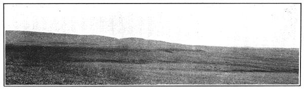
Figure 4--A prominent bench capped by ironstone concretions in basal part of the Blue Hill shale member of the Carlile shale, in sec. 3, T. 11 S., R. 15 W., Russell County.
Horizons suitable for mapping--As already noted, the widespread slumping of the Fort Hays member makes the contact of the Fort Hays and the Blue Hill member a key horizon that can be used successfully for detailed mapping only with the exercise of great care. The persistence, thinness and characteristic lithology of the ironstone bed near the base of the Blue Hill make it an excellent key bed. The less closely spaced, flat calcareous concretions about 50 feet above the base of the member may also be used for this purpose, but they are somewhat less satisfactory than the ironstone bed. The higher concretions, because of their greater size and weight, tend to slide down the steeper slopes, making it difficult to determine their true stratigraphic position. The two lines of rusty-weathering concretions near the middle of the member are the most distinctive of the horizons of concretions and can be used if care is taken to find the highest individual concretions.
Name--The Blue Hill member was named by Cragin, in 1896, the "Victoria clays," from the town of Victoria, and Victoria creek near by, in Ellis County, Kansas, six miles west of Russell County. [Cragin, F. W.; On the stratigraphy of the Platte series: Colo. Coll. Studies, vol. 6, p. 50; 1896.] In the following year Logan called this member the Blue Hill shales, apparently from the Blue Hills, in Mitchell county, Kansas, which he stated "rest upon the Ostrea beds and are composed of the Blue Hill shale, capped by a layer of Fort Hays limestone." [Logan, W. N.; The Upper Cretaceous of Kansas: Kansas Univ. Geol. Survey, vol. 2, pp. 218-219, 225; 1897.] Logan's unit was limited below by his "Ostrea shales" (the Fairport chalky shale member of this report) and above by the Septaria horizon--the large septarian concretions in the upper part of the present Blue Hill member. The Septaria horizon he included in the Niobrara, although he stated that it is at many places embedded in the Blue Hill shale. Not only are the shale beds in and above the Septaria of Logan lithologically indistinguishable from those of his Blue Hill, but the diagnostic septarian concretions in and near Russell County extend much lower into his Blue Hill member than Logan suspected, and the fossils are Carlile and not Niobrara species. [J. B. Reeside, Jr.; personal communication.] Most later writers, including Logan, have included the Septaria horizon in the Blue Hill, and it is here included in that member. [Logan, W. N.; The invertebrates of the Benton, Niobrara and Fort Pierre groups: Kansas Univ. Geol. Survey, vol. 4, pp. 434-436, 441; 1898. Logan, W. N.; A discussion and correlation of certain subdivisions of the Colorado formation: Jour. Geology, vol. 7, pp. 88-89; 1899.] Cragin described as the "Cannonball zone" a group of large concretions in the lower part of his "Victoria clays," apparently applying the term to the lower of the two brown-weathering concretion layers. Although Cragin's name "Victoria" has slight priority over Logan's name Blue Hill, and about equal usage with Blue Hill, it conflicts with three other uses of Victoria (for rocks of Devonian, Mississippian and Cretaceous ages) in American and Canadian literature, but there is no conflict with the name Blue Hill. For this reason Blue Hill has been adopted for this member and the name "Victoria" has been discontinued. The fauna found in the Blue Hill member is an upper Carlile assemblage of species. [Reeside, J. B., Jr.; personal communication.]
Fairport Chalky Shale Member
Character and distribution--The Blue Hill membei is underlain by 85 feet of chalky marl and thin chalk beds that are here called the Fairport chalky shale member of the Carlile shale. Although this member crops out in its entire thickness only in the northwestern eighth of Russell County, its lower part is exposed on the uplands throughout the area. Its basal third or fourth contains nearly all the harder chalk of the Fairport member, the upper beds being composed almost entirely of chalky marl.
So persistent laterally in and near Russell County are even the thinnest beds of the Fairport member that the accompanying composite section is thought to be representative for the area. Minor variations in the thickness of the several beds and units, but no general directions of thickening were found, and the variations are in fact less than the probable error in measurement.
| Average section of Fairport chalky shale member of the Carlile shale near Fairport, Russell County, Kansas (in descending order). [Fossils identified by J. B. Reeside, Jr.] | Ft. | In. | |
|---|---|---|---|
| Blue Hill shale member of Carlile shale | |||
| Fairport chalky shale member of Carlile shale: | |||
| 1. | Chalky, slightly sandy shale; dark where fresh; weathers yellow. Abundant fragments of thick shells of Inoceramus and some Ostrea congesta | 11 | 0 |
| 2. | Chalky, slightly sandy shale with one or more half-inch beds of medium gray, hard, crystalline limestone at top. Finely banded; weathers yellow; selenite crystals on surface. Very large, thin shells of Inoceramus near base | 13 | 0 |
| 3. | Sandy chalk, rusty brown, soft. Inoceramus (resembles I. dimidius), Prionoiropis woolgari, Scaphites, fragments of teeth and bone | 3 | |
| 4. | Chalky shale, very dark gray with half-inch bed of bluish-white clay near center. Contains Ostrea | 2 | 2 |
| 5. | Ocherous clay | 2 | |
| 6. | Chalky shale | 2 | |
| 7. | Sandy chalk, brown streaked with gray. Contains Prionotropis woolgari and Serpula | 5 | |
| 8. | Chalky shale with beds of white clay one-eighth inch thick. Very large, very thin shells of Inoceramus | 1 | 10 |
| 9. | Argillaceous chalk, brown. No Inoceramus shells | 2 | |
| 10. | Chalky shale with half-inch bed of clay at top | 1 | 11 |
| 11. | Argillaceous chalk, brown. No Inoceramus shells | 2 | |
| 12. | Chalky shale | 3 | 0 |
| 13. | Sandy chalk, concretionary, ferruginous, soft. Abundant fragments of thick Inoceramus shells | 3 | |
| 14. | Chalky shale | 2 | 5 |
| 15. | Sandy chalk, concretionary, ferruginous, Large, very thin shells of Inoceramus | 3 | |
| 16. | Chalky shale with thin beds of yellow clay. Contains Ostrea | 6 | 3 |
| 17. | Sandy chalk, hard. Contains many fragments of Ostrea, Inoceramus and Serpula | 2 | |
| 18. | Chalky shale, white and buff mottled, with thin yellow clay at top. Contains smooth, white Ostrea | 4 | 2 |
| 19. | Agrillaceous sandy chalk; tan, thin-bedded | 2 | |
| 20. | Chalky shale | 1 | 4 |
| 21. | Argillaceous, sandy chalk; hard, tan, thin-bedded | 2 | |
| 22. | Chalky, sandy shale, medium gray to drab where fresh, mottled white and buff where weathered; thin-bedded. Fragments of thick Inoceramus shells; abundant Ostrea congesta | 11 | 3 |
| 23. | Slightly sandy chalk, rusty brown, fossiliferous | 4 | |
| 24. | Chalky shale, tan, with abundant Ostrea congesta | 2 | 0 |
| 25. | Chalk, tan; contains a few fish scales | 3 | |
| 26. | Chalky shale, very slightly sandy; black where fresh, very light gray to tan where weathered. Contains abundant Ostrea congesta | 2 | 3 |
| 27. | Chalk, hard, brown to pink (the Pink lime of some oil geologists) | 4 | |
| 28. | Chalky shale, tan, fissile. Fish scales and abundant Ostrea congesta | 5 | 2 |
| 29. | Chalk, rather coarse grained, dark gray to buff. Contains Inoceramus fragilis and Priontropis woolgari | 5 | |
| 30. | Chalky shale, dark to white and tan mottled; fissile. Contains two horizons of concretions, the upper random and discontinuous, about 5 inches thick and less than 2 feet below top; the lower closely spaced, persistent; concretions ellipsoidal, about 8 inches thick, and about 3 feet below top. Many fish scales, Inoceramus fragilis, and Prionotropis woolgari | 7 | 11 |
| 31. | Chalk, hard, gray. Contains Inoceramus fragilis and Prionotropis woolgari | 5 | |
| 32. | Clay, ocherous in color, highly calcareous; resembles bentonite | 5 | |
| 33. | Chalky shale, slightly sandy, fissile; medium gray where fresh, buff or tan where weathered; includes three horizons of concretionary, harder, crinkly bedded chalk in beds about 2 inches thick. Contains fish scales and Ostrea | 4 | 10 |
| Greenhorn limestone | |||
| Total thickness of Fairport member | 85 | 0 | |
Distinctive beds--The thin but persistent beds of yellow and white clay are valuable aids in identifying the adjacent chalk beds. They are easily recognizable by a peculiar jointing that has been appropriately likened to the texture of fish meat. The distinctive 5-inch bed of yellow clay near the base of the member (bed No. 32 of the accompanying section) is a means of identifying the overlying chalk bed as the one 5 1/2 feet above the top of the Greenhorn limestone. The persistence and the structure of these beds of clay greatly resemble that of the layers of bentonite" which are so common in the Cretaceous sediments of Wyoming and elsewhere. [Bentonite is probably a decomposed volcanic ash. See Hewett, D. F.; The origin of bentonite [etc.]: ,Wash. Acad, Sci. Jour., vol. 7, pp. 196-198; 1917.] The clays in Russell County, however, do not show the marked peculiarity of most bentonites--that of swelling to several times their original volume when immersed in water--and so, though they may be bentonitic, many geologists would not call them true bentonites.
The distinctive ellipsoidal calcareous concretions that lie about 11 feet above the base of the member (the lower of the two zones of concretions in No. 30 of the accompanying section) range from a foot to a foot and a half in diameter and from 6 to 10 inches in thickness and occur regularly every few feet horizontally in all the exposures examined. In many of the exposures the median plane carries abundant large Inoceramus shells. The bedding of the chalky shale bends sharply over and under the concretions (Fig. 3). The three horizons of much flatter concretions at the base of the member (No. 33 of section) are also distinctive.
An extreme example of the variation found in this member is seen in the bed of chalk that lies about 20 feet above its base--the Pink lime of some oil geologists (No. 27 of section). About 2 miles south of Fairport this bed is a hard, pink chalk about 6 inches thick, but a few miles to the northwest it becomes soft, rusty brown, and but 2 or 3 inches thick, and 3 miles north of Wilson it is a limestone or chalk breccia consisting of scattered, slightly tilted flat fragments of pink, dense limestone, from 2 to 8 inches across, embedded in porous gray chalk.
The chalky shale beds are dark gray, dark buffy gray, or nearly black on fresh exposures, but where weathered are light tan. The beds in the upper third of the member (Nos. 1 and 2 of the section) weather to a brighter yellow than those below.
Fossils [Identifications by J. B. Reeside, Jr.]--Flattened shells of Ostrea congesta about half an inch in diameter abound throughout the member, occurring chiefly in the shale, but also in the chalk, both isolated and in clusters on clam shells. The ammonite Prionotropis woolgari occurs most abundantly in the lower 15 feet and about 20 feet below the top. Traces of the worm Serpula tenuicarinata Meek and Hayden were found in two of the upper chalk beds. A deeply cupped, coarsely ribbed Inoceramus, similar to but not identical with Inoceramus dimidius, less than an inch in diameter, occurs in a few beds about 25 feet below the top of the member. Inoceramus shells, many of them less than a quarter of an inch thick, but some measuring 32 inches or more across, are abundant from 20 to 45 feet below the top. Shells of this type are rarely found unbroken and generally are seen merely as cross sections of broken shells. Fragments of thick Inoceramus shells occur most abundantly in the upper beds, but are also found in the middle portion of the member. Fish scales, some of them an inch across, are commonest in the lower fourth, but some, which are associated with fragments of teeth, extend nearly to the top, though in fewer numbers. Near the west quarter corner of sec. 5, T. 13 S., R. 15 W., Russell County, lentils of brown lignite a foot or more long, containing thin layers of "glance" coal, occur at the base of a concretionary chalk bed 3 feet above the base of the member.
Means of recognition--Only the lower 20 or 25 feet of the Fairport member is hard enough to make conspicuous topographic features. This part makes benched slopes or small points and isolated hills on top of the persistent bench formed by the Greenhorn limestone. The middle and upper parts of the member make nearly flat weathered slopes with few exposures.
The soils derived from the lower and middle parts of the Fairport member are dark drab to black; those derived from beds near the top are sandy and bright yellow. The high fertility of these soils and the gentleness of the slopes on which they lie combine to make them some of the most desirable wheat-growing land in the region. Where the soils formed by this member are not under cultivation they bear an abundant growth of native short grasses.
The Fairport member somewhat resembles the Smoky Hill and Fort Hays members of the Niobrara formation and the Greenhorn limestone. From the Fort Hays member and from most of the Greenhorn limestone it can be readily distinguished by the facts that it does not contain numerous hard chalk beds, that its weathered color is yellower, and that it is underlain by a series of beds of chalk and chalky shale. It can be distinguished from the Greenhorn limestone by means of features mentioned in the description of that formation, and it can be distinguished from the Smoky Hill member by its lack of massive beds of chalk and large ferruginous concretions and its abundant content of shells of Ostrea.
The boundary between the Fairport and Blue Hill members of the Carlile shale is readily determinable. The beds below the contact effervesce with acid and weather to light yellowish tints; those above the contact are free from lime and are dark bluish gray. The high degree of fissility and the concretions and the ironstone bench in the Blue Hill, as well as the slight sandiness and bright yellow color of the upper part of the Fairport, afford additional means of recognizing this boundary. The striking change in the composition and stickiness of the shales at the upper limit of the member should be detectable in drilled holes, although few well logs show this change.
Beds useful in detailed mapping--The beds that form the lower 25 feet of this member are useful for detailed mapping, for they are distinctive and easily followed. With greater care, the chalk beds in the middle and upper parts can also be traced, but the poor exposures common to this part of the section make it generally less desirable for use than the easily recognized beds in the lower part of the overlying Blue Hill shale. Although the contact of the Blue Hill shale with the Fairport member cannot be followed as continuously as many of the hard beds, it is sufficiently distinctive to be mapped. The wide, soil-covered flat uplands that are underlain by the lower part of. this member may most profitably be mapped by the use of numerous shallow drill holes. The sequence of the beds, which is especially distinctive in the lower 25 feet of the member, should make the recognition of key horizons in such borings possible.
Name and correlation--The name Fairport is here proposed for this member, from the exposures a few miles south and west of Fairport, Russell County. The lower 22 feet of the member are well exposed in the southeast quarter of sec. 7, T. 12 S., R. 15 W., Russell County, 2 miles south of Fairport. Good exposures of the lower 55 feet are found in Ellis County, in the southeast quarter of sec. 3, T. 12 S., R. 16 W., 2 1/2 miles southwest of Fairport; of the lower 60 feet in the northeast quarter of sec. 29, T. 12 S., R. 16 W., 5 miles west of Fairport; and of the upper 28 feet in the southwest quarter of the same section. The name is proposed as a geographic name to replace Logan's "Ostrea shales," a term which he first used in 1897, [Logan, W. N.; The Upper Cretaceous: Kansas Univ. Geol. Survey, vol. 2, pp. 217, 218; 1897.] and which has been adopted by subsequent writers. Logan somewhat ambiguously defines the lower limit of his "Ostrea shales" by stating that the "Fence-post horizon" is "near the top of the (underlying) limestone group" (p. 217), but this ambiguity is cleared up by his statement that the "Ostrea shales rest conformably upon the Fence-post horizon of the lower group" (p. 217). His name was distinctive and appropriate, for the shales contain an abundance of Ostrea, but modern American stratigraphic names are geographic, taken from places where typical exposures are found.
The fossils contained in the Fairport member are the species found in the lower part of the Carlile shale of Colorado, Wyoming and elsewhere. [J. B. Reeside, Jr.; personal communication]
Prev Page--Rocks Exposed, Cenozoic || Next Page--Rocks Exposed, More on Mesozoic
Kansas Geological Survey, Geology
Placed on web March 17, 2014; originally published 1925.
Comments to webadmin@kgs.ku.edu
The URL for this page is http://www.kgs.ku.edu/Publications/Bulletins/10/03_rocks2.html