


Kansas Geological Survey, Open File Report 96-50
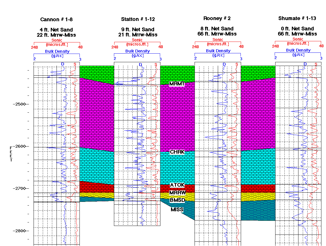
Seismic Modeling in the Minneola Complex, Figure 7a
Please use the "Back" command of your browser to return to the page
you were viewing.
Figure 7a--Multi-well model cross section. Sonic
curves are red and bulk density curves are blue. Vertical scale in
feet below sea level. Horizon (tops) abbreviations are Marmaton
(MRMT), Cherokee (CHRK), Atoka (ATOK), Morrow (MRRW), base of upper
Morrow sandstone (BMSD), and Mississippian (MISS).
Please use the "Back" command of your browser to return to the page
you were viewing.
Report Contents
Kansas Geological Survey, Open-File Report 96-50
Placed online Feb. 1997
Comments to webadmin@kgs.ku.edu
URL=http://www.kgs.ku.edu/PRS/publication/OFR96_50/fig7a.html