
Kansas Geological Survey
Open-file Report 2001-38
|
|
|
Kansas Geological Survey Open-file Report 2001-38 |
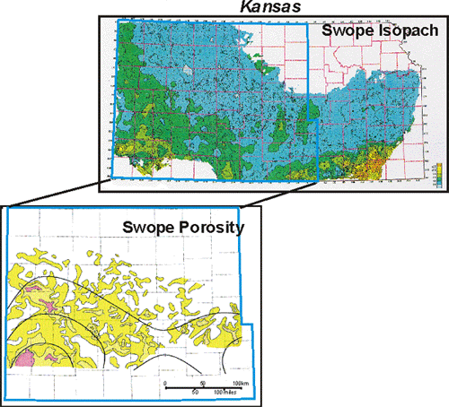
Isopach map of Swope Limestone exhibits thickening along southern reaches of Kansas shelf bordering the Anadarko and Arkoma Basins. Lithofacies are predominately limestone except for minor clastics deposited along southeastern edge of carbonate shelf.
|
Isopach map of Swope Limestone with porosity greater than 8% Porous carbonate is mainly oolitic lithologies dominated by oomoldic pores. Whereas the large-scale lobes in the map resemble in form modern oolite shoals, these lobes are interpreted to represent composites of temporally distinct shoals similar in scale to shoals deposited in the present-day Joulter’s Cays region. |
|
|
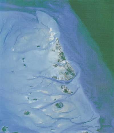 |
| Satellite image of Joulters Cay area showing ooid sand complex with fringing windward margin and active sand shoals to east and shallow sand flat to west. (Harris, 1994) |
|
|
|
e-mail : webadmin@kgs.ku.edu
Last updated December 2001
http://www.kgs.ku.edu/PRS/publication/OFR2001-38/P1-05.html