Seismic Structure Interpretation
 |
|
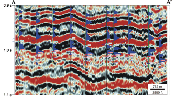
| Vertical seismic section through wells with sonic logs from a 5.5 sq. mile 3-D seismic survey in Cheyenne Wells and Smoky Creek fields. Peaks are black and troughs are red. Synthetic seismograms generated from the sonic logs are superimposed in blue. The following formation tops are displayed: Morrow (cyan), BMS/KYS (red), Top Mississippian St. Louis (violet), Spergen (dark blue), Warsaw (gold). | |
 |
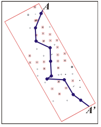 |
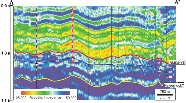
| Section through model based inversion volume corresponding to the seismic section at left. The BMS/KYS horizon (red) is visible as a sharp impedance increase. A deeper continuous horizon corresponding to another impedance increase is tentatively interpreted as the top of Kinderhook (yellow). | Location Map for seismic sections. |
BMS/KYS Subsea Structure
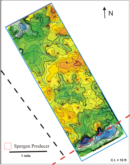
BMS/KYS subsea depth structure map derived from seismic data. Orange indicates structural highs and purple indicates structural lows. Interpreted drainage patterns are indicated by blue dashed lines. The red dashed line is a Precambrian shear zone and the black dashed line is a high angle basement fault from Sims et al. (2001).
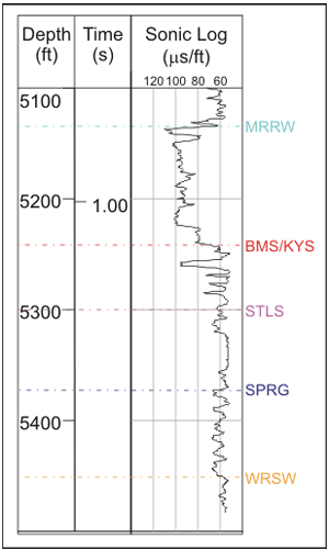 |
A sonic log for a well in the Smoky Creek field shows that the top Mississippian (STLS) and top Spergen (SPRG) do not correspond to significant acoustic impedance contrasts. The closest seismic horizon to the reservoir interval that can be reliably interpreted across the entire dataset is the BMS/KYS. |
- Synthetic seismograms have been used to tie formation tops to seismic reflections and to guide a model-based acoustic impedance inversion of the seismic data.
- St. Louis, Spergen, and Warsaw tops do not correspond to strong impendance contrasts. The Base Morrow Shale / Top Keyes (BMS/KYS) is the closest continuous seismic reflector.
- The drainage pattern interpreted on the BMS/KYS structure map is reminiscent of karst drainage consisting of blind valleys. Local topographic depressions as small as 20 acres in size may be sinkholes.
- A down-to-the-south fault at the southern end of the seismic survey aligns with a Precambrian shear zone.
http://www.kgs.ku.edu/PRS/publication/2006/2006-14/p3-03.html
Last Modified May 2006